world.wikisort.org - USA
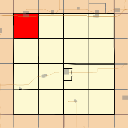
Summit Township is one of seventeen townships in Adair County, Iowa, USA. At the 2010 census, its population was 967.[3]
Summit Township, Adair County | |
|---|---|
Township | |
 | |
| Coordinates: 41°27′45″N 094°38′29″W | |
| Country | |
| State | |
| County | Adair |
| Area | |
| • Total | 35.59 sq mi (92.18 km2) |
| • Land | 35.54 sq mi (92.04 km2) |
| • Water | 0.05 sq mi (0.14 km2) |
| Elevation | 1,375 ft (419 m) |
| Population (2010) | |
| • Total | 967 |
| • Density | 27.2/sq mi (10.5/km2) |
| Time zone | UTC-6 (CST) |
| • Summer (DST) | UTC-5 (CDT) |
| FIPS code | 19-94035[2] |
| GNIS feature ID | 0468760 |
History
Summit Township was organized in 1871. Summit is named from the ridge it contains that forms the watershed between the Mississippi and Missouri rivers.[4]
Geography
Summit Township covers an area of 35.59 square miles (92.2 km2) and contains one incorporated settlement, Adair. According to the USGS, it contains two cemeteries: Saint Johns and Sunny Hill.
References
- "US Board on Geographic Names". United States Geological Survey. 2007-10-25. Retrieved 2008-01-31.
- "U.S. Census website". United States Census Bureau. Retrieved 2008-01-31.
- "IA - Summit township". United States Census Bureau. Archived from the original on April 9, 2013. Retrieved March 17, 2013.
- Kilburn, Lucian Moody (1915). History of Adair County, Iowa, and Its People, Volume 1. Pioneer Publishing Company. pp. 127–128.
External links
Municipalities and communities of Adair County, Iowa, United States | ||
|---|---|---|
County seat: Greenfield | ||
| Cities |
|  |
| Townships |
| |
| Unincorporated communities |
| |
| Footnotes | ‡This populated place also has portions in an adjacent county or counties | |
| ||
This article about the geography of Adair County, Iowa is a stub. You can help Wikipedia by expanding it. |
Текст в блоке "Читать" взят с сайта "Википедия" и доступен по лицензии Creative Commons Attribution-ShareAlike; в отдельных случаях могут действовать дополнительные условия.
Другой контент может иметь иную лицензию. Перед использованием материалов сайта WikiSort.org внимательно изучите правила лицензирования конкретных элементов наполнения сайта.
Другой контент может иметь иную лицензию. Перед использованием материалов сайта WikiSort.org внимательно изучите правила лицензирования конкретных элементов наполнения сайта.
2019-2026
WikiSort.org - проект по пересортировке и дополнению контента Википедии
WikiSort.org - проект по пересортировке и дополнению контента Википедии