world.wikisort.org - USA
Sugar Creek Township is one of eleven townships in Montgomery County, Indiana, United States. As of the 2010 census, its population was 448 and it contained 167 housing units.[2]
Sugar Creek Township | |
|---|---|
Township | |
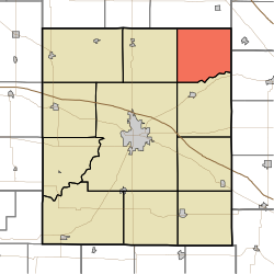 Location in Montgomery County | |
| Coordinates: 40°10′44″N 86°45′42″W | |
| Country | |
| State | |
| County | Montgomery |
| Government | |
| • Type | Indiana township |
| Area | |
| • Total | 33.83 sq mi (87.6 km2) |
| • Land | 33.83 sq mi (87.6 km2) |
| • Water | 0 sq mi (0 km2) 0% |
| Elevation | 804 ft (245 m) |
| Population (2010) | |
| • Total | 448 |
| • Density | 13.2/sq mi (5.1/km2) |
| Time zone | UTC-5 (Eastern (EST)) |
| • Summer (DST) | UTC-4 (EDT) |
| ZIP codes | 46035, 47930, 47933, 47940, 47955 |
| Area code(s) | 765 |
| GNIS feature ID | 453883 |
History
William Fisher Polygonal Barn was listed on the National Register of Historic Places in 1993.[3]
Geography
According to the 2010 census, the township has a total area of 33.83 square miles (87.6 km2), all land.[2]
Unincorporated towns
Cemeteries
The township contains these four cemeteries: Bowers, Clouser, Peterson and Rice.
School districts
- North Montgomery Community School Corporation
Political districts
- Indiana's 4th congressional district
- State House District 41
- State Senate District 23
References
- "Sugar Creek Township, Montgomery County, Indiana". Geographic Names Information System. United States Geological Survey. Retrieved 2009-09-27.
- United States Census Bureau 2008 TIGER/Line Shapefiles
- IndianaMap
- "US Board on Geographic Names". United States Geological Survey. October 25, 2007. Retrieved 2017-05-09.
- "Population, Housing Units, Area, and Density: 2010 - County -- County Subdivision and Place -- 2010 Census Summary File 1". United States Census. Archived from the original on 2020-02-12. Retrieved 2013-05-10.
- "National Register Information System". National Register of Historic Places. National Park Service. July 9, 2010.
External links
- Indiana Township Association
- United Township Association of Indiana
- City-Data.com page for Sugar Creek Township
Places adjacent to Sugar Creek Township, Montgomery County, Indiana | ||||||||||||||||
|---|---|---|---|---|---|---|---|---|---|---|---|---|---|---|---|---|
| ||||||||||||||||
Municipalities and communities of Montgomery County, Indiana, United States | ||
|---|---|---|
County seat: Crawfordsville | ||
| City |
|  |
| Towns |
| |
| Townships |
| |
| CDP | ||
| Other unincorporated communities |
| |
| Footnotes | ‡This populated place also has portions in an adjacent county or counties | |
| ||
Текст в блоке "Читать" взят с сайта "Википедия" и доступен по лицензии Creative Commons Attribution-ShareAlike; в отдельных случаях могут действовать дополнительные условия.
Другой контент может иметь иную лицензию. Перед использованием материалов сайта WikiSort.org внимательно изучите правила лицензирования конкретных элементов наполнения сайта.
Другой контент может иметь иную лицензию. Перед использованием материалов сайта WikiSort.org внимательно изучите правила лицензирования конкретных элементов наполнения сайта.
2019-2025
WikiSort.org - проект по пересортировке и дополнению контента Википедии
WikiSort.org - проект по пересортировке и дополнению контента Википедии