world.wikisort.org - USA
Study Butte (/ˈstjuːdi ˌbjuːt/ STEW-dee BEWT[2]) is a census-designated place (CDP) in Brewster County, Texas, United States. The population was 233 at the 2010 census.[3] At the 2000 census, the area was part of the Study Butte-Terlingua CDP.
Study Butte, Texas | |
|---|---|
Census-designated place | |
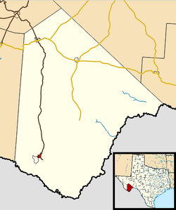 Location in Brewster County and the state of Texas | |
| Coordinates: 29°19′29″N 103°31′44″W | |
| Country | United States |
| State | Texas |
| County | Brewster |
| Area | |
| • Total | 4.7 sq mi (12.3 km2) |
| • Land | 4.7 sq mi (12.3 km2) |
| • Water | 0.0 sq mi (0.0 km2) |
| Population (2010) | |
| • Total | 233 |
| • Density | 49/sq mi (18.9/km2) |
| Time zone | UTC-6 (Central (CST)) |
| • Summer (DST) | UTC-5 (CDT) |
| FIPS code | 48-70688[1] |
Geography
Study Butte is located at 29°19′29″N 103°31′44″W[4] in southern Brewster County. The Terlingua CDP borders Study Butte to the southwest. Texas State Highway 118 passes through Study Butte and leads 3.7 miles (6.0 km) southeast to the west entrance to Big Bend National Park and 78 miles (126 km) north to the city of Alpine.
According to the United States Census Bureau, the Study Butte CDP has a total area of 4.7 square miles (12.3 km2), all of it land.[3]
Climate
This area has a large amount of sunshine year round due to its stable descending air and high pressure. According to the Köppen Climate Classification system, Study Butte-Terlingua has a desert climate, abbreviated "BWh" on climate maps.[5]
- Coordinates: 29.32861°N 103.55306°W
- Elevation: 2,563 feet (781 m)[6]
| Climate data for Study Butte, Texas (May 1, 1993–Jun 30, 2006) | |||||||||||||
|---|---|---|---|---|---|---|---|---|---|---|---|---|---|
| Month | Jan | Feb | Mar | Apr | May | Jun | Jul | Aug | Sep | Oct | Nov | Dec | Year |
| Record high °F (°C) | 88 (31) |
94 (34) |
101 (38) |
107 (42) |
111 (44) |
113 (45) |
111 (44) |
108 (42) |
106 (41) |
102 (39) |
96 (36) |
85 (29) |
113 (45) |
| Average high °F (°C) | 69.2 (20.7) |
73.2 (22.9) |
81.0 (27.2) |
88.9 (31.6) |
98.2 (36.8) |
100.6 (38.1) |
99.6 (37.6) |
98.2 (36.8) |
94.7 (34.8) |
86.3 (30.2) |
75.7 (24.3) |
66.3 (19.1) |
86.0 (30.0) |
| Daily mean °F (°C) | 52.8 (11.6) |
57.3 (14.1) |
64.1 (17.8) |
72.1 (22.3) |
82.2 (27.9) |
86.7 (30.4) |
86.6 (30.3) |
85.6 (29.8) |
81.3 (27.4) |
71.7 (22.1) |
60.8 (16.0) |
51.4 (10.8) |
71.1 (21.7) |
| Average low °F (°C) | 36.5 (2.5) |
41.5 (5.3) |
47.3 (8.5) |
55.2 (12.9) |
66.3 (19.1) |
72.9 (22.7) |
73.8 (23.2) |
73.0 (22.8) |
67.9 (19.9) |
57.2 (14.0) |
45.9 (7.7) |
36.5 (2.5) |
56.2 (13.4) |
| Record low °F (°C) | 18 (−8) |
20 (−7) |
21 (−6) |
37 (3) |
47 (8) |
62 (17) |
61 (16) |
61 (16) |
49 (9) |
27 (−3) |
25 (−4) |
16 (−9) |
16 (−9) |
| Average precipitation inches (mm) | 0.26 (6.6) |
0.17 (4.3) |
0.37 (9.4) |
0.33 (8.4) |
0.63 (16) |
1.32 (34) |
1.86 (47) |
1.77 (45) |
0.61 (15) |
1.09 (28) |
0.47 (12) |
0.26 (6.6) |
9.14 (232) |
| Average snowfall inches (cm) | 0.0 (0.0) |
0.0 (0.0) |
0.0 (0.0) |
0.0 (0.0) |
0.0 (0.0) |
0.0 (0.0) |
0.0 (0.0) |
0.0 (0.0) |
0.0 (0.0) |
0.0 (0.0) |
0.0 (0.0) |
0.0 (0.0) |
0.0 (0.0) |
| Average precipitation days (≥ 0.01 in) | 1 | 1 | 1 | 1 | 2 | 3 | 5 | 4 | 2 | 2 | 2 | 1 | 25 |
| Source: Western Regional Climate Center, Desert Research Institute[7] | |||||||||||||
Demographics
| Historical population | |||
|---|---|---|---|
| Census | Pop. | %± | |
| 2010 | 233 | — | |
Education
Study Butte is served by the Terlingua Common School District.[8] Big Bend High School is the local school. Prior to fall 1996 students at the high school level attended Alpine High School in the Alpine Independent School District.[9] Previously the Terlingua CSD had Big Bend High and Terlingua Elementary as separate schools.[10]
References
- "U.S. Census website". United States Census Bureau. Retrieved 2008-01-31.
- "Towns S Texas Pronunciation Guide". Archived from the original on 2008-02-14.
- "Geographic Identifiers: 2010 Demographic Profile Data (G001): Study Butte CDP, Texas". U.S. Census Bureau, American Factfinder. Archived from the original on February 12, 2020. Retrieved April 22, 2014.
- "US Gazetteer files: 2010, 2000, and 1990". United States Census Bureau. 2011-02-12. Retrieved 2011-04-23.
- Climate Summary for Study Butte-Terlingua, Texas
- "US COOP Station Map". Western Regional Climate Center, Desert Research Institute. Retrieved Mar 22, 2016.
- "STUDY BUTTE, TEXAS (4187146959), Period of Record Monthly Climate Summary". Western Regional Climate Center, Desert Research Institute. Retrieved Mar 22, 2016.
- Verhovek, Sam Howe (1996-05-27). "End Near for 179-Mile Bus Trip to High School". The New York Times. Retrieved 2021-06-16. - Alternate title: "Longest school bus ride about to end", in Wilmington Star-News, May 27, 1996, page 3A.
- Pressly, Sue Ann (1997-08-10). "Town's New High School Makes Grade With Students". Los Angeles Times. Retrieved 2021-06-16.
- "Terlingua Common School District". Texas Education Agency. 2001-03-06. Archived from the original on 2001-03-06. Retrieved 2021-06-16.
External links
Municipalities and communities of Brewster County, Texas, United States | ||
|---|---|---|
County seat: Alpine | ||
| City |  | |
| CDPs |
| |
| Other communities | ||
| Ghost towns |
| |
| Annexed former counties |
| |
| ||
Другой контент может иметь иную лицензию. Перед использованием материалов сайта WikiSort.org внимательно изучите правила лицензирования конкретных элементов наполнения сайта.
WikiSort.org - проект по пересортировке и дополнению контента Википедии