world.wikisort.org - USA
Stryker is an unincorporated community and census-designated place (CDP) in Lincoln County, Montana, United States. As of the 2010 census it had a population of 26.[4] Stryker has the 59933 ZIP code.[3]
Stryker, Montana | |
|---|---|
Census-designated place | |
 Stryker post office | |
 Stryker  Stryker | |
| Coordinates: 48°40′27″N 114°46′13″W | |
| Country | United States |
| State | Montana |
| County | Lincoln |
| Area | |
| • Total | 1.03 sq mi (2.67 km2) |
| • Land | 1.03 sq mi (2.67 km2) |
| • Water | 0.00 sq mi (0.00 km2) |
| Elevation | 3,297 ft (1,005 m) |
| Population (2020) | |
| • Total | 25 |
| • Density | 24.27/sq mi (9.37/km2) |
| Time zone | UTC-7 (Mountain (MST)) |
| • Summer (DST) | UTC-6 (MDT) |
| ZIP code | 59933[3] |
| Area code | 406 |
| GNIS feature ID | 791609[2] |
| FIPS code | 30-71575 |
Named for local homesteaders, Stryker served as a stage station on the Kalispell–Fort Steele (British Columbia) trail. A forest fire swept through the town in 1926. Stryker’s railroad depot closed with the construction of Libby Dam.[5]
Stryker is located in northeastern Lincoln County on U.S. Route 93, 20 miles (32 km) southeast of Eureka and 45 miles (72 km) northwest of Kalispell. It is located just south of a drainage divide separating the Stillwater River, which runs just east of Stryker and flows southeast to the Flathead River, from Summit Creek, which flows northwest and is part of the Tobacco River watershed flowing to the Kootenai River. According to the U.S. Census Bureau, the Stryker CDP has an area of 1.0 square mile (2.7 km2), all land.[6]
Demographics
| Historical population | |||
|---|---|---|---|
| Census | Pop. | %± | |
| 2020 | 25 | — | |
| U.S. Decennial Census[7] | |||
Images
 A building in Stryker
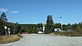 Railroad crossing


References
- "ArcGIS REST Services Directory". United States Census Bureau. Retrieved September 5, 2022.
- U.S. Geological Survey Geographic Names Information System: Stryker, Montana
- "Stryker, Montana Zip Code". zip-codes.com. Retrieved January 11, 2014.
- "Total Population: 2010 Census DEC Summary File 1 (P1), Stryker CDP, Montana". data.census.gov. U.S. Census Bureau. Retrieved April 29, 2020.
- "Stryker". Montana Place Names Companion. Montana Historical Society. Retrieved 9 April 2021.
- "U.S. Gazetteer Files: 2019: Places: Montana". U.S. Census Bureau Geography Division. Retrieved April 29, 2020.
- "Census of Population and Housing". Census.gov. Retrieved June 4, 2016.
Municipalities and communities of Lincoln County, Montana, United States | ||
|---|---|---|
County seat: Libby | ||
| Cities |  | |
| Towns | ||
| CDPs | ||
| Other communities |
| |
| ||
This Lincoln County, Montana state location article is a stub. You can help Wikipedia by expanding it. |
Другой контент может иметь иную лицензию. Перед использованием материалов сайта WikiSort.org внимательно изучите правила лицензирования конкретных элементов наполнения сайта.
WikiSort.org - проект по пересортировке и дополнению контента Википедии