world.wikisort.org - USA
Stratton Township is one of fifteen townships in Edgar County, Illinois, USA. As of the 2010 census, its population was 481 and it contained 230 housing units.[2] The name of the township was Wayne Township until May 9, 1857.
Stratton Township | |
|---|---|
Township | |
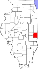
 Location in Edgar County | |
 Edgar County's location in Illinois | |
| Coordinates: 39°36′25″N 87°35′28″W | |
| Country | United States |
| State | Illinois |
| County | Edgar |
| Established | November 4, 1856 |
| Area | |
| • Total | 24.8 sq mi (64 km2) |
| • Land | 24.8 sq mi (64 km2) |
| • Water | 0 sq mi (0 km2) 0% |
| Elevation | 666 ft (203 m) |
| Population (2010) | |
| • Estimate (2016)[1] | 455 |
| • Density | 19.4/sq mi (7.5/km2) |
| Time zone | UTC-6 (CST) |
| • Summer (DST) | UTC-5 (CDT) |
| ZIP code | 61944 |
| FIPS code | 17-045-73092 |
Geography
According to the 2010 census, the township has a total area of 24.8 square miles (64 km2), all land.[2]
Cities, towns, villages
- Vermilion (north three-quarters)
Extinct towns
- Kentucky
Cemeteries
The township contains these three cemeteries: Blackburn, Little Grove and Pryor. There have been records found for Oak Grove, Whalen, and Wilkins.
Major highways
 US Route 150
Demographics
| Historical population | |||
|---|---|---|---|
| Census | Pop. | %± | |
| 2016 (est.) | 455 | [1] | |
| U.S. Decennial Census[3] | |||
School districts
- Paris Community Unit School District 4
Political districts
- Illinois' 15th congressional district
- State House District 109
- State Senate District 55
References
- "Stratton Township, Edgar County, Illinois". Geographic Names Information System. United States Geological Survey. Retrieved 2010-01-10.
- United States Census Bureau 2007 TIGER/Line Shapefiles
- United States National Atlas
- "Population and Housing Unit Estimates". Retrieved June 9, 2017.
- "Population, Housing Units, Area, and Density: 2010 - County -- County Subdivision and Place -- 2010 Census Summary File 1". United States Census. Archived from the original on 2020-02-12. Retrieved 2013-05-28.
- "Census of Population and Housing". Census.gov. Retrieved June 4, 2016.
External links
Places adjacent to Stratton Township, Edgar County, Illinois | ||||||||||||||||
|---|---|---|---|---|---|---|---|---|---|---|---|---|---|---|---|---|
| ||||||||||||||||
Municipalities and communities of Edgar County, Illinois, United States | ||
|---|---|---|
County seat: Paris | ||
| Cities |  | |
| Villages | ||
| Townships | ||
| Unincorporated communities | ||
| Footnotes | ‡This populated place also has portions in an adjacent county or counties | |
| ||
Текст в блоке "Читать" взят с сайта "Википедия" и доступен по лицензии Creative Commons Attribution-ShareAlike; в отдельных случаях могут действовать дополнительные условия.
Другой контент может иметь иную лицензию. Перед использованием материалов сайта WikiSort.org внимательно изучите правила лицензирования конкретных элементов наполнения сайта.
Другой контент может иметь иную лицензию. Перед использованием материалов сайта WikiSort.org внимательно изучите правила лицензирования конкретных элементов наполнения сайта.
2019-2026
WikiSort.org - проект по пересортировке и дополнению контента Википедии
WikiSort.org - проект по пересортировке и дополнению контента Википедии