world.wikisort.org - USA
St. Mary's is a census-designated place (CDP) located in and governed by Clear Creek County, Colorado, United States. The CDP is a part of the Denver–Aurora–Lakewood, CO Metropolitan Statistical Area. The population of the St. Mary's CDP was 333 at the United States Census 2020.[1] The St. Mary's Glacier Metropolitan District and the St. Mary's Glacier Water & Sanitation District provide services. The Idaho Springs post office (Zip Code 80452) serves the area.[4]
St. Mary's, Colorado | |
|---|---|
Census Designated Place | |
 The Silver Lake Condos, with part of Silver Lake on the right, June 2021 | |
Location of the St. Mary's CDP in Clear Creek County, Colorado. | |
 St. Mary's Location of the St. Mary's CDP in the United States. | |
| Coordinates: 39°48′59″N 105°38′52″W[1] | |
| Country | |
| State | |
| County | Clear Creek County |
| Government | |
| • Type | unincorporated community |
| Area | |
| • Total | 1.446 sq mi (3.744 km2) |
| • Land | 1.439 sq mi (3.726 km2) |
| • Water | 0.007 sq mi (0.018 km2) |
| Elevation | 10,088 ft (3,075 m) |
| Population (2020)[3] | |
| • Total | 333 |
| • Density | 230/sq mi (89/km2) |
| Time zone | UTC-7 (MST) |
| • Summer (DST) | UTC-6 (MDT) |
| ZIP Code[4] | Idaho Springs 80452 |
| Area codes | 303 & 720 |
| GNIS feature[2] | St. Mary's CDP |
Geography
The St. Mary's CDP has an area of 925 acres (3.744 km2), including 4.4 acres (0.018 km2) of water.[1]
Demographics
| Year | Pop. | ±% |
|---|---|---|
| 2000 | 251 | — |
| 2010 | 283 | +12.7% |
| 2020 | 333 | +17.7% |
| Source: United States Census Bureau | ||
The United States Census Bureau initially defined the St. Mary's CDP for the United States Census 2000.
Historic ski area
- St. Mary's Glacier Ski Area[5]
See also
- List of census-designated places in Colorado
References
- "State of Colorado Census Designated Places - BAS20 - Data as of January 1, 2020". United States Census Bureau. Retrieved November 3, 2021.
- "U.S. Board on Geographic Names: Domestic Names". United States Geological Survey. Retrieved December 21, 2020.
- "QuickFacts for Colorado". United States Census Bureau. Retrieved October 30, 2021.
- "Zip Code 80452 Map and Profile". zipdatamaps.com. 2020. Retrieved December 21, 2020.
- Colorado Ski History: St. Mary's Glacier
External links
St. Mary's, Colorado at Wikipedia's sister projects
 Definitions from Wiktionary
 Media from Commons
 News from Wikinews
 Quotations from Wikiquote
 Texts from Wikisource
 Textbooks from Wikibooks
 Resources from Wikiversity
Municipalities and communities of Clear Creek County, Colorado, United States | ||
|---|---|---|
County seat: Georgetown | ||
| Cities | 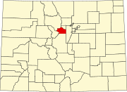 | |
| Towns | ||
| CDPs | ||
| Unincorporated communities | ||
| Ghost towns |
| |
| Footnotes | ‡This populated place also has portions in an adjacent county or counties | |
| ||
Текст в блоке "Читать" взят с сайта "Википедия" и доступен по лицензии Creative Commons Attribution-ShareAlike; в отдельных случаях могут действовать дополнительные условия.
Другой контент может иметь иную лицензию. Перед использованием материалов сайта WikiSort.org внимательно изучите правила лицензирования конкретных элементов наполнения сайта.
Другой контент может иметь иную лицензию. Перед использованием материалов сайта WikiSort.org внимательно изучите правила лицензирования конкретных элементов наполнения сайта.
2019-2026
WikiSort.org - проект по пересортировке и дополнению контента Википедии
WikiSort.org - проект по пересортировке и дополнению контента Википедии