world.wikisort.org - USA
Southside is an incorporated city located in Independence County, Arkansas, United States.
Southside, Arkansas | |
|---|---|
City | |
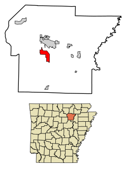 Location of Southside in Independence County, Arkansas. | |
| Country | United States |
| State | Arkansas |
| County | Independence |
| Incorporated | 2014 |
| Government | |
| Area | |
| • Total | 9.86 sq mi (25.53 km2) |
| • Land | 9.86 sq mi (25.53 km2) |
| • Water | 0.00 sq mi (0.01 km2) |
| Elevation | 374 ft (114 m) |
| Population (2020) | |
| • Total | 4,279 |
| • Density | 434.20/sq mi (167.64/km2) |
| Time zone | UTC-6 (CST) |
| • Summer (DST) | UTC-5 (CDT) |
| FIPS code | 05-65630 [2] |
| GNIS feature ID | 2771128[2] |
The elevation of Southside is 354 feet (108 m).[2]
The spur route of Arkansas Highway 14 connects Southside with Salado.[3]
History
Southside was incorporated on October 29, 2014.
Demographics
| Historical population | |||
|---|---|---|---|
| Census | Pop. | %± | |
| 2020 | 4,279 | — | |
| U.S. Decennial Census | |||
| Race | Number | Percentage |
|---|---|---|
| White (NH) | 3,660 | 85.53% |
| Black or African American (NH) | 79 | 1.85% |
| Native American or Alaska Native (NH) | 6 | 0.14% |
| Asian (NH) | 31 | 0.72% |
| Pacific Islander (NH) | 2 | 0.05% |
| Some Other Race (NH) | 4 | 0.09% |
| Mixed/Multi-Racial (NH) | 249 | 5.82% |
| Hispanic or Latino | 248 | 5.8% |
| Total | 4,279 |
As of the 2020 United States census, there were 4,279 people, 1,560 households, and 1,002 families residing in the city.
Education
Students in Southside can go to Southside School District or Batesville School District, Arkansas.
References
- "2020 U.S. Gazetteer Files". United States Census Bureau. Retrieved October 29, 2021.
- U.S. Geological Survey Geographic Names Information System: Southside, Independence County, Arkansas
- "Archived copy" (PDF). Archived from the original (PDF) on 2015-09-23. Retrieved 2015-10-14.
{{cite web}}: CS1 maint: archived copy as title (link) - "Explore Census Data". data.census.gov. Retrieved 2022-06-17.
- https://www.census.gov/ [not specific enough to verify]
- "About the Hispanic Population and its Origin". www.census.gov. Retrieved 18 May 2022.
External links
Municipalities and communities of Independence County, Arkansas, United States | ||
|---|---|---|
County seat: Batesville | ||
| Cities |  | |
| Towns | ||
| CDPs | ||
| Other unincorporated communities |
| |
| Footnotes | ‡This populated place also has portions in an adjacent county or counties | |
| ||
Текст в блоке "Читать" взят с сайта "Википедия" и доступен по лицензии Creative Commons Attribution-ShareAlike; в отдельных случаях могут действовать дополнительные условия.
Другой контент может иметь иную лицензию. Перед использованием материалов сайта WikiSort.org внимательно изучите правила лицензирования конкретных элементов наполнения сайта.
Другой контент может иметь иную лицензию. Перед использованием материалов сайта WikiSort.org внимательно изучите правила лицензирования конкретных элементов наполнения сайта.
2019-2026
WikiSort.org - проект по пересортировке и дополнению контента Википедии
WikiSort.org - проект по пересортировке и дополнению контента Википедии