world.wikisort.org - USA
Sonnette is an unincorporated community in west central Powder River County, Montana, United States. The community is situated near the headwaters of Pumpkin Creek, just west of the Custer National Forest. It lies along local roads northwest of the town of Broadus, the county seat of Powder River County.[2]
Sonnette | |
|---|---|
Unincorporated community | |
 Sonnette Location within the state of Montana | |
| Coordinates: 45°24′47″N 105°49′53″W | |
| Country | United States |
| State | Montana |
| County | Powder River |
| Elevation | 3,766 ft (1,148 m) |
| Time zone | UTC-7 (Mountain (MST)) |
| • Summer (DST) | UTC-6 (MDT) |
| GNIS feature ID | 790852[1] |
Climate
According to the Köppen Climate Classification system, Sonnette has a semi-arid climate, abbreviated "BSk" on climate maps.[3]
| Climate data for Sonnette, Montana, 1991–2020 normals, extremes 1965–present | |||||||||||||
|---|---|---|---|---|---|---|---|---|---|---|---|---|---|
| Month | Jan | Feb | Mar | Apr | May | Jun | Jul | Aug | Sep | Oct | Nov | Dec | Year |
| Record high °F (°C) | 68 (20) |
70 (21) |
80 (27) |
87 (31) |
103 (39) |
105 (41) |
107 (42) |
103 (39) |
100 (38) |
91 (33) |
77 (25) |
71 (22) |
107 (42) |
| Mean maximum °F (°C) | 54.2 (12.3) |
56.5 (13.6) |
68.7 (20.4) |
77.4 (25.2) |
83.9 (28.8) |
91.3 (32.9) |
98.0 (36.7) |
96.8 (36.0) |
92.9 (33.8) |
81.1 (27.3) |
66.1 (18.9) |
54.3 (12.4) |
99.3 (37.4) |
| Average high °F (°C) | 36.8 (2.7) |
38.7 (3.7) |
48.8 (9.3) |
57.3 (14.1) |
66.6 (19.2) |
76.5 (24.7) |
86.5 (30.3) |
85.9 (29.9) |
75.3 (24.1) |
59.6 (15.3) |
46.5 (8.1) |
36.8 (2.7) |
59.6 (15.3) |
| Daily mean °F (°C) | 23.2 (−4.9) |
25.0 (−3.9) |
34.7 (1.5) |
43.0 (6.1) |
52.3 (11.3) |
61.7 (16.5) |
69.7 (20.9) |
68.5 (20.3) |
58.5 (14.7) |
44.8 (7.1) |
32.5 (0.3) |
23.6 (−4.7) |
44.8 (7.1) |
| Average low °F (°C) | 9.5 (−12.5) |
11.3 (−11.5) |
20.6 (−6.3) |
28.8 (−1.8) |
38.1 (3.4) |
46.8 (8.2) |
53.0 (11.7) |
51.1 (10.6) |
41.7 (5.4) |
30.0 (−1.1) |
18.4 (−7.6) |
10.4 (−12.0) |
30.0 (−1.1) |
| Mean minimum °F (°C) | −17.4 (−27.4) |
−14.4 (−25.8) |
−3.5 (−19.7) |
10.3 (−12.1) |
21.6 (−5.8) |
34.0 (1.1) |
41.6 (5.3) |
37.8 (3.2) |
26.7 (−2.9) |
9.9 (−12.3) |
−4.7 (−20.4) |
−13.2 (−25.1) |
−25.7 (−32.1) |
| Record low °F (°C) | −38 (−39) |
−42 (−41) |
−33 (−36) |
−8 (−22) |
11 (−12) |
26 (−3) |
33 (1) |
25 (−4) |
10 (−12) |
−16 (−27) |
−25 (−32) |
−44 (−42) |
−44 (−42) |
| Average precipitation inches (mm) | 0.50 (13) |
0.70 (18) |
0.91 (23) |
1.85 (47) |
2.95 (75) |
2.69 (68) |
1.67 (42) |
1.10 (28) |
1.09 (28) |
1.38 (35) |
0.56 (14) |
0.51 (13) |
15.91 (404) |
| Average snowfall inches (cm) | 3.9 (9.9) |
6.6 (17) |
5.0 (13) |
3.4 (8.6) |
0.2 (0.51) |
0.0 (0.0) |
0.0 (0.0) |
0.0 (0.0) |
0.0 (0.0) |
1.3 (3.3) |
3.1 (7.9) |
5.6 (14) |
29.1 (74.21) |
| Average precipitation days (≥ 0.01 in) | 3.8 | 5.6 | 4.9 | 7.3 | 8.7 | 7.9 | 6.5 | 5.1 | 4.6 | 5.8 | 3.8 | 3.6 | 67.6 |
| Average snowy days (≥ 0.1 in) | 1.9 | 2.4 | 1.3 | 1.0 | 0.1 | 0.0 | 0.0 | 0.0 | 0.0 | 0.8 | 1.3 | 2.0 | 10.8 |
| Source 1: NOAA[4] | |||||||||||||
| Source 2: National Weather Service[5] | |||||||||||||
References
- "Sonnette, Montana". Geographic Names Information System. United States Geological Survey, United States Department of the Interior.
- Rand McNally. The Road Atlas '08. Chicago: Rand McNally, 2008, p. 61.
- Climate Summary for Sonnette, Montana
- "U.S. Climate Normals Quick Access". National Oceanic and Atmospheric Administration. Retrieved August 7, 2022.
- "NOAA Online Weather Data". National Weather Service. Retrieved August 7, 2022.
Municipalities and communities of Powder River County, Montana, United States | ||
|---|---|---|
County seat: Broadus | ||
| Town | 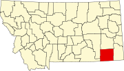 | |
| CDP | ||
| Other communities | ||
| ||
This Powder River County, Montana state location article is a stub. You can help Wikipedia by expanding it. |
Текст в блоке "Читать" взят с сайта "Википедия" и доступен по лицензии Creative Commons Attribution-ShareAlike; в отдельных случаях могут действовать дополнительные условия.
Другой контент может иметь иную лицензию. Перед использованием материалов сайта WikiSort.org внимательно изучите правила лицензирования конкретных элементов наполнения сайта.
Другой контент может иметь иную лицензию. Перед использованием материалов сайта WikiSort.org внимательно изучите правила лицензирования конкретных элементов наполнения сайта.
2019-2026
WikiSort.org - проект по пересортировке и дополнению контента Википедии
WikiSort.org - проект по пересортировке и дополнению контента Википедии