world.wikisort.org - USA
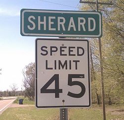
Sherard is an unincorporated community located in Coahoma County, Mississippi, United States. Sherard is located along Mississippi Highway 1, 6 miles (9.7 km) west of Clarksdale.
Sherard, Mississippi | |
|---|---|
Unincorporated community | |
 | |
 Sherard  Sherard | |
| Coordinates: 34°12′56″N 90°42′22″W | |
| Country | United States |
| State | Mississippi |
| County | Coahoma |
| Elevation | 164 ft (50 m) |
| Time zone | UTC-6 (Central (CST)) |
| • Summer (DST) | UTC-5 (CDT) |
| ZIP code | 38669 |
| Area code(s) | 662 |
| GNIS feature ID | 677650[1] |
History
Sherard is named for the Sherard family, who cleared the land for a plantation in 1874. The plantation originally had two cotton gins, a saw mill, and pecan processing equipment.[2] Sherard is located on the former Yazoo and Mississippi Valley Railroad and in 1910 was home to four general stores and the Memphis Shingle Company.[3] A post office first began operation under the name Sherard in 1890.[4]
Sherard is served by the Coahoma County School District. Residents are served by Sherard Elementary School and Coahoma County Junior-Senior High School.[5]
A cultivar of pecan known as Sherard was developed in Sherard in 1916.[6]
Notable person
- Lewis C. Hudson, Brigadier General in the Marine Corps, lived in Sherard in the 1920s.
References
- U.S. Geological Survey Geographic Names Information System: Sherard, Mississippi
- Best Books on (1938). Mississippi; a Guide to the Magnolia State,. Best Books on. pp. 347–8. ISBN 978-1-62376-023-6.
- Howe, Tony. "Sherard, Mississippi". Mississippi Rails. Retrieved 10 June 2020.
- "Coahoma County". Jim Forte Postal History. Retrieved 10 June 2020.
- "Schools." Coahoma County School District. Retrieved on July 6, 2017.
- Proceedings of the ... convention of the American Pomological Society. 1922. p. 301.
Другой контент может иметь иную лицензию. Перед использованием материалов сайта WikiSort.org внимательно изучите правила лицензирования конкретных элементов наполнения сайта.
WikiSort.org - проект по пересортировке и дополнению контента Википедии
