world.wikisort.org - USA
Selman is an unincorporated community in Harper County, Oklahoma, United States. It is about 8 miles (13 km) east-southeast of Buffalo, Oklahoma, the county seat. It is the site of a highway department office and lot, and a scattering of small houses. [3]
Selman, Oklahoma | |
|---|---|
Unincorporated community | |
 Selman  Selman | |
| Coordinates: 36°48′07″N 99°29′27″W | |
| Country | United States |
| State | Oklahoma |
| County | Harper |
| Area | |
| • Total | 0.24 sq mi (0.62 km2) |
| • Land | 0.24 sq mi (0.62 km2) |
| • Water | 0.00 sq mi (0.00 km2) |
| Elevation | 1,729 ft (527 m) |
| Population (2020) | |
| • Total | 12 |
| • Density | 50.42/sq mi (19.48/km2) |
| Time zone | UTC-6 (Central (CST)) |
| • Summer (DST) | UTC-5 (CDT) |
| Area code | 580 |
| GNIS feature ID | 1097906[2] |
The first official auction of Selman town lots occurred in late April, 1920, although some lots were purchased, and some building erected, prior to this.[4] The townsite was originally the homestead of one J. B. Fesler.[4] Fesler sold it to J. O. Selman, and Selman sold it to the townsite company, which had it platted and named in Selman’s honor.[4] The town was in a wheat-growing area, and was quickly linked to Buffalo by rail to allow transport of wheat.[4] The post office was relocated from Charleston, Oklahoma after Selman was organized, but retained the name Charleston until September 21, 1923.[4][5] In the 1920s, Selman had a two-story school, a Methodist Episcopal Church, two groceries, a creamery, a café, a lumber & supply, a variety store, a hotel, a bank, and other businesses.[4]
In the present-day, no rail lines remain anywhere in Harper County,[6] and Selman is not located on any major highway, being south of US Route 64 off N1980 Rd.[3] The Oklahoma Public School District Directory shows Harper County schools only in Buffalo and Laverne.[7]
Demographics
| Historical population | |||
|---|---|---|---|
| Census | Pop. | %± | |
| 2020 | 12 | — | |
| U.S. Decennial Census[8] | |||
References
- "ArcGIS REST Services Directory". United States Census Bureau. Retrieved September 20, 2022.
- U.S. Geological Survey Geographic Names Information System: Selman, Oklahoma
- "Selman, Oklahoma". Google Maps. Retrieved November 12, 2021.
- "Selman Celebrates Fifth Anniversary". The Harper County Journal, April 30, 1925 (accessed on OKGenWeb). Retrieved November 12, 2021.
- "Charleston". Oklahoma Historical Society (accessed on Waymarking,com. Retrieved November 12, 2021.
- "Oklahoma 2018-2020 State Railroad Map" (PDF). Oklahoma Department of Transportation. Retrieved November 12, 2021.
- "Oklahoma Public School District Directory". Oklahoma State Department of Education, July 27, 2021. Retrieved November 12, 2021.
- "Census of Population and Housing". Census.gov. Retrieved June 4, 2016.
Municipalities and communities of Harper County, Oklahoma, United States | ||
|---|---|---|
County seat: Buffalo | ||
| Towns | 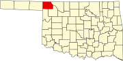 | |
| CDP | ||
| Ghost towns |
| |
| ||
This Oklahoma state location article is a stub. You can help Wikipedia by expanding it. |
Другой контент может иметь иную лицензию. Перед использованием материалов сайта WikiSort.org внимательно изучите правила лицензирования конкретных элементов наполнения сайта.
WikiSort.org - проект по пересортировке и дополнению контента Википедии