world.wikisort.org - USA
Seiling is a city in Dewey County, Oklahoma, United States. The population was 860 at the 2010 census. The town was named in 1899 for Louis Seiling, a local store owner who had acquired a homestead in the Cheyenne-Arapaho land run of April 1892. The Hobson Town and Improvement Company established a town called Hobson, but the name was changed to Seiling in January 1899. It incorporated in 1909. Seiling is now the largest city in Dewey County.[5] Their girls basketball team has also won the Oklahoma State Championship four times in a row (2016-2019). [6]
Seiling, Oklahoma | |
|---|---|
City | |
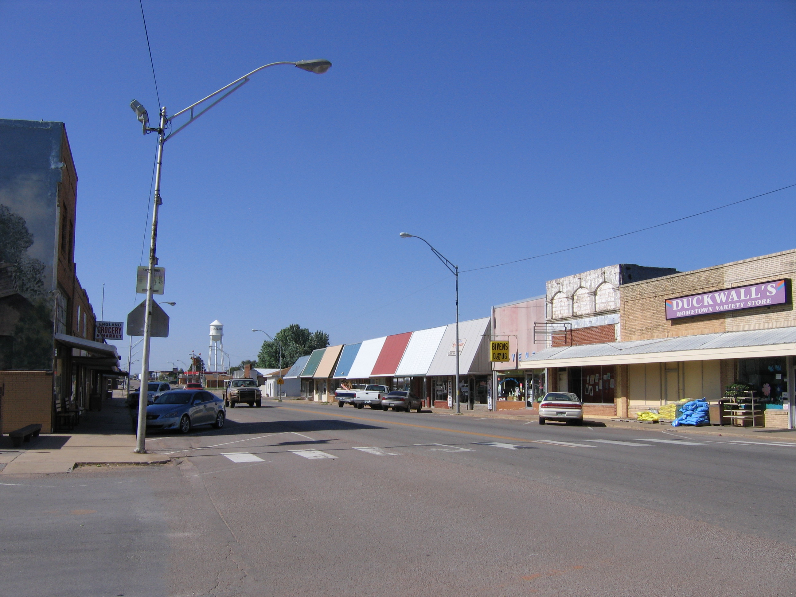 Downtown Seiling | |
| Nickname: Crossroads of Northwest Oklahoma[1] | |
 Location of Seiling, Oklahoma | |
| Coordinates: 36.149°N 98.925°W | |
| Country | United States |
| State | Oklahoma |
| County | Dewey |
| Area | |
| • Total | 1.19 sq mi (3.07 km2) |
| • Land | 1.19 sq mi (3.07 km2) |
| • Water | 0.00 sq mi (0.00 km2) |
| Elevation | 1,749 ft (533 m) |
| Population (2020) | |
| • Total | 850 |
| • Density | 716.69/sq mi (276.65/km2) |
| Time zone | UTC-6 (Central (CST)) |
| • Summer (DST) | UTC-5 (CDT) |
| ZIP code | 73663 |
| Area code | 580 |
| FIPS code | 40-66250[3] |
| GNIS feature ID | 1097902[4] |
History
Seiling developed as a local agricultural center and became the largest town in Dewey County despite the fact that the nearest railroad depot was in Canton, more than 25 miles (40 km) away . Moreover, there were no bridges across either of the Canadian rivers until 1906. A horse racing track was built in 1903.[5]
Geography
Seiling is located at 36°8′55″N 98°55′30″W (36.148579, -98.925123).[7] It is immediately south of the North Canadian River and 7 miles (11 km) north of the Canadian River, 10 miles (16 km) from Taloga, the county seat.[5]
According to the United States Census Bureau, the city has a total area of 0.8 square miles (2.1 km2), all land.
Demographics
| Historical population | |||
|---|---|---|---|
| Census | Pop. | %± | |
| 1910 | 352 | — | |
| 1920 | 323 | −8.2% | |
| 1930 | 568 | 75.9% | |
| 1940 | 629 | 10.7% | |
| 1950 | 700 | 11.3% | |
| 1960 | 910 | 30.0% | |
| 1970 | 1,033 | 13.5% | |
| 1980 | 1,103 | 6.8% | |
| 1990 | 1,031 | −6.5% | |
| 2000 | 875 | −15.1% | |
| 2010 | 860 | −1.7% | |
| 2020 | 850 | −1.2% | |
| U.S. Decennial Census[8] | |||
As of the 2010 census, there were 860 people, 325 households, and 216 families residing in the city.[9] The population density was 1,000 people per square mile (400/km2). There were 402 housing units at an average density of 488.6 per square mile (786.3/km2). Residents self-identified as 95.1% white, 12.7% Native American, 4.9% of mixed heritage, 1.6% Asian, and 0.1% African American.[9] Hispanic or Latino Americans made up 3.7% of the population.[9]
There were 325 households, out of which 29.5% had children under the age of 18 living with them, 48.9% were married couples living together, 12% had a female householder with no husband present, and 33.5% were non-families.[9] Individuals living alone accounted for 31.1% of households.[9] The average household size was 2.58 and the average family size was 3.24.[9] The median age was 37.9 years.[9]
The median income for a household in the city was $45,650, and the median income for a family was $58,466.[10] Males who were employed full-time had a median income of $43,333. Females who were employed full-time had a median income of $32,500.[10] The per capita income for the city was $24,410.[10] Below the poverty line were 9.7% of people, 10.3% of families, 13% of those under 18 and 11.6% of those over 64.[10]
Economy
The local economy has been based on agriculture since the land was opened to non-Indian settlement. The major crops initially were broomcorn and cotton. Seiling soon had a cotton gin and a feed mill. Wheat and rye became important crops before World War I. In 1918, the Seiling Milling Company opened a flour mill and marketed "White Rose Special" flour until it closed in 1952.[5]
Transportation
Seiling is on US-60, US-270, US-281, SH-3, and SH-51, some of which run concurrently through the town.[11] US-183 is immediately to the west.[11] Thus the town bills itself as the “Crossroads of Northwest Oklahoma.”[1]
Seiling Airport (FAA Identifier: 1S4) is immediately adjacent to Seiling on the northwest.[12]
Parks and recreation
Seiling City Park is in the town, located on Seiling Creek.[13]
The 9-hole Seiling Golf Course was built in 1980.[14]
The Seiling Swimming Pool is open to the general public, and for special event rental.[15]
Canton Lake is to the east.[11]
Little Sahara State Park is about a half-hour to the north.[16]
Notable people
- Gary England, meteorologist for KWTV-News 9
- Carrie Nation, Prohibition advocate
- Tom L. Ward, oil and gas businessman
- Jordy Mercer, Major League Baseball Player
- Gary Gore, owner Gore Nitrogen.
References
- "Local Amenities". Town of Seiling. Retrieved August 10, 2020.
- "ArcGIS REST Services Directory". United States Census Bureau. Retrieved September 20, 2022.
- "U.S. Census website". United States Census Bureau. Retrieved 2008-01-31.
- "US Board on Geographic Names". United States Geological Survey. 2007-10-25. Retrieved 2008-01-31.
- Everett, Dianna. "Seiling," Encyclopedia of Oklahoma History and Culture, 2009. Retrieved April 3, 2015.
- "Class A girls basketball News Article".
- "US Gazetteer files: 2010, 2000, and 1990". United States Census Bureau. 2011-02-12. Retrieved 2011-04-23.
- "Census of Population and Housing". Census.gov. Retrieved June 4, 2015.
- U.S. Census Bureau, 2010 Demographic Profile Data for Seiling city, Oklahoma at U.S. Census website (accessed September 19, 2013)
- U.S. Census Bureau, 2007-2011 American Community Survey, accessed via U.S. Census website database search of Seiling city, Oklahoma on September 19, 2013.
- "Seiling, Oklahoma". Google Maps. Retrieved August 10, 2020.
- "Seiling Airport". SkyVector. Retrieved August 10, 2020.
- "Seiling City Park". Google Maps. Retrieved August 10, 2020.
- "Seiling Golf Course". GolfAdvisor. Retrieved August 10, 2020.
- "Seiling Swimming Pool". Town of Seiling. Retrieved August 10, 2020.
- "Seiling to Little Sahara". Google Maps. Retrieved August 10, 2020.
Municipalities and communities of Dewey County, Oklahoma, United States | ||
|---|---|---|
County seat: Taloga | ||
| City |  | |
| Towns | ||
| CDP | ||
| Other community | ||
| ||
Authority control | |
|---|---|
| General | |
| National libraries | |
Другой контент может иметь иную лицензию. Перед использованием материалов сайта WikiSort.org внимательно изучите правила лицензирования конкретных элементов наполнения сайта.
WikiSort.org - проект по пересортировке и дополнению контента Википедии