world.wikisort.org - USA
Sabinal is a city in Uvalde County, Texas, United States. The population was 1,695 at the 2010 census.[5]
Sabinal, Texas | |
|---|---|
City | |
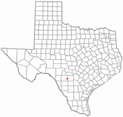 Location of Sabinal, Texas | |
 Mayor: Charles D. Story | |
| Coordinates: 29°19′14″N 99°28′8″W | |
| Country | United States |
| State | Texas |
| County | Uvalde |
| Area | |
| • Total | 1.19 sq mi (3.08 km2) |
| • Land | 1.19 sq mi (3.08 km2) |
| • Water | 0.00 sq mi (0.00 km2) |
| Elevation | 958 ft (292 m) |
| Population (2010) | |
| • Total | 1,695 |
| • Estimate (2019)[2] | 1,673 |
| • Density | 1,409.44/sq mi (543.97/km2) |
| Time zone | UTC-6 (Central (CST)) |
| • Summer (DST) | UTC-5 (CDT) |
| ZIP code | 78881 |
| Area code | 830 |
| FIPS code | 48-64004[3] |
| GNIS feature ID | 1367078[4] |
| Website | https://www.cityofsabinal.org |

Geography
Sabinal is located at 29°19′14″N 99°28′8″W (29.320678, –99.468887).[6]
According to the United States Census Bureau, the city has a total area of 1.2 square miles (3.1 km2), all of it land.
Climate
The climate in this area is characterized by hot, humid summers and generally mild to cool winters. According to the Köppen Climate Classification system, Sabinal has a humid subtropical climate, abbreviated "Cfa" on climate maps.[7]
Demographics
| Historical population | |||
|---|---|---|---|
| Census | Pop. | %± | |
| 1910 | 1,640 | — | |
| 1920 | 1,458 | −11.1% | |
| 1930 | 1,586 | 8.8% | |
| 1940 | 1,768 | 11.5% | |
| 1950 | 1,974 | 11.7% | |
| 1960 | 1,747 | −11.5% | |
| 1970 | 1,554 | −11.0% | |
| 1980 | 1,827 | 17.6% | |
| 1990 | 1,584 | −13.3% | |
| 2000 | 1,586 | 0.1% | |
| 2010 | 1,695 | 6.9% | |
| 2019 (est.) | 1,673 | [2] | −1.3% |
| U.S. Decennial Census[8] | |||
2020 Census
| Race | Number | Percentage |
|---|---|---|
| White (NH) | 364 | 26.69% |
| Black or African American (NH) | 3 | 0.22% |
| Native American or Alaska Native (NH) | 1 | 0.07% |
| Pacific Islander (NH) | 1 | 0.07% |
| Mixed/Multi-Racial (NH) | 18 | 1.32% |
| Hispanic or Latino | 977 | 71.63% |
| Total | 1,364 |
As of the 2020 United States census, there were 1,364 people, 458 households, and 234 families residing in the city.
2000 Census
As of the census[3] of 2000, there were 1,586 people, 560 households, and 417 families residing in the city. The population density was 1,336.3 people per square mile (514.6/km2). There were 655 housing units at an average density of 551.9/sq mi (212.5/km2). The racial makeup of the city was 79.51% White, 0.06% African American, 0.19% Native American, 0.06% Asian, 0.06% Pacific Islander, 16.46% from other races, and 3.66% from two or more races. Hispanic or Latino of any race were 64.06% of the population.
There were 560 households, out of which 38.6% had children under the age of 18 living with them, 58.2% were married couples living together, 12.7% had a female householder with no husband present, and 25.5% were non-families. 23.6% of all households were made up of individuals, and 12.9% had someone living alone who was 65 years of age or older. The average household size was 2.83 and the average family size was 3.39.
In the city, the population was spread out, with 30.1% under the age of 18, 7.9% from 18 to 24, 25.9% from 25 to 44, 20.9% from 45 to 64, and 15.3% who were 65 years of age or older. The median age was 35 years. For every 100 females, there were 94.8 males. For every 100 females age 18 and over, there were 90.2 males.
The median income for a household in the city was $26,429, and the median income for a family was $31,776. Males had a median income of $25,169 versus $16,250 for females. The per capita income for the city was $12,393. About 17.2% of families and 21.6% of the population were below the poverty line, including 26.9% of those under age 18 and 19.8% of those age 65 or over.
Education
The city is served by the Sabinal Independent School District.
References
- "2019 U.S. Gazetteer Files". United States Census Bureau. Retrieved August 7, 2020.
- "Population and Housing Unit Estimates". United States Census Bureau. May 24, 2020. Retrieved May 27, 2020.
- "U.S. Census website". United States Census Bureau. Retrieved 2008-01-31.
- "US Board on Geographic Names". United States Geological Survey. 2007-10-25. Retrieved 2008-01-31.
- "Profile of General Population and Housing Characteristics: 2010 Demographic Profile Data (DP-1): Sabinal city, Texas". United States Census Bureau. Retrieved March 28, 2012.
- "US Gazetteer files: 2010, 2000, and 1990". United States Census Bureau. 2011-02-12. Retrieved 2011-04-23.
- Climate Summary for Sabinal, Texas
- "Census of Population and Housing". Census.gov. Retrieved June 4, 2015.
- "Explore Census Data". data.census.gov. Retrieved 2022-05-20.
- https://www.census.gov/ [not specific enough to verify]
- "About the Hispanic Population and its Origin". www.census.gov. Retrieved 18 May 2022.
Municipalities and communities of Uvalde County, Texas, United States | ||
|---|---|---|
County seat: Uvalde | ||
| Cities |  | |
| CDPs | ||
| Other community |
| |
| Ghost town | ||
| ||
На других языках
[de] Sabinal (Texas)
Sabinal ist eine Ortschaft im Uvalde County im Süden des US-Bundesstaats Texas. Sie hatte im Jahr 2010 laut Zensus 1.695 Einwohner.[1]- [en] Sabinal, Texas
Другой контент может иметь иную лицензию. Перед использованием материалов сайта WikiSort.org внимательно изучите правила лицензирования конкретных элементов наполнения сайта.
WikiSort.org - проект по пересортировке и дополнению контента Википедии