world.wikisort.org - USA
Rosbys Rock is an unincorporated community in Marshall County, West Virginia, United States.
Rosbys Rock | |
|---|---|
Unincorporated community | |
 Rosbys Rock Location within the state of West Virginia  Rosbys Rock Rosbys Rock (the United States) | |
| Coordinates: 39°50′29″N 80°42′43″W | |
| Country | |
| State | |
| County | |
| Elevation | 778 ft (237 m) |
| Time zone | UTC-5 (Eastern (EST)) |
| • Summer (DST) | UTC-4 (EDT) |
| GNIS ID | 1546066[1] |
The community was named after Roseby Carr, who with his son led two railroad construction crews that met on December 24, 1852 and thereby connected the Baltimore and Ohio Railroad to the Ohio River near a huge (900 cubic yard) sandstone boulder near the original town site.[2]
At the height of train service, eight passenger trains and eight to twelve freight trains passed through the town daily, and B&O crews kept painting a memorial sign (originally carved with typographical error) on the rock. The last passenger train ran through the village in 1957 and the last freight train in 1973 or 1972. The tracks were removed in 1974 and replaced by an unpaved road (Boulder Road)(on the opposite side of Grave Creek from the paved Grave Creek road).[3][4][5]
The historical marker about the event is about 5 miles west of the actual rock, at the intersection of Lafayette and 12th Streets near the Ohio River bridge, with additional signage on 12th street pointing the route to Grave Creek Road.[6]
References
- U.S. Geological Survey Geographic Names Information System: Rosbys Rock, West Virginia
- Kenny, Hamill (1945). West Virginia Place Names: Their Origin and Meaning, Including the Nomenclature of the Streams and Mountains. Piedmont, WV: The Place Name Press. p. 541.
- "E-WV | Rosbys Rock".
- "Rosbys Rock". Archived from the original on 2008-12-02.
- "Rocking Christmas Eve". 24 December 2015.
- "Rosby's Rock - West Virginia Historical Markers on". Waymarking.com. Retrieved 2022-05-03.
Municipalities and communities of Marshall County, West Virginia, United States | ||
|---|---|---|
County seat: Moundsville | ||
| Cities | 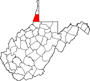 | |
| Unincorporated communities |
| |
| Ghost towns | ||
| Footnotes | ‡This populated place also has portions in an adjacent county or counties | |
| ||
This article about a location in Marshall County, West Virginia is a stub. You can help Wikipedia by expanding it. |
Другой контент может иметь иную лицензию. Перед использованием материалов сайта WikiSort.org внимательно изучите правила лицензирования конкретных элементов наполнения сайта.
WikiSort.org - проект по пересортировке и дополнению контента Википедии