world.wikisort.org - USA
Republican is an unincorporated community in Faulkner County, Arkansas, United States. The community is located along local roads in the northeast part of the county, 3.9 miles (6.3 km) northwest of Greenbrier.[2]
Republican, Arkansas | |
|---|---|
Unincorporated community | |
 Republican  Republican | |
| Coordinates: 35°16′53″N 92°25′31″W | |
| Country | United States |
| State | Arkansas |
| County | Faulkner |
| Elevation | 374 ft (114 m) |
| Time zone | UTC-6 (Central (CST)) |
| • Summer (DST) | UTC-5 (CDT) |
| Area code(s) | 501 |
| GNIS feature ID | 78166[1] |
The Castleberry-Harrington Historic District and the Farris and Evelyn Langley House, which are listed on the National Register of Historic Places, are both near the community.[3]
References
- "Republican". Geographic Names Information System. United States Geological Survey.
- Faulkner County, Arkansas General Highway Map (PDF) (Map). Arkansas State Highway and Transportation Department. September 11, 2014. Retrieved April 9, 2016.
- "National Register Information System". National Register of Historic Places. National Park Service. July 9, 2010.
Municipalities and communities of Faulkner County, Arkansas, United States | ||
|---|---|---|
County seat: Conway | ||
| Cities | 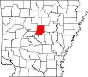 | |
| Towns | ||
| Unincorporated communities |
| |
| Footnotes | ‡This populated place also has portions in an adjacent county or counties | |
| ||
Текст в блоке "Читать" взят с сайта "Википедия" и доступен по лицензии Creative Commons Attribution-ShareAlike; в отдельных случаях могут действовать дополнительные условия.
Другой контент может иметь иную лицензию. Перед использованием материалов сайта WikiSort.org внимательно изучите правила лицензирования конкретных элементов наполнения сайта.
Другой контент может иметь иную лицензию. Перед использованием материалов сайта WikiSort.org внимательно изучите правила лицензирования конкретных элементов наполнения сайта.
2019-2026
WikiSort.org - проект по пересортировке и дополнению контента Википедии
WikiSort.org - проект по пересортировке и дополнению контента Википедии