world.wikisort.org - USA
Red Wing is an unincorporated community along the Huerfano River in Huerfano County, Colorado, United States.
Red Wing, Colorado
Point of Rocks | |
|---|---|
Unincorporated community | |
 Some old dwellings in Red Wing | |
 Red Wing Location of Red Wing in Huerfano County, Colorado  Red Wing Red Wing (the United States) | |
| Coordinates: 37°44′10″N 105°17′24″W[1] | |
| Country | |
| State | |
| Counties | Huerfano |
| Elevation | 7,726 ft (2,355 m) |
| Time zone | UTC-7 (MST) |
| • Summer (DST) | UTC-6 (MDT) |
Geography
Red Wing is located at 37°44′10″N 105°17′24″W (37.7361158,-105. 2900038). The community lies southwest of Gardner and just east of the Sangre de Cristo Range along County Road 580 in the Huerfano River Valley. The community is agrarian and has many interesting geological features, such as faults, outcrops of Dakota sandstone, and igneous intrusions.[2]
See also
![]() Colorado portal
Colorado portal
References
- "Red Wing". Geographic Names Information System. United States Geological Survey, United States Department of the Interior.
- "Red Wing, Colorado". Sangres.com. Retrieved 2018-05-03.
External links
![]() Media related to Red Wing, Colorado at Wikimedia Commons
Media related to Red Wing, Colorado at Wikimedia Commons
Municipalities and communities of Huerfano County, Colorado, United States | ||
|---|---|---|
County seat: Walsenburg | ||
| City | 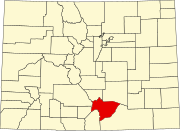 | |
| Town | ||
| CDP | ||
| Unincorporated communities | ||
| Ghost towns |
| |
| ||
Текст в блоке "Читать" взят с сайта "Википедия" и доступен по лицензии Creative Commons Attribution-ShareAlike; в отдельных случаях могут действовать дополнительные условия.
Другой контент может иметь иную лицензию. Перед использованием материалов сайта WikiSort.org внимательно изучите правила лицензирования конкретных элементов наполнения сайта.
Другой контент может иметь иную лицензию. Перед использованием материалов сайта WikiSort.org внимательно изучите правила лицензирования конкретных элементов наполнения сайта.
2019-2026
WikiSort.org - проект по пересортировке и дополнению контента Википедии
WikiSort.org - проект по пересортировке и дополнению контента Википедии