world.wikisort.org - USA
Raynesford is an unincorporated community in Judith Basin County, Montana, United States. Its elevation is 4,042 feet (1,232 m), and it is located at 47°16′12″N 110°43′48″W (47.2699643, -110.7299417).[3] The community includes a community center, a catholic church, a fire department,[4] and a post office.[5] The post office was established under the name of "Spion Kop" on March 31, 1906; its name was changed to Raynesford exactly three years later.[5]
Raynesford, Montana | |
|---|---|
Census-Designated Place | |
 The Historic Montana Elevator Co. elevator next to the tracks. | |
| Country | United States |
| State | Montana |
| County | Judith Basin |
| Area | |
| • Total | 0.10 sq mi (0.26 km2) |
| • Land | 0.10 sq mi (0.26 km2) |
| • Water | 0.00 sq mi (0.00 km2) |
| Population (2020) | |
| • Total | 31 |
| • Density | 310.00/sq mi (119.91/km2) |
| FIPS code | 30-61300 |
| GNIS feature ID | 789423[2] |
U.S. Route 87 passes through town. Big Otter Creek flows through town.
Demographics
| Historical population | |||
|---|---|---|---|
| Census | Pop. | %± | |
| 2020 | 31 | — | |
| U.S. Decennial Census[6] | |||
Climate
According to the Köppen Climate Classification system, Raynesford has a semi-arid climate, abbreviated "BSk" on climate maps.[7]
References
- "ArcGIS REST Services Directory". United States Census Bureau. Retrieved September 18, 2022.
- U.S. Geological Survey Geographic Names Information System: Raynesford, Montana
- U.S. Geological Survey Geographic Names Information System: Raynesford, Montana
- U.S. Geological Survey Geographic Names Information System: Judith Basin Rural Fire District Raynesford
- U.S. Geological Survey Geographic Names Information System: Raynesford Post Office
- "Census of Population and Housing". Census.gov. Retrieved June 4, 2016.
- Climate Summary for Raynesford, Montana
Municipalities and communities of Judith Basin County, Montana, United States | ||
|---|---|---|
County seat: Stanford | ||
| City | 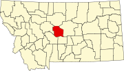 | |
| Town | ||
| CDPs | ||
| Other community |
| |
| Ghost town |
| |
| ||
This Judith Basin County, Montana state location article is a stub. You can help Wikipedia by expanding it. |
Другой контент может иметь иную лицензию. Перед использованием материалов сайта WikiSort.org внимательно изучите правила лицензирования конкретных элементов наполнения сайта.
WikiSort.org - проект по пересортировке и дополнению контента Википедии