world.wikisort.org - USA
Pushmataha is an unincorporated community in Choctaw County, Alabama, United States.[1] It was named in honor of famed Choctaw chief Pushmataha.[2] Much of the community is part of the Pushmataha Historic District, listed on the Alabama Register of Landmarks and Heritage in October 2008.[3]
Pushmataha, Alabama | |
|---|---|
Unincorporated community | |
 Pushmataha, Alabama Location within the state of Alabama  Pushmataha, Alabama Pushmataha, Alabama (the United States) | |
| Coordinates: 32°11′36″N 88°21′12″W | |
| Country | United States |
| State | Alabama |
| County | Choctaw |
| Elevation | 243 ft (74 m) |
| Time zone | UTC-6 (Central (CST)) |
| • Summer (DST) | UTC-5 (CDT) |
| Area code(s) | 205, 659 |
Pushmataha's population as an unincorporated community was listed as 124 at the 1880 U.S. Census, the only time a figure was returned.
Geography
Pushmataha is located at 32.19347°N 88.35336°W and has an elevation of 243 feet (74 m).[1]
Demographics
| Historical population | |||
|---|---|---|---|
| Census | Pop. | %± | |
| 1880 | 124 | — | |
| U.S. Decennial Census[4] | |||
References
- U.S. Geological Survey Geographic Names Information System: Pushmataha
- Greg O'Brien (February 6, 2011). "Pushmataha". The Encyclopedia of Alabama. Auburn University. Retrieved July 23, 2011.
- "The Alabama Register of Landmarks & Heritage". preserveala.org. Alabama Historical Commission. May 31, 2011. Archived from the original (PDF) on June 6, 2011. Retrieved June 6, 2011.
- "U.S. Decennial Census". Census.gov. Retrieved June 6, 2013.
Municipalities and communities of Choctaw County, Alabama, United States | ||
|---|---|---|
County seat: Butler | ||
| Towns | 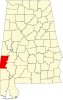 | |
| CDP | ||
| Unincorporated communities | ||
| Footnotes | ‡This populated place also has portions in an adjacent county or counties | |
| ||
This Choctaw County, Alabama state location article is a stub. You can help Wikipedia by expanding it. |
Текст в блоке "Читать" взят с сайта "Википедия" и доступен по лицензии Creative Commons Attribution-ShareAlike; в отдельных случаях могут действовать дополнительные условия.
Другой контент может иметь иную лицензию. Перед использованием материалов сайта WikiSort.org внимательно изучите правила лицензирования конкретных элементов наполнения сайта.
Другой контент может иметь иную лицензию. Перед использованием материалов сайта WikiSort.org внимательно изучите правила лицензирования конкретных элементов наполнения сайта.
2019-2026
WikiSort.org - проект по пересортировке и дополнению контента Википедии
WikiSort.org - проект по пересортировке и дополнению контента Википедии