world.wikisort.org - USA
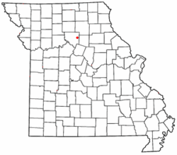
Prairie Hill is an unincorporated community in eastern Chariton County, Missouri, United States.[3] The community is located at the intersection of Missouri routes W and HH approximately seven miles north-northeast of Salisbury. The Thomas Hill Reservoir dam is seven miles to the northeast in adjacent Randolph County.[4]
Prairie Hill, Missouri | |
|---|---|
Census-Designated Place | |
 Location of Prairie Hill in Missouri | |
| Country | United States |
| State | Missouri |
| County | Chariton |
| Area | |
| • Total | 0.46 sq mi (1.19 km2) |
| • Land | 0.46 sq mi (1.19 km2) |
| • Water | 0.00 sq mi (0.00 km2) |
| Population (2020) | |
| • Total | 50 |
| • Density | 109.17/sq mi (42.12/km2) |
| FIPS code | 29-59708 |
| GNIS feature ID | 724853[2] |
A post office called Prairie Hill was established in 1869, and remained in operation until 1966.[5] The community was named for its elevated location upon a prairie.[6]
Demographics
| Historical population | |||
|---|---|---|---|
| Census | Pop. | %± | |
| 2020 | 50 | — | |
| U.S. Decennial Census[7] | |||
References
- "ArcGIS REST Services Directory". United States Census Bureau. Retrieved September 5, 2022.
- U.S. Geological Survey Geographic Names Information System: Prairie Hill, Missouri
- U.S. Geological Survey Geographic Names Information System: Prairie Hill, Missouri
- Missouri Atlas & Gazetteer, DeLorme, 1998, First edition, p. 30, ISBN 0-89933-224-2
- "Post Offices". Jim Forte Postal History. Retrieved 17 September 2016.
- "Chariton County Place Names, 1928–1945 (archived)". The State Historical Society of Missouri. Archived from the original on 24 June 2016. Retrieved 17 September 2016.
{{cite web}}: CS1 maint: bot: original URL status unknown (link) - "Census of Population and Housing". Census.gov. Retrieved June 4, 2016.
Текст в блоке "Читать" взят с сайта "Википедия" и доступен по лицензии Creative Commons Attribution-ShareAlike; в отдельных случаях могут действовать дополнительные условия.
Другой контент может иметь иную лицензию. Перед использованием материалов сайта WikiSort.org внимательно изучите правила лицензирования конкретных элементов наполнения сайта.
Другой контент может иметь иную лицензию. Перед использованием материалов сайта WikiSort.org внимательно изучите правила лицензирования конкретных элементов наполнения сайта.
2019-2025
WikiSort.org - проект по пересортировке и дополнению контента Википедии
WikiSort.org - проект по пересортировке и дополнению контента Википедии
