world.wikisort.org - USA
Pine Level, also known as Pine Tucky, is an unincorporated community in Montgomery County, Alabama, United States. Pine Level is located along U.S. Route 231 (also known as Alabama State Route 53), 25 miles (40 km) southeast of Montgomery.
Pine Level, Alabama | |
|---|---|
Unincorporated community | |
 Pine Level  Pine Level | |
| Coordinates: 32°04′05″N 86°03′35″W | |
| Country | United States |
| State | Alabama |
| County | Montgomery |
| Elevation | 489 ft (149 m) |
| Population (2007) | |
| • Total | 1,782 |
| Time zone | UTC-6 (Central (CST)) |
| • Summer (DST) | UTC-5 (CDT) |
| ZIP code | 36069 |
| Area code(s) | 334 |
| GNIS feature ID | 152926[1] |
History
Pine Level was originally known as Pine Tucky, most likely due to its location on poor sandy soil covered with pine trees. The community later began to be called Pine Level.[2] A post office first opened under the name Pine Level in 1839.[3]
Notable people
- Rosa Parks, her arrest served as a catalyst to the Montgomery bus boycott during the Civil Rights Movement. She lived in Pine Level as a child.
- Claudette Colvin, arrested for refusing to give up her seat on a segregated bus, nine months before Rosa Parks was arrested for doing the same thing. She lived in Pine Level until she was 8-years-old.
References
- "Pine Level". Geographic Names Information System. United States Geological Survey.
- Foscue, Virginia (1989). Place Names in Alabama. Tuscaloosa: The University of Alabama Press. p. 111. ISBN 0-8173-0410-X.
- "Montgomery County". Jim Forte Postal History. Retrieved 18 January 2015.
Municipalities and communities of Montgomery County, Alabama, United States | ||
|---|---|---|
County seat: Montgomery | ||
| Cities | 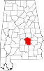 | |
| Towns |
| |
| Unincorporated communities | ||
| Indian reservation |
| |
| Footnotes | ‡This populated place also has portions in an adjacent county or counties | |
| ||
This Montgomery County, Alabama state location article is a stub. You can help Wikipedia by expanding it. |
Текст в блоке "Читать" взят с сайта "Википедия" и доступен по лицензии Creative Commons Attribution-ShareAlike; в отдельных случаях могут действовать дополнительные условия.
Другой контент может иметь иную лицензию. Перед использованием материалов сайта WikiSort.org внимательно изучите правила лицензирования конкретных элементов наполнения сайта.
Другой контент может иметь иную лицензию. Перед использованием материалов сайта WikiSort.org внимательно изучите правила лицензирования конкретных элементов наполнения сайта.
2019-2026
WikiSort.org - проект по пересортировке и дополнению контента Википедии
WikiSort.org - проект по пересортировке и дополнению контента Википедии