world.wikisort.org - USA
Perrysburg is a city located in Wood County, Ohio, United States, along the south side of the Maumee River. The population was 25,041 at the 2020 census. Part of the Toledo metropolitan area, the city is 12 miles (19 km) southwest of Toledo. Perrysburg is the second-largest city in Wood County, after the county seat of Bowling Green.
Perrysburg, Ohio | |
|---|---|
City | |
 Downtown Perrysburg | |
| Motto: "Embracing Our Past. Poised For The Future." | |
 Location of Perrysburg in Ohio | |
 Location of Perrysburg in Wood County | |
| Coordinates: 41°33′1″N 83°37′48″W | |
| Country | United States |
| State | Ohio |
| County | Wood |
| Government | |
| • Mayor | Tom Mackin |
| Area | |
| • Total | 11.93 sq mi (30.91 km2) |
| • Land | 11.89 sq mi (30.80 km2) |
| • Water | 0.04 sq mi (0.11 km2) |
| Elevation | 630 ft (192 m) |
| Population (2020)[3] | |
| • Total | 25,041 |
| • Density | 1,818.53/sq mi (702.15/km2) |
| Time zone | UTC-5 (Eastern (EST)) |
| • Summer (DST) | UTC-4 (EDT) |
| ZIP codes | 43551–43552 |
| Area code | 419 |
| FIPS code | 39-62148[4] |
| GNIS feature ID | 1066139[2] |
| Website | ci.perrysburg.oh.us |
History

Early history
Perrysburg lies near the center of the Twelve Mile Square Reservation, a tract of land ceded in 1795 to the United States of America by the Ottawa people following their defeat in the Northwest Indian Wars. They had occupied this territory since the turn of the 18th century, after having settled in the region of the French trading post at Fort Detroit. The Ottawa had controlled much of the territory along the Maumee River in present-day northwestern Ohio.[5]
In 1810, early European-American settlers here were Major Amos Spafford (1753-1818), his wife Olive (1756-1823), and their four children. In 1796, Spafford, a native of Connecticut, was a surveyor for the Connecticut Land Company. He drew the first map laying out Cleveland and named the city. He left there in 1810 following appointment as US Customs Collector and postmaster for the new port at the Foot of the Rapids of the Miami of the Lake Maumee River. Two years later, 67 families lived in the area, but most fled at the outbreak of the War of 1812.[6] After the war and the 1817 Treaty of Fort Meigs, which extinguished the Ottawa claim to this area, Spafford returned to the area. He settled on a 160-acre land grant, signed by President James Monroe, on River Tract #64 in Waynesfield Township. Other veterans who received land grants for their service during that war also settled in this area.
War of 1812
When the war clouds of 1812 began to edge toward Northwest Ohio, General William Henry Harrison ordered the construction of the fort, beginning in February 1813. Harrison was General Anthony Wayne's former aide-de-camp. Later he was elected as the country's ninth president. The installation was named Fort Meigs in honor of Ohio's fourth governor, Return Jonathan Meigs. Fort Meigs was constructed on a bluff above the Maumee River, and built from a design by the army engineer Captain Eleazer D. Wood, for whom the county would be named. Two critical battles with the British were fought at the fort during the War of 1812.
Early settlers in the area fled to Huron during the War of 1812. They returned to settle in the floodplain below Fort Meigs, calling the settlement Orleans. They moved to higher ground after being flooded out. Perrysburg was located by a surveying team led by Alexander Bourne, appointed to that position by Edward Tiffin, Surveyor General of the United States. Contrary to numerous Internet postings, Charles Pierre L'Enfant did not survey and plat Perrysburg, Ohio on April 27, 1816; this survey was performed in late June and early July 1816, by surveyors Joseph Wampler and William Brookfield under the auspices of Alexander Bourne and Josiah Meigs, Surveyor General of Ohio, Michigan, Indiana, Illinois, and Missouri.[7]
There is a myth that Perrysburg was one of only two cities to be surveyed by the Federal Government. This myth was shattered in 2018 when research into the National Archives identified many town and village surveys conducted by the Federal Government in the 19th century.[8]
Growth of Perrysburg

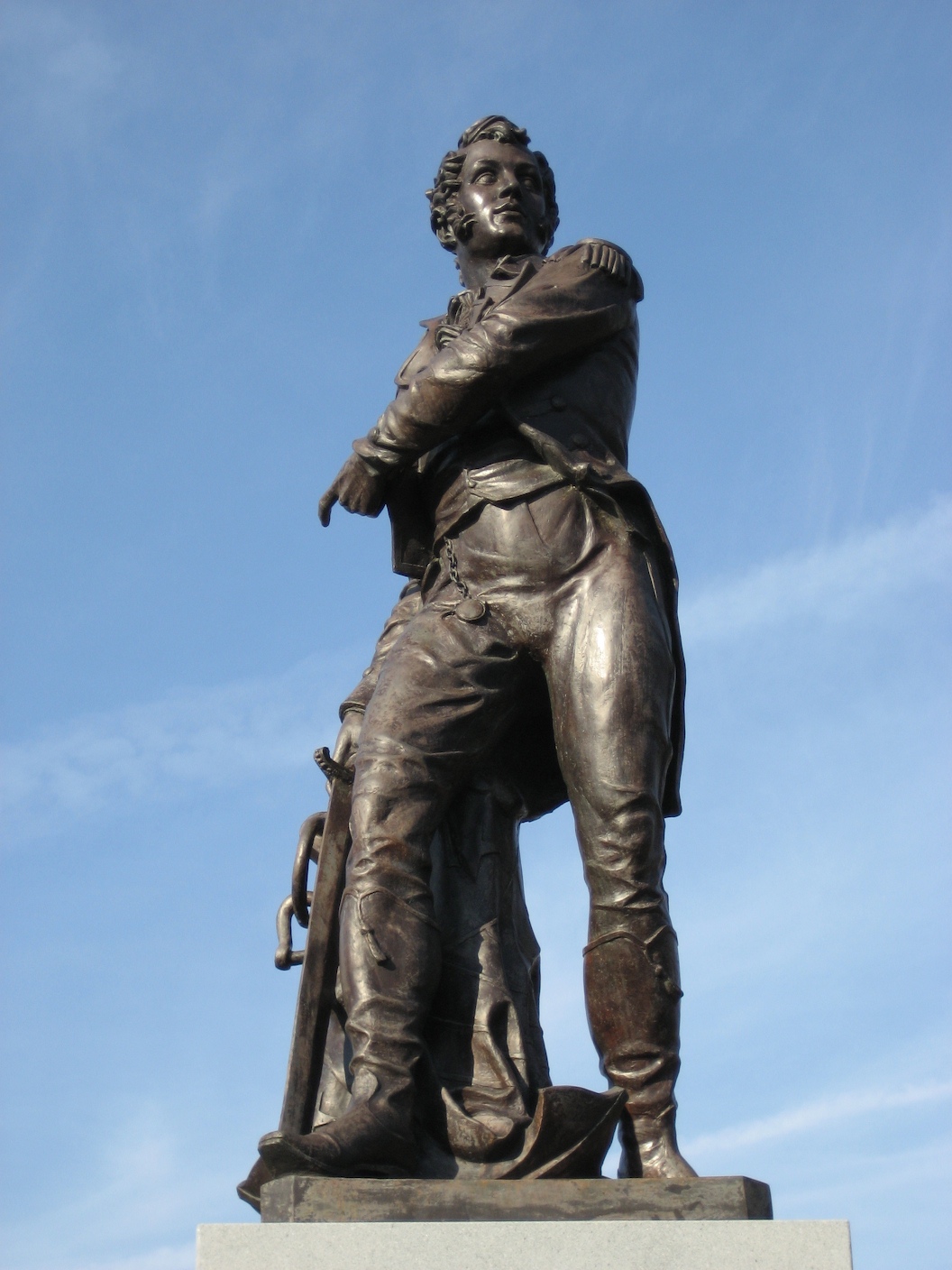
The town soon became a center for shipbuilding and commerce on Lake Erie. It was named after Commodore Oliver Hazard Perry, naval commander during the War of 1812 and hero of the Battle of Lake Erie.[9]
From 1822 to 1868 Perrysburg served as the county seat.[10]
In 1833, Perrysburg contained a courthouse, jail, schoolhouse, two stores, two taverns, two physicians, two lawyers, about 60 houses, and 250 inhabitants.[11]
In 1854, an epidemic of cholera devastated the population. The town closed down for two months in that summer, trying to contain the epidemic at a time when people did not understand how it was transmitted. More than 100 people died. Other towns along the Maumee also suffered high losses from the epidemic, and Providence, Ohio was abandoned. It had suffered a disastrous fire less than a decade before.
Modern Perrysburg
On October 12, 1984 President Ronald Reagan made a whistle stop in Perrysburg in the Ferdinand Magellan drawing a crowd of over 20,000.[12]
Geography
According to the United States Census Bureau, the city has a total area of 11.51 square miles (29.81 km2), all land.[13] Contrary to popular opinion and hundreds of historical articles, the 1816 survey of Perrysburg encompassed 1.786 square miles, NOT 1.000 square miles.[14]
Demographics
| Historical population | |||
|---|---|---|---|
| Census | Pop. | %± | |
| 1830 | 182 | — | |
| 1840 | 1,041 | 472.0% | |
| 1850 | 1,199 | 15.2% | |
| 1860 | 1,494 | 24.6% | |
| 1870 | 1,835 | 22.8% | |
| 1880 | 1,909 | 4.0% | |
| 1890 | 1,747 | −8.5% | |
| 1900 | 1,766 | 1.1% | |
| 1910 | 1,913 | 8.3% | |
| 1920 | 2,429 | 27.0% | |
| 1930 | 3,182 | 31.0% | |
| 1940 | 3,457 | 8.6% | |
| 1950 | 4,006 | 15.9% | |
| 1960 | 5,519 | 37.8% | |
| 1970 | 7,693 | 39.4% | |
| 1980 | 10,196 | 32.5% | |
| 1990 | 12,551 | 23.1% | |
| 2000 | 16,945 | 35.0% | |
| 2010 | 20,623 | 21.7% | |
| 2020 | 25,041 | 21.4% | |
| Sources:[4][15][16][17][18][19][20] | |||
2010 census
As of the census[3] of 2010, there were 20,623 people, 8,246 households, and 5,504 families living in the city. The population density was 1,791.7 inhabitants per square mile (691.8/km2). There were 8,845 housing units at an average density of 768.5 per square mile (296.7/km2). The racial makeup of the city was 92.9% White, 1.4% African American, 0.1% Native American, 3.1% Asian, 0.8% from other races, and 1.6% from two or more races. Hispanic or Latino of any race were 3.2% of the population.
There were 8,246 households, of which 34.7% had children under the age of 18 living with them, 56.5% were married couples living together, 7.3% had a female householder with no husband present, 2.9% had a male householder with no wife present, and 33.3% were non-families. 28.3% of all households were made up of individuals, and 11% had someone living alone who was 65 years of age or older. The average household size was 2.48 and the average family size was 3.10.
The median age in the city was 38.4 years. 26.5% of residents were under the age of 18; 6.5% were between the ages of 18 and 24; 27.1% were from 25 to 44; 27.6% were from 45 to 64; and 12.3% were 65 years of age or older. The gender makeup of the city was 48.4% male and 51.6% female.
2000 census

As of the census[4] of 2000, there were 16,945 people, 6,592 households, and 4,561 families living in the city. The population density was 1,899.2 people per square mile (733.5/km2). There were 6,964 housing units at an average density of 780.5 per square mile (301.4/km2). The racial makeup of the city was 95.34% White, 1.03% African American, 0.10% Native American, 1.77% Asian, 0.02% Pacific Islander, 0.90% from other races, and 0.84% from two or more races. Hispanic or Latino of any race were 2.05% of the population.
There were 6,390 households, out of which 38.0% had children under the age of 18 living with them, 61.1% were married couples living together, 6.3% had a female householder with no husband present, and 30.8% were non-families. 27.8% of all households were made up of individuals, and 14.2% had someone living alone who was 65 years of age or older. The average household size was 2.55 and the average family size was 3.18.
In the city the population was spread out, with 29.0% under the age of 18, 5.6% from 18 to 24, 28.3% from 25 to 44, 24.0% from 45 to 64, and 13.0% who were 65 years of age or older. The median age was 38 years. For every 100 females, there were 92.7 males. For every 100 females age 18 and over, there were 86.5 males.
The median income for a household in the city was $62,237 and the median income for a family was $75,651. Males had a median income of $56,496 versus $31,401 for females. The per capita income for the city was $29,652. About 1.5% of families and 2.8% of the population were below the poverty line, including 1.7% of those under age 18 and 8.1% of those age 65 or over.
Education
Perrysburg is home to The Islamic School of Greater Toledo,[21] Saint Rose School[22] and Perrysburg Schools, which includes a preschool, four elementary schools, one intermediate school, one junior high school and Perrysburg High School.[23]
In the year 2016, 51% of Perrysburg residents over the age of 25 had a bachelor's degree or a higher level of education, compared to 31.7% of Wood County residents, 23% of residents in the Toledo MSA, 26.7% of Ohioans, and 30.3% in the U.S.[24][25][26][27]
Library
The Way Public Library serves Perrysburg area. In 2016, the library loaned 639,113 items and provided 726 programs to its 34,336 registered borrowers. Total holdings in 2016 were 93,416 print materials and 182 print subscriptions.[28]
Notable people
- Burke Badenhop, professional baseball pitcher in Major League Baseball[29][30]
- Clara Blinn, pioneer who died in the aftermath of the Battle of Washita River[31]
- Douglas Brinkley, award-winning historian, lived in Perrysburg from 1968 to 1982
- Bil Dwyer, cartoonist (Dumb Dora) and humorist
- T. J. Fatinikun, professional football player in the National Football League (NFL) and Arena Football League
- Jerry Glanville, NFL and college football head coach[32]
- Jim Harbaugh, professional football player in the NFL and head coach in the NFL and college football
- John Harbaugh, head coach in the National Football League (NFL)
- Sam Jaeger, actor and screenwriter[33]
- Ralph Wesley Judd, professional baseball player in Major League Baseball[34]
- Lance K. Landrum, United States Air Force lieutenant general currently serving as the 23rd Deputy Chair of the NATO Military Committee
- Jim Leyland, professional baseball player and manager in Major League Baseball[35]
- Anna Tunnicliffe, 2008 US Olympic Sailing Team gold medalist[36]
Notable companies

- Burkett Restaurant Equipment, dealer in food service equipment
- Owens-Illinois Inc., global glass container manufacturer[37]
- Universal Tube & Rollform Equipment, metalworking machinery dealer, specializing in tube mills, roll forming and coil processing equipment.
- Fox Software, creator of FoxPro (Defunct after being acquired by Microsoft in 1992)
- First Solar, a global provider of comprehensive PV solar solutions that use its advanced module and system technology.
References
- "2019 U.S. Gazetteer Files". United States Census Bureau. Retrieved July 28, 2020.
- "US Board on Geographic Names". United States Geological Survey. 2007-10-25. Retrieved 2008-01-31.
- "U.S. Census website". United States Census Bureau. Retrieved 2013-01-06.
- "U.S. Census website". United States Census Bureau. Retrieved 2008-01-31.
- Atlas of Great Lakes Indian History, (University of Oklahoma Press: Norman, 1986) pp. 3, 58–59; and R. Douglas Hurt, The Ohio Frontier: Crucible of the Old Northwest, 1720–1830 (Indiana University Press: Bloomington, 1998), pp. 8–12
- "Remarkable Ohio". Archived from the original on 2014-12-06. Retrieved 2014-12-04.
- History of the Maumee River Basin from the Earliest Account to Its Organization into Counties; Charles Elihu Slocum, 1905
- "The Founding and Survey of Perrysburg, Ohio"; Gary L. Franks; InstantPublisher.com, Collierville TN; 2018
- "Profile for Perrysburg, Ohio". ePodunk. Retrieved 2010-06-06.
- "Dinner celebrates Wood County history". Sentinel-Tribune. Retrieved 7 February 2022.
- Kilbourn, John (1833). The Ohio Gazetteer, or, a Topographical Dictionary. Scott and Wright. pp. 367. Retrieved 12 December 2013.
- "Former actor, future president stumped often in northwest Ohio". Toledo Blade. Retrieved 24 February 2020.
- "US Gazetteer files 2010". United States Census Bureau. Archived from the original on 2012-01-25. Retrieved 2013-01-06.
- "The Founding and Survey of Perrysburg, Ohio"; Gary L. Franks; InstantPublisher, Collierville TN; 2018
- "Population of Civil Divisions Less than Counties" (PDF). Statistics of the Population of the United States at the Ninth Census. U.S. Census Bureau. 1870. Archived from the original (PDF) on 2018-12-26. Retrieved 28 November 2013.
- "Population of Civil Divisions Less than Counties" (PDF). Statistics of the Population of the United States at the Tenth Census. U.S. Census Bureau. 1880. Retrieved 28 November 2013.
- "Population: Ohio" (PDF). 1910 U.S. Census. U.S. Census Bureau. Retrieved 28 November 2013.
- "Population: Ohio" (PDF). 1930 US Census. U.S. Census Bureau. Retrieved 28 November 2013.
- "Number of Inhabitants: Ohio" (PDF). 18th Census of the United States. U.S. Census Bureau. 1960. Retrieved 17 May 2020.
- "Ohio: Population and Housing Unit Counts" (PDF). U.S. Census Bureau. Retrieved 22 November 2013.
- "About Our School - The Islamic Center of Greater Toledo". Icgt.org. Retrieved 2022-03-21.
- "Saint Rose". Saintroseonline.org. Retrieved 2022-03-21.
- "Perrysburg Schools".
- "Metropolitan Areas - Enrollment, Teachers, and Educational Attainment" (PDF). 2007.
- "EDUCATIONAL ATTAINMENT 2010-2014 American Community Survey 5-Year Estimates". 2014.
- "U.S. Census Quick Facts Ohio". 2016.
- "U.S. Census Quick Facts". 2016.
- "2016 Ohio Public Library Statistics". State Library of Ohio. Archived from the original on 2008-05-19. Retrieved December 30, 2017.
- BGSU Falcons player bio. Retrieved on June 13, 2008.
- Florida Marlins player bio. Retrieved on June 13, 2008.
- Justus, Judith P. (2000). "The Saga of Clara H. Blinn at the Battle of the Washita." Research Review: Journal of the Little Bighorn Associates 14(1): 11–20, p. 12
- Portland State U. coach bio Archived 2008-09-22 at the Wayback Machine. Retrieved on June 13, 2008.
- IMDB bio. Retrieved on June 13, 2008.
- Alabama County Marriages, 1809–1950 found at www.familysearch.org
- Detroit Tigers coach bio. Retrieved on June 13, 2008.
- The Toledo Blade - Sailing into Olympics. Retrieved on June 13, 2008.
- OI Company Facts http://www.o-i.com/About-O-I/Company-Facts/. Retrieved December 30, 2017.
{{cite web}}: Missing or empty|title=(help)
External links
Toledo, Ohio and suburbs | |||||||||||
|---|---|---|---|---|---|---|---|---|---|---|---|
Metropolitan area · TMACOG · Mayors · Port Authority · Media · Catholic Diocese | |||||||||||
| History |
| ||||||||||
| Transportation |
| ||||||||||
| Attractions |
| ||||||||||
| Shopping malls |
| ||||||||||
| Businesses |
| ||||||||||
| Hospitals |
| ||||||||||
| Education |
| ||||||||||
| Sports |
| ||||||||||
| Neighborhoods |
| ||||||||||
| Suburbs | |||||||||||
| |||||||||||
Municipalities and communities of Wood County, Ohio, United States | ||
|---|---|---|
County seat: Bowling Green | ||
| Cities |  | |
| Villages | ||
| Townships | ||
| CDPs | ||
| Other unincorporated communities |
| |
| Footnotes | ‡This populated place also has portions in an adjacent county or counties | |
| ||
Authority control | |
|---|---|
| General | |
| National libraries | |
| Other |
|
На других языках
[de] Perrysburg (Ohio)
Perrysburg ist eine Stadt im Wood County im US-Bundesstaat Ohio, entlang dem Maumee River in der Nähe von Toledo.- [en] Perrysburg, Ohio
Другой контент может иметь иную лицензию. Перед использованием материалов сайта WikiSort.org внимательно изучите правила лицензирования конкретных элементов наполнения сайта.
WikiSort.org - проект по пересортировке и дополнению контента Википедии