world.wikisort.org - USA
Peabody Township is a township in Marion County, Kansas, United States.[1] As of the 2010 census, the township population was 1,382, including most of the city of Peabody.[2]
Peabody Township Marion County, Kansas | |
|---|---|
Township | |
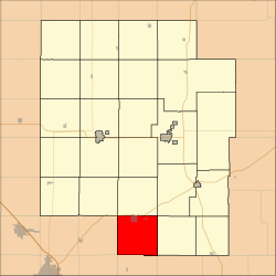 Location within Marion County | |
 Peabody Township Marion County, Kansas Location within the state of Kansas | |
| Coordinates: 38.1307624°N 97.0977035°W[1] | |
| Country | United States |
| State | Kansas |
| County | Marion |
| Area | |
| • Total | 36 sq mi (90 km2) |
| Dimensions | |
| • Length | 6.0 mi (9.7 km) |
| • Width | 6.0 mi (9.7 km) |
| Elevation | 1,434 ft (437 m) |
| Population (2010)[2] | |
| • Total | 1,382 |
| • Density | 38/sq mi (15/km2) |
| Time zone | UTC-6 (CST) |
| • Summer (DST) | UTC-5 (CDT) |
| Area code | 620 |
| FIPS code | 20-55125 [1] |
| GNIS ID | 477777 [1] |
| Website | County website |
Geography
Peabody Township covers an area of 36 square miles (93.2 km2).
Cities and towns
The township contains the following settlements:
- City of Peabody (south of 9th Street). A small north part of Peabody is located in Catlin Township.
Cemeteries
The township contains the following cemeteries:
- No cemeteries. The Prairie Lawn Cemetery for the city of Peabody is located in Catlin Township.
Transportation
Two railroads, BNSF Railway and Union Pacific Railroad, pass through the township. The BNSF Railway runs northeast to southwest through the township.[3] The Oklahoma Kansas Texas (OKT)[4] line of the Union Pacific Railroad runs north to south through the township.[5]
U.S. Route 50 passes along the northern township edge, and follows roughly parallel to the BNSF Railway.[6]
References
- "Peabody Township, Marion County, Kansas", Geographic Names Information System, United States Geological Survey, United States Department of the Interior
- "2010 Total Population - Township of Peabody". U.S. Census Bureau. Archived from the original on February 10, 2020. Retrieved June 17, 2013.
- BNSF Railway Map. Archived 2011-03-25 at the Wayback Machine
- "UP Railroad Common Line Names" (PDF). Union Pacific Railroad. Retrieved 2013-06-15.
- Union Pacific Railway Map.
- Marion County Highway Map; KSDOT.
Further reading
External links
- Marion County website
- City-Data.com
- Marion County maps: Current, Historic, KDOT
Places adjacent to Peabody Township, Marion County, Kansas | |
|---|---|
Municipalities and communities of Marion County, Kansas, United States | ||
|---|---|---|
County seat: Marion | ||
| Cities |  | |
| Unincorporated communities | ||
| Ghost towns | ||
| Townships | ||
| Footnotes | †This community is designated a Census-Designated Place (CDP) by the United States Census Bureau. ‡This community also has portions in an adjacent county or counties. | |
| ||
Текст в блоке "Читать" взят с сайта "Википедия" и доступен по лицензии Creative Commons Attribution-ShareAlike; в отдельных случаях могут действовать дополнительные условия.
Другой контент может иметь иную лицензию. Перед использованием материалов сайта WikiSort.org внимательно изучите правила лицензирования конкретных элементов наполнения сайта.
Другой контент может иметь иную лицензию. Перед использованием материалов сайта WikiSort.org внимательно изучите правила лицензирования конкретных элементов наполнения сайта.
2019-2025
WikiSort.org - проект по пересортировке и дополнению контента Википедии
WikiSort.org - проект по пересортировке и дополнению контента Википедии