world.wikisort.org - USA
Patoka Township is one of nine townships in Crawford County, Indiana, United States. As of the 2010 census, its population was 1,579 and it contained 1,076 housing units.[3]
Patoka Township | |
|---|---|
Township | |
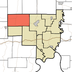 Location of Patoka Township in Crawford County | |
| Coordinates: 38°21′18″N 86°36′23″W | |
| Country | United States |
| State | Indiana |
| County | Crawford |
| Named for | Patoka River or Patoka Lake, both located within the township. |
| Government | |
| • Type | Indiana township |
| Area | |
| • Total | 45.65 sq mi (118.2 km2) |
| • Land | 43.65 sq mi (113.1 km2) |
| • Water | 2 sq mi (5 km2) |
| Elevation | 709 ft (216 m) |
| Population (2010) | |
| • Total | 1,579 |
| • Density | 36.2/sq mi (14.0/km2) |
| FIPS code | 18-58284[2] |
| GNIS feature ID | 453707 |
Geography
According to the 2010 census, the township has a total area of 45.65 square miles (118.2 km2), of which 43.65 square miles (113.1 km2) (or 95.62%) is land and 2 square miles (5.2 km2) (or 4.38%) is water.[3]
Unincorporated towns
- Newton Stewart
- Riceville
- Taswell
- Wickliffe
(This list is based on USGS data and may include former settlements.)
Adjacent townships
- Jackson Township, Orange County (north)
- Greenfield Township, Orange County (northeast)
- Sterling Township (east)
- Union Township (southeast)
- Jefferson Township, Dubois County (southwest)
- Johnson Township (southwest)
- Hall Township, Dubois County (west)
Major highways
 Indiana State Road 64
 Indiana State Road 145
 Indiana State Road 164
Cemeteries
The township contains four cemeteries: Brown, Eckerty, Mount Eden and Williams.
References
- "US Board on Geographic Names". United States Geological Survey. 2007-10-25. Retrieved 2008-01-31.
- "U.S. Census website". United States Census Bureau. Retrieved 2008-01-31.
- "Population, Housing Units, Area, and Density: 2010 - County -- County Subdivision and Place -- 2010 Census Summary File 1". United States Census. Archived from the original on 2020-02-12. Retrieved 2013-05-10.
External links
Wikimedia Commons has media related to Patoka Township, Crawford County, Indiana.
Municipalities and communities of Crawford County, Indiana, United States | ||
|---|---|---|
County seat: English | ||
| Towns |  | |
| Townships | ||
| Unincorporated communities |
| |
| Footnotes | ‡This populated place also has portions in an adjacent county or counties | |
| ||
Текст в блоке "Читать" взят с сайта "Википедия" и доступен по лицензии Creative Commons Attribution-ShareAlike; в отдельных случаях могут действовать дополнительные условия.
Другой контент может иметь иную лицензию. Перед использованием материалов сайта WikiSort.org внимательно изучите правила лицензирования конкретных элементов наполнения сайта.
Другой контент может иметь иную лицензию. Перед использованием материалов сайта WikiSort.org внимательно изучите правила лицензирования конкретных элементов наполнения сайта.
2019-2025
WikiSort.org - проект по пересортировке и дополнению контента Википедии
WikiSort.org - проект по пересортировке и дополнению контента Википедии