world.wikisort.org - USA
Parkville is an unincorporated community and census-designated place in Baltimore County, Maryland, United States. As of the 2010 census, the population was 30,734.[2]
This article needs additional citations for verification. (February 2022) |
Parkville, Maryland | |
|---|---|
Census-designated place | |
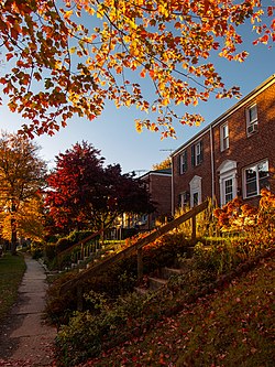 Townhomes on a residential street in the Ridgeleigh area of Parkville, Maryland | |
 Location of Parkville, Maryland | |
| Coordinates: 39°22′59″N 76°33′0″W | |
| Country | |
| State | |
| County | |
| Area | |
| • Total | 4.29 sq mi (11.10 km2) |
| • Land | 4.29 sq mi (11.10 km2) |
| • Water | 0.00 sq mi (0.00 km2) |
| Elevation | 331 ft (101 m) |
| Population (2020) | |
| • Total | 31,812 |
| • Density | 7,424.04/sq mi (2,866.58/km2) |
| Time zone | UTC−5 (Eastern (EST)) |
| • Summer (DST) | UTC−4 (EDT) |
| ZIP code | 21234 |
| Area code(s) | 410 |
| FIPS code | 24-60275 |
| GNIS feature ID | 0590976 |
Geography
Parkville is located at 39°22′59″N 76°33′0″W (39.383039, −76.550065).[3]
According to the United States Census Bureau, the CDP has a total area of 4.2 square miles (11 km2), all land. The northern border of the CDP is Interstate 695 (the Baltimore Beltway) from Loch Raven Boulevard to Putty Hill Avenue. The eastern border is roughly where Putty Hill Avenue becomes Rossville Boulevard, the southern border is the Baltimore City/Baltimore County line from near Glen Road to Loch Raven Boulevard, and the western boundary is Loch Raven Boulevard from the city line to I-695.[4]
Demographics
| Historical population | |||
|---|---|---|---|
| Census | Pop. | %± | |
| 2020 | 31,812 | — | |
| U.S. Decennial Census[5] | |||
At the 2000 census there were 31,118 people, 13,044 households, and 8,243 families living in the CDP. The population density was 7,352.1 people per square mile (2,840.4/km2). There were 13,550 housing units at an average density of 3,201.4 per square mile (1,236.8/km2). The racial makeup of the CDP was 73.64% White, 22.48% African American, 0.16% Native American, 1.88% Asian, 0.02% Pacific Islander, 0.42% from other races, and 1.39% from two or more races. Hispanic or Latino of any race were 1.65%.[6]
Of the 13,044 households 28.3% had children under the age of 18 living with them, 42.8% were married couples living together, 16.2% had a female householder with no husband present, and 36.8% were non-families. 29.8% of households were one person and 11.1% were one person aged 65 or older. The average household size was 2.36 and the average family size was 2.93.
The age distribution was 22.8% under the age of 18, 8.9% from 18 to 24, 30.4% from 25 to 44, 20.8% from 45 to 64, and 17.1% 65 or older. The median age was 38 years. For every 100 females, there were 86.1 males. For every 100 females age 18 and over, there were 81.5 males.
The median income for a household in the CDP was $41,410, and the median family income was $50,421. Males had a median income of $36,728 versus $27,579 for females. The per capita income for the CDP was $20,633. About 6.4% of families and 7.4% of the population were below the poverty line, including 8.9% of those under age 18 and 5.7% of those age 65 or over.
Education
People in Parkville are zoned for the following schools:
Elementary schools
- Halstead Academy
- Pine Grove Elementary
- Oakleigh Elementary
- Villa Cresta Elementary
- Harford Hills Elementary
- Carney Elementary
- Elmwood Elementary
- Pleasant Plains Elementary (in Towson)
- Seven Oaks Elementary
Middle schools

- Parkville Middle and Center of Technology
- Pine Grove Middle School
- Loch Raven Technical Academy (in Towson)
Elementary/middle schools
- Woodhome Elementary/Middle School
High schools
- Parkville High School
- Loch Raven High School (in Towson)
- Perry Hall High School (in Perry Hall)
Transportation
Roads
Some of the major roads in the Parkville area are:
- Harford Road (MD-147)
- Joppa Road
- Old Harford Road
- Perring Parkway
- Putty Hill Avenue
- Taylor Avenue
Public transportation
The Maryland Transit Administration's Bus Route 19 operates along Harford Road between the Carney Park-and-Ride and Downtown Baltimore.
Local culture
An annual Czech and Slovak Heritage Festival is held in Parkville to celebrate the Czech and Slovak heritage of Baltimore.[7][8]
For several years, Parkville was the primary location for the music festival Stanstock, a nonprofit charity that primarily benefits two local charities, the Nicole Van Horn Foundation and the Catch a Lift Fund.[9][10][11]
References
- "2020 U.S. Gazetteer Files". United States Census Bureau. Retrieved April 26, 2022.
- "Profile of General Population and Housing Characteristics: 2010 Demographic Profile Data (DP-1): Parkville CDP, Maryland". United States Census Bureau. Retrieved February 29, 2012.
- "US Gazetteer files: 2010, 2000, and 1990". United States Census Bureau. 2011-02-12. Retrieved 2011-04-23.
- "P.L. 94-171 County Block Map (2010 Census): Baltimore County, MD; Map sheets 65 and 66" (PDF). U.S. Census Bureau. Retrieved February 29, 2012.
- "Census of Population and Housing". Census.gov. Retrieved June 4, 2016.
- "U.S. Census website". United States Census Bureau. Retrieved 2008-01-31.
- "Czech-Slovak festival is Sunday in Parkville". The Baltimore Sun. Retrieved 2014-08-10.
- "Czech and Slovak Festival is Sunday". The Baltimore Sun. Retrieved 2014-08-10.
- "Pines Resident Recognized for Charitable Efforts" (PDF). The Courier (Delmarva). Retrieved 2017-04-28.
- "A Humanitarian With A Message Of Hope" (PDF). The Courier (Delmarva). Retrieved 2017-04-28.
- "People Are Talking". WJZ-TV. Retrieved 2017-05-01.
External links
 Media related to Parkville, Maryland at Wikimedia Commons
Municipalities and communities of Baltimore County, Maryland, United States | ||
|---|---|---|
County seat: Towson | ||
| CDPs |
|  |
| Other communities |
| |
| ||
Другой контент может иметь иную лицензию. Перед использованием материалов сайта WikiSort.org внимательно изучите правила лицензирования конкретных элементов наполнения сайта.
WikiSort.org - проект по пересортировке и дополнению контента Википедии