world.wikisort.org - USA
Packard is an unincorporated community located in the town of Wagner, Marinette County, Wisconsin, United States.[1]
Packard, Wisconsin | |
|---|---|
Unincorporated community | |
 Packard, Wisconsin  Packard, Wisconsin | |
| Coordinates: 45°21′17″N 87°41′39″W | |
| Country | |
| State | |
| County | Marinette |
| Elevation | 211 m (692 ft) |
| Time zone | UTC-6 (Central (CST)) |
| • Summer (DST) | UTC-5 (CDT) |
| Area code(s) | 715 & 534 |
| GNIS feature ID | 1577764[1] |
Geography
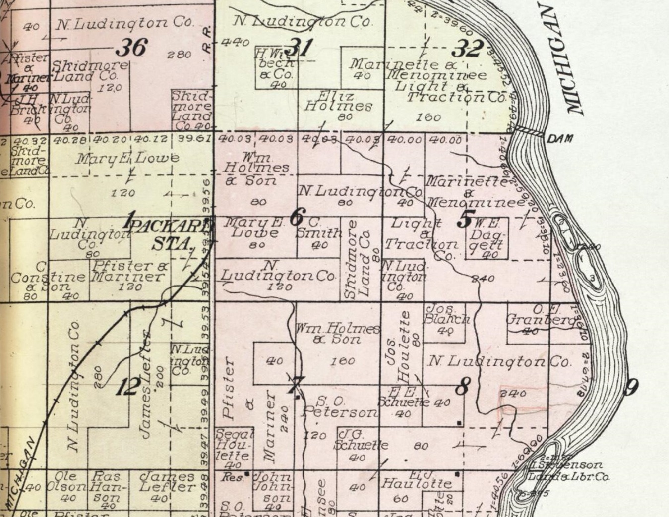
Packard is located at the intersection of Country Trunk Highway JJ and Chapin Road,[2] at an elevation of 692 feet (211 m).[1] It is connected by road to McAllister to the south and Koss, Michigan to the north.[2]
History
Packard was a stop between McAllister and Koss on the Wisconsin & Michigan (W. & M.) Railway line from Bagley Junction to Iron Mountain.[3] The rail line through Packard was discontinued in 1938, when the tracks were torn out and the rolling stock sold off.[3][4][5] The entire town was destroyed by a forest fire in October, 1908.[6]
References
- "Packard, Wisconsin". Geographic Names Information System. United States Geological Survey.
- Stephenson Quadrangle Wisconsin–Michigan, 15 Minute Series (Topographic). 1963. Map, 1:62,500. Washington, DC: U. S. Geological Survey.
- McLeod, Richard (1968). "History of the Wisconsin and Michigan Railway". The Railway and Locomotive Historical Society Bulletin. 118: 7–20.
- "Seek Permission to Abandon Lines". The Oshkosh Northwestern. April 10, 1937. p. 17. Retrieved August 4, 2019 – via Newspapers.com.

- "Approve Wisconsin and Michigan Ry. Line Abandonment". The Daily Tribune. January 20, 1938. p. 5. Retrieved August 4, 2019 – via Newspapers.com.
- "Half of Pound, Wis., Destroyed by Fires". Green Bay Press-Gazette. October 16, 1908. p. 1. Retrieved August 4, 2019 – via Newspapers.com.
External links
 Media related to Packard, Wisconsin at Wikimedia Commons
Municipalities and communities of Marinette County, Wisconsin, United States | ||
|---|---|---|
County seat: Marinette | ||
| Cities |
|  |
| Villages |
| |
| Towns |
| |
| CDPs |
| |
| Unincorporated communities |
| |
| Footnotes | ‡This populated place also has portions in an adjacent county or counties | |
| ||
This article about a location in Marinette County, Wisconsin is a stub. You can help Wikipedia by expanding it. |
Другой контент может иметь иную лицензию. Перед использованием материалов сайта WikiSort.org внимательно изучите правила лицензирования конкретных элементов наполнения сайта.
WikiSort.org - проект по пересортировке и дополнению контента Википедии