world.wikisort.org - USA
Oretta is a census-designated place in Beauregard Parish, Louisiana, United States.[2] As of the 2010 census, it had a population of 418.[3]
Oretta, Louisiana | |
|---|---|
Census-designated place | |
 Oretta | |
| Coordinates: 30°31′32″N 93°26′13″W | |
| Country | United States |
| State | Louisiana |
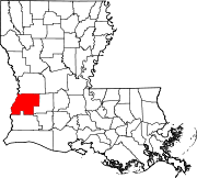
| Parish | Beauregard |
| Area | |
| • Total | 2.20 sq mi (5.70 km2) |
| • Land | 2.20 sq mi (5.70 km2) |
| • Water | 0.00 sq mi (0.00 km2) |
| Elevation | 108 ft (33 m) |
| Population (2020) | |
| • Total | 371 |
| • Density | 168.71/sq mi (65.14/km2) |
| Time zone | UTC-6 (CST) |
| • Summer (DST) | UTC-5 (CDT) |
| Area code(s) | 337 |
| FIPS code | 22-58150 |
| GNIS feature ID | 0543559 |
Geography
Oretta is located in southern Beauregard Parish at 30°31′32″N 93°26′13″W. Louisiana Highway 27 leads through the center of the CDP, leading north 25 miles (40 km) to DeRidder, the parish seat, and south 5 miles (8 km) to DeQuincy in Calcasieu Parish.
According to the United States Census Bureau, the Oretta CDP has a total area of 2.2 square miles (5.7 km2), all land.[3]
Demographics
| Historical population | |||
|---|---|---|---|
| Census | Pop. | %± | |
| 2020 | 371 | — | |
| U.S. Decennial Census[4] | |||
References
- "2020 U.S. Gazetteer Files". United States Census Bureau. Retrieved March 20, 2022.
- U.S. Geological Survey Geographic Names Information System: Oretta, Louisiana
- "Geographic Identifiers: 2010 Demographic Profile Data (G001): Oretta CDP, Louisiana". U.S. Census Bureau, American Factfinder. Archived from the original on February 12, 2020. Retrieved November 27, 2013.
- "Census of Population and Housing". Census.gov. Retrieved June 4, 2016.
Municipalities and communities of Beauregard Parish, Louisiana, United States | ||
|---|---|---|
Parish seat: DeRidder | ||
| City |
|  |
| Town |
| |
| CDPs | ||
| Other communities | ||
| Ghost town |
| |
| Footnotes | ‡This populated place also has portions in an adjacent parish or parishes | |
| ||
This Louisiana state location article is a stub. You can help Wikipedia by expanding it. |
Текст в блоке "Читать" взят с сайта "Википедия" и доступен по лицензии Creative Commons Attribution-ShareAlike; в отдельных случаях могут действовать дополнительные условия.
Другой контент может иметь иную лицензию. Перед использованием материалов сайта WikiSort.org внимательно изучите правила лицензирования конкретных элементов наполнения сайта.
Другой контент может иметь иную лицензию. Перед использованием материалов сайта WikiSort.org внимательно изучите правила лицензирования конкретных элементов наполнения сайта.
2019-2026
WikiSort.org - проект по пересортировке и дополнению контента Википедии
WikiSort.org - проект по пересортировке и дополнению контента Википедии