world.wikisort.org - USA
Olney is an unincorporated community in Coal County, Oklahoma, United States.[1] It is located seven miles west of Lehigh.[2]
Olney, Oklahoma | |
|---|---|
Unincorporated community | |
 Olney Location within the state of Oklahoma  Olney Olney (the United States) | |
| Coordinates: 34°28′21″N 96°21′40″W | |
| Country | United States |
| State | Oklahoma |
| County | Coal |
| Elevation | 617 ft (188 m) |
| Time zone | UTC-6 (Central (CST)) |
| • Summer (DST) | UTC-5 (CDT) |
| GNIS feature ID | 1096264 |
History
The community was founded by Eliphalet Nott and James Brooks Wright, who were the sons of Choctaw leader Allen Wright.[3] The community was originally named Parmicho, after the Choctaw words "pala misha," which mean "lighted place in the distance."[2] The name came from a lantern hanging at the railway station.[2] The town's name was changed to Olney on July 12, 1902.[2]
References
- U.S. Geological Survey Geographic Names Information System: Olney, Oklahoma
- Shirk, George. Oklahoma Place Names, 2nd ed. University of Oklahoma Press: Norman, Oklahoma. 1987. p.186.
- Milligan, James C. "Coal County," Encyclopedia of Oklahoma History and Culture, Oklahoma Historical Society, Accessed July 1, 2015.
Municipalities and communities of Coal County, Oklahoma, United States | ||
|---|---|---|
County seat: Coalgate | ||
| Cities | 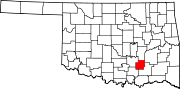 | |
| Towns | ||
| CDPs |
| |
| Other communities |
| |
| Indian reservations |
| |
| Footnotes | ‡This populated place also has portions in an adjacent county or counties | |
| ||
This Oklahoma state location article is a stub. You can help Wikipedia by expanding it. |
Текст в блоке "Читать" взят с сайта "Википедия" и доступен по лицензии Creative Commons Attribution-ShareAlike; в отдельных случаях могут действовать дополнительные условия.
Другой контент может иметь иную лицензию. Перед использованием материалов сайта WikiSort.org внимательно изучите правила лицензирования конкретных элементов наполнения сайта.
Другой контент может иметь иную лицензию. Перед использованием материалов сайта WikiSort.org внимательно изучите правила лицензирования конкретных элементов наполнения сайта.
2019-2026
WikiSort.org - проект по пересортировке и дополнению контента Википедии
WikiSort.org - проект по пересортировке и дополнению контента Википедии