world.wikisort.org - USA
Oak Harbor is a city located on Whidbey Island in Island County, Washington, United States. The population was 22,075 at the 2010 census. Oak Harbor was incorporated on May 14, 1915.
Oak Harbor | |
|---|---|
City | |
 Windjammer Park | |
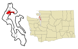 Location of Oak Harbor, Washington | |
| Coordinates: 48°17′42″N 122°39′31″W | |
| Country | United States |
| State | Washington |
| County | Island |
| City | May 14, 1915 |
| Government | |
| • Type | Mayor–council[1] |
| • Mayor | Robert Severns |
| Area | |
| • City | 12.32 sq mi (31.90 km2) |
| • Land | 9.65 sq mi (25.00 km2) |
| • Water | 2.66 sq mi (6.90 km2) |
| Elevation | 92 ft (28 m) |
| Population (2020)[3] | |
| • City | 24,622 |
| • Density | 2,551.5/sq mi (984.88/km2) |
| • Metro | 86,857 (US: 48th) |
| Time zone | UTC-8 (Pacific (PST)) |
| • Summer (DST) | UTC-7 (PDT) |
| ZIP codes | 98277–98278 |
| Area code | 360 |
| Telephone exchanges | 240, 257, 279, 395, 632, 675, 678, 679 |
| FIPS code | 53-50360 |
| GNIS feature ID | 1512518[5] |
| Website | www |
History

Oak Harbor - otherwise known as Kla-tole-tsche in the Salish language - is Whidbey Island's largest incorporated city; it is named for the Garry Oak trees which grace its skyline. The city's growth coincided with two major events: the building of Deception Pass Bridge on July 31, 1935, and the completion of Naval Air Station Whidbey Island on September 21, 1942.
The Upper Skagit Indian Tribe have been inhabiting Oak Harbor since time immemorial. In the early 1850s, two settlers staked claims where the city now stands—Zakarias Toftezen, a shoemaker from Norway; C.W. Sumner from New England.[6]
Houses and businesses sprouted up along the shores of Oak Harbor as the pioneers relied entirely on water transportation until the 1900s. For the next 30 years, steamers and freighters carried passengers and freight from the Island to the mainland and back as well as Fidalgo Island to the north.
The Irish came in the late 1850s, making Oak Harbor grow and prosper as they fished and farmed the area, and the city's Dutch heritage arrived in the 1890s. Churches, schools, and more businesses followed the arrival of the Dutch. The high school was built in 1906. Oak Harbor flourished as a small country town until the Deception Pass Bridge and the NAS Whidbey Island base (built in 1935 and 1942 respectively) connected the city to the rest of the region and the world.
Deception Pass Bridge, a National Historic Monument since 1982, is actually two spans that link Whidbey Island to Fidalgo Island over Canoe Pass and Deception Pass. The bridge, one of the scenic wonders and destinations of the Pacific Northwest, was a Public Works Administration project built by the Civilian Conservation Corps. Deception Pass State Park has over 4,100 acres (17 km2) of forest, campsites, trails, and scenic vistas of the San Juan Islands, Victoria (British Columbia, Canada), Mount Baker, and Fidalgo Island.
Geography
According to the United States Census Bureau, the city has a total area of 9.47 square miles (24.53 km2), of which, 9.42 square miles (24.40 km2) is land and 0.05 square miles (0.13 km2) is water.[7] Access to the island by land is only available by driving through Deception Pass. Other ways to travel to Whidbey Island include flying or utilizing a ferry service. The Mukilteo–Clinton Ferry provides service connecting the southern end of Whidbey Island and just north of Seattle, WA.
Surveys of shorelines throughout the Puget Sound region have indicated that 58% are "unstable". Average retreat rates range from one to eight centimeters per year and shores in the Puget Sound area, composed of unconsolidated sediment, erode 10 to 100 times faster than rocky shoreline.[8]
Climate
Oak Harbor has a pleasant Mediterranean climate (Köppen Csb) characterized by warm dry summers and cold, though not severe, and damp winters. The Olympic rain shadow means that the region is much drier than most of the Pacific Northwest west of the Cascades.
| Month | Jan | Feb | Mar | Apr | May | Jun | Jul | Aug | Sep | Oct | Nov | Dec | Year |
|---|---|---|---|---|---|---|---|---|---|---|---|---|---|
| Record high °F (°C) | 62 (17) |
69 (21) |
78 (26) |
81 (27) |
85 (29) |
92 (33) |
95 (35) |
98 (37) |
91 (33) |
79 (26) |
67 (19) |
62 (17) |
98 (37) |
| Average high °F (°C) | 47 (8) |
50 (10) |
54 (12) |
59 (15) |
64 (18) |
68 (20) |
73 (23) |
74 (23) |
69 (21) |
59 (15) |
51 (11) |
46 (8) |
60 (15) |
| Average low °F (°C) | 37 (3) |
36 (2) |
39 (4) |
42 (6) |
46 (8) |
50 (10) |
52 (11) |
52 (11) |
49 (9) |
44 (7) |
39 (4) |
35 (2) |
43 (6) |
| Record low °F (°C) | 3 (−16) |
5 (−15) |
14 (−10) |
26 (−3) |
28 (−2) |
35 (2) |
40 (4) |
38 (3) |
29 (−2) |
20 (−7) |
6 (−14) |
3 (−16) |
3 (−16) |
| Average precipitation inches (mm) | 2.50 (64) |
1.75 (44) |
1.88 (48) |
1.67 (42) |
1.83 (46) |
1.33 (34) |
0.86 (22) |
0.77 (20) |
1.27 (32) |
1.97 (50) |
3.15 (80) |
2.53 (64) |
21.51 (546) |
| Source: [9] | |||||||||||||
Demographics
| Historical population | |||
|---|---|---|---|
| Census | Pop. | %± | |
| 1920 | 337 | — | |
| 1930 | 362 | 7.4% | |
| 1940 | 376 | 3.9% | |
| 1950 | 1,193 | 217.3% | |
| 1960 | 3,942 | 230.4% | |
| 1970 | 9,167 | 132.5% | |
| 1980 | 12,271 | 33.9% | |
| 1990 | 17,176 | 40.0% | |
| 2000 | 19,795 | 15.2% | |
| 2010 | 22,075 | 11.5% | |
| 2020 | 24,622 | 11.5% | |
| U.S. Decennial Census[10] 2018 Estimate[11] | |||
2010 census
As of the census[12] of 2010, there were 22,075 people, 8,677 households, and 5,789 families living in the city. The population density was 2,343.4 inhabitants per square mile (904.8/km2). There were 9,553 housing units at an average density of 1,014.1 per square mile (391.5/km2). The racial makeup of the city was 72.6% White, 4.9% African American, 0.9% Native American, 10.2% Asian, 1.0% Pacific Islander, 2.7% from other races, and 7.8% from two or more races. Hispanic or Latino of any race were 9.3% of the population.
There were 8,677 households, of which 38.6% had children under the age of 18 living with them, 51.7% were married couples living together, 11.4% had a female householder with no husband present, 3.5% had a male householder with no wife present, and 33.3% were non-families. 26.9% of all households were made up of individuals, and 8.5% had someone living alone who was 65 years of age or older. The average household size was 2.53 and the average family size was 3.09.
The median age in the city was 29 years. 28.3% of residents were under the age of 18; 12.3% were between the ages of 18 and 24; 31.9% were from 25 to 44; 17% were from 45 to 64; and 10.3% were 65 years of age or older. The gender makeup of the city was 49.2% male and 50.8% female.
2000 census
As of the census of 2000, there were 19,795 people, 7,333 households, and 5,265 families living in the city. The population density was 2,175.0 people per square mile (839.9/km2). There were 7,772 housing units at an average density of 854.0 per square mile (329.8/km2). The racial makeup of the city was 74.9% White, 5.5% African American, 9.6% Asian, 1.2% Native American, 0.8% Pacific Islander, 2.4% from other races, and 5.6% from two or more races. Hispanic or Latino of any race were 6.6% of the population.
There were 7,333 households, out of which 43.4% had children under the age of 18 living with them, 59.0% were married couples living together, 9.7% had a female householder with no husband present, and 28.2% were non-families. Also, 22.2% of all households comprised individuals and 7.2% had someone living alone who was 65 years of age or older. The average household size was 2.68 and the average family size was 3.18.
In the city, the population was spread out, with 31.6% under the age of 18, 11.6% from 18 to 24, 34.4% from 25 to 44, 13.4% from 45 to 64, and 9.0% who were 65 years of age or older. The median age was 28 years. For every 100 females, there were 98.7 males. For every 100 females age 18 and over, there were 95.2 males.
The median income for a household in the city was $36,641, and the median income for a family was $41,579. Males had a median income of $29,498 versus $21,633 for females. The per capita income for the city was $16,830. About 8.1% of families and 9.3% of the population were below the poverty line, including 11.2% of those under age 18 and 5.4% of those age 65 or over.
Government
As of the 2020 election, Oak Harbor has gotten a majority Republican vote (47.53%), followed by Democratic (46.81%) and the Third Parties (5.66%).
| Year | Democratic | Republican | Third Parties |
|---|---|---|---|
| 2020[13] | 46.81% 4,660 | 47.53% 4,731 | 5.66% 563 |
| 2016[14] | 39.07% 3,006 | 50.14% 3,857 | 10.79% 830 |
| 2012[15] | 42.00% 3,219 | 53.80% 4,123 | 4.20% 322 |
| 2008[16] | 43.21% 3,183 | 56.79% 4,183 | 0.00% 0 |
| 2004[17] | 33.17% 2,226 | 64.02% 4,296 | 2.80% 188 |
| 2000[18] | 37.20% 2,058 | 57.94% 3,206 | 4.86% 269 |
Notable people
- Shayla Beesley – actress
- Lamont Brightful – player in the NFL and Canadian Football League
- Michael Harring – filmmaker
- Marti Malloy – Olympic Judo medalist
- Patricia McPherson – actress
- Jerod Turner – golfer
- Robert Lee Yates - serial killer
References
- "Office of the Mayor". City of Oak Harbor. Retrieved April 2, 2022.
- "2019 U.S. Gazetteer Files". United States Census Bureau. Retrieved August 7, 2020.
- "2020 Decennial Census". United States Census Bureau. Retrieved April 12, 2022.
- "2020 Decennial Census". United States Census Bureau. Retrieved April 12, 2022.
- "Oak Harbor". Geographic Names Information System. United States Geological Survey, United States Department of the Interior.
- "Toftezen Memorial, Lutheran Cemetery, Pioneer Highway". Stanwood Area Historic Society. Retrieved April 1, 2016.
- "US Gazetteer files 2010". United States Census Bureau. Archived from the original on January 25, 2012. Retrieved 2012-12-19.
- Rogers, Heather E.; Swanson, Terry W.; Stone, John O. (2017). "Long-term shoreline retreat rates on Whidbey Island, Washington, USA". Quaternary Research. 78 (2): 315–322. doi:10.1016/j.yqres.2012.06.001. S2CID 140167429.
- "Monthly Averages for Oak Harbor, WA". Retrieved July 6, 2012.
- United States Census Bureau. "Census of Population and Housing". Retrieved July 21, 2014.
- "Population Estimates". United States Census Bureau. Retrieved June 16, 2019.
- "U.S. Census website". United States Census Bureau. Retrieved December 19, 2012.
- "Island County November 3, 2020 General Election".
- https://www.islandcountywa.gov/Auditor/Elections/PastElections/Results_110816.pdf [bare URL PDF]
- https://www.islandcountywa.gov/Auditor/Elections/PastElections/results_110612.pdf [bare URL PDF]
- https://www.islandcountywa.gov/Auditor/Elections/PastElections/results_110408.pdf [bare URL PDF]
- https://www.islandcountywa.gov/Auditor/Elections/PastElections/results_110204.pdf [bare URL PDF]
- https://www.islandcountywa.gov/Auditor/Elections/PastElections/results_110700.pdf [bare URL PDF]
External links
- City of Oak Harbor official website
- Oak Harbor Tourism and Visitor Service
- Oak Harbor Chamber of Commerce
- Oak Harbor Events and Activities
Municipalities and communities of Island County, Washington, United States | ||
|---|---|---|
County seat: Coupeville | ||
| Cities |  | |
| Town | ||
| CDPs | ||
| Other communities | ||
| ||
Authority control | |
|---|---|
| General | |
| National libraries | |
| Other |
|
На других языках
[de] Oak Harbor (Washington)
Oak Harbor ist eine Stadt auf Whidbey Island im Island County im Bundesstaat Washington. Laut US Census hatte Oak Harbor 24.622[1] Einwohner (Stand: 2020). Der Ort wurde am 14. Mai 1915 als „City“ eingetragen.- [en] Oak Harbor, Washington
Другой контент может иметь иную лицензию. Перед использованием материалов сайта WikiSort.org внимательно изучите правила лицензирования конкретных элементов наполнения сайта.
WikiSort.org - проект по пересортировке и дополнению контента Википедии