world.wikisort.org - USA
Norwood is a village in East Feliciana Parish, Louisiana, United States. The population was 322 at the 2010 census.[2] It is part of the Baton Rouge Metropolitan Statistical Area.
Norwood, Louisiana | |
|---|---|
Village | |
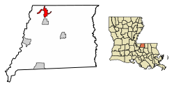 Location of Norwood in East Feliciana Parish, Louisiana. | |
 Location of Louisiana in the United States | |
| Coordinates: 30°58′10″N 91°06′20″W | |
| Country | United States |
| State | Louisiana |
| Parish | East Feliciana |
| Area | |
| • Total | 4.10 sq mi (10.62 km2) |
| • Land | 4.08 sq mi (10.58 km2) |
| • Water | 0.02 sq mi (0.04 km2) |
| Elevation | 312 ft (95 m) |
| Population (2020) | |
| • Total | 279 |
| • Density | 68.33/sq mi (26.38/km2) |
| Time zone | UTC-6 (CST) |
| • Summer (DST) | UTC-5 (CDT) |
| Area code | 225 |
| FIPS code | 22-56295 |
Geography
Norwood is located in northwestern East Feliciana Parish at 30°58′10″N 91°6′20″W (30.969430, -91.105509).[3] Louisiana Highway 19 passes through the village, leading south 39 miles (63 km) to Baton Rouge and north 2 miles (3 km) to the Mississippi border. Centreville, Mississippi, is 9 miles (14 km) north of Norwood, and Clinton, the East Feliciana Parish seat, is 10 miles (16 km) to the southeast.
According to the United States Census Bureau, Norwood has a total area of 4.1 square miles (10.6 km2), of which 0.02 square miles (0.04 km2), or 0.40%, is water.[2]
Demographics
| Historical population | |||
|---|---|---|---|
| Census | Pop. | %± | |
| 1950 | 414 | — | |
| 1960 | 427 | 3.1% | |
| 1970 | 348 | −18.5% | |
| 1980 | 421 | 21.0% | |
| 1990 | 317 | −24.7% | |
| 2000 | 337 | 6.3% | |
| 2010 | 322 | −4.5% | |
| 2020 | 279 | −13.4% | |
| U.S. Decennial Census[4] | |||
| Race | Number | Percentage |
|---|---|---|
| White (non-Hispanic) | 217 | 77.78% |
| Black or African American (non-Hispanic) | 60 | 21.51% |
| Hispanic or Latino | 2 | 0.72% |
As of the 2020 United States census, there were 279 people, 127 households, and 71 families residing in the village.
Notable people
- Lawrence Brooks (1909-2022), the oldest American veteran of World War II, was born in Norwood.
Municipalities and communities of East Feliciana Parish, Louisiana, United States | ||
|---|---|---|
Parish seat: Clinton | ||
| Towns |  | |
| Villages | ||
| Unincorporated communities | ||
| ||
References
- "2020 U.S. Gazetteer Files". United States Census Bureau. Retrieved March 20, 2022.
- "Geographic Identifiers: 2010 Demographic Profile Data (G001): Norwood village, Louisiana". American Factfinder. U.S. Census Bureau. Archived from the original on February 13, 2020. Retrieved February 10, 2016.
- "US Gazetteer files: 2010, 2000, and 1990". United States Census Bureau. 2011-02-12. Retrieved 2011-04-23.
- "Census of Population and Housing". Census.gov. Retrieved June 4, 2015.
- "Explore Census Data". data.census.gov. Retrieved 2021-12-28.
Другой контент может иметь иную лицензию. Перед использованием материалов сайта WikiSort.org внимательно изучите правила лицензирования конкретных элементов наполнения сайта.
WikiSort.org - проект по пересортировке и дополнению контента Википедии