world.wikisort.org - USA
North Okaw Township is one of twelve townships in Coles County, Illinois, USA. As of the 2010 census, its population was 983 and it contained 377 housing units.[2] The Kaskaskia River flows through the township. The Cook Mills Consolidated oil field is within this township. The township changed its name from Okaw Township on May 7, 1860.
North Okaw Township | |
|---|---|
Township | |
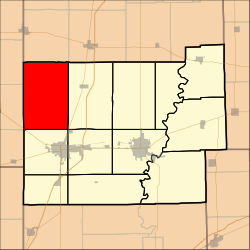 Location in Coles County | |
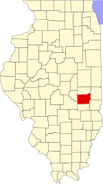 Coles County's location in Illinois | |
| Coordinates: 39°35′N 88°25′W | |
| Country | United States |
| State | Illinois |
| County | Coles |
| Established | November 8, 1859 |
| Area | |
| • Total | 54.41 sq mi (140.9 km2) |
| • Land | 54.37 sq mi (140.8 km2) |
| • Water | 0.04 sq mi (0.1 km2) 0.07% |
| Elevation | 653 ft (199 m) |
| Population (2010) | |
| • Estimate (2016)[1] | 955 |
| • Density | 18.1/sq mi (7.0/km2) |
| Time zone | UTC-6 (CST) |
| • Summer (DST) | UTC-5 (CDT) |
| ZIP codes | 61910, 61911, 61931, 61938, 61951 |
| FIPS code | 17-029-54014 |
Geography
According to the 2010 census, the township has a total area of 54.41 square miles (140.9 km2), of which 54.37 square miles (140.8 km2) (or 99.93%) is land and 0.04 square miles (0.10 km2) (or 0.07%) is water.[2]
Unincorporated towns
- Cooks Mills
(This list is based on USGS data and may include former settlements.)
Cemeteries
The township contains five cemeteries: Brann, Mount Zion, Pleasant Grove, Smith and Zoar.
Major highways
 US Route 45
 Illinois Route 121
Demographics
| Historical population | |||
|---|---|---|---|
| Census | Pop. | %± | |
| 2016 (est.) | 955 | [1] | |
| U.S. Decennial Census[3] | |||
School districts
- Arcola Consolidated Unit School District 306
- Arthur Community Unit School District 305
- Mattoon Community Unit School District 2
- Sullivan Community Unit School District 300
Political districts
- Illinois' 15th congressional district
- State House District 110
- State Senate District 55
References
- "North Okaw Township, Coles County, Illinois". Geographic Names Information System. United States Geological Survey. Retrieved 2010-01-10.
- United States Census Bureau 2007 TIGER/Line Shapefiles
- United States National Atlas
- "Population and Housing Unit Estimates". Retrieved June 9, 2017.
- "Population, Housing Units, Area, and Density: 2010 - County -- County Subdivision and Place -- 2010 Census Summary File 1". United States Census. Archived from the original on 2020-02-12. Retrieved 2013-05-28.
- "Census of Population and Housing". Census.gov. Retrieved June 4, 2016.
External links
Adjacent townships
Places adjacent to North Okaw Township, Coles County, Illinois | ||||||||||||||||
|---|---|---|---|---|---|---|---|---|---|---|---|---|---|---|---|---|
| ||||||||||||||||
Municipalities and communities of Coles County, Illinois, United States | ||
|---|---|---|
County seat: Charleston | ||
| Cities |
|  |
| Villages |
| |
| Townships |
| |
| Unincorporated communities | ||
| Extinct community |
| |
| Footnotes | ‡This populated place also has portions in an adjacent county or counties | |
| ||
Authority control | |
|---|---|
| General |
|
| National libraries | |
Текст в блоке "Читать" взят с сайта "Википедия" и доступен по лицензии Creative Commons Attribution-ShareAlike; в отдельных случаях могут действовать дополнительные условия.
Другой контент может иметь иную лицензию. Перед использованием материалов сайта WikiSort.org внимательно изучите правила лицензирования конкретных элементов наполнения сайта.
Другой контент может иметь иную лицензию. Перед использованием материалов сайта WikiSort.org внимательно изучите правила лицензирования конкретных элементов наполнения сайта.
2019-2026
WikiSort.org - проект по пересортировке и дополнению контента Википедии
WikiSort.org - проект по пересортировке и дополнению контента Википедии