world.wikisort.org - USA
Newport Township is one of the twenty-two townships of Washington County, Ohio, United States. The 2000 census found 2,176 people in the township.[3]
Newport Township, Washington County, Ohio | |
|---|---|
Township | |
 The Hildreth Bridge, a township landmark | |
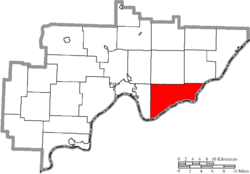 Location of Newport Township in Washington County | |
| Coordinates: 39°23′48″N 81°16′25″W | |
| Country | United States |
| State | Ohio |
| County | Washington |
| Area | |
| • Total | 35.7 sq mi (92.4 km2) |
| • Land | 35.5 sq mi (92.0 km2) |
| • Water | 0.1 sq mi (0.3 km2) |
| Elevation | 994 ft (303 m) |
| Population (2000) | |
| • Total | 2,176 |
| • Density | 61.2/sq mi (23.6/km2) |
| Time zone | UTC-5 (Eastern (EST)) |
| • Summer (DST) | UTC-4 (EDT) |
| ZIP code | 45768 |
| Area code(s) | 740 |
| FIPS code | 39-55356[2] |
| GNIS feature ID | 1087141[1] |
Geography
Located in the southeastern part of the county along the Ohio River, it borders the following townships:
- Lawrence Township - north
- Independence Township - northeast
- Marietta Township - west
- Fearing Township - northwest corner
Pleasants County, West Virginia lies across the Ohio River to the southeast.
No municipalities are located in Newport Township, although the unincorporated community of Newport lies on the township's eastern shoreline.
Name and history
It is the only Newport Township statewide.[4]
In 1833, Newport Township contained a meeting house, several brick school houses, two dry goods stores, and a flour mill.[5]
The Hildreth Covered Bridge in Newport Township is listed on the National Register of Historic Places.
Government
The township is governed by a three-member board of trustees, who are elected in November of odd-numbered years to a four-year term beginning on the following January 1. Two are elected in the year after the presidential election and one is elected in the year before it. There is also an elected township fiscal officer,[6] who serves a four-year term beginning on April 1 of the year after the election, which is held in November of the year before the presidential election. Vacancies in the fiscal officership or on the board of trustees are filled by the remaining trustees.
References
- "US Board on Geographic Names". United States Geological Survey. 2007-10-25. Retrieved 2008-01-31.
- "U.S. Census website". United States Census Bureau. Retrieved 2008-01-31.
- Washington County, Ohio — Population by Places Estimates[permanent dead link] Ohio State University, 2007. Accessed 15 May 2007.
- "Detailed map of Ohio" (PDF). United States Census Bureau. 2000. Retrieved 2007-02-16.
- Kilbourn, John (1833). The Ohio Gazetteer, or, a Topographical Dictionary. Scott and Wright. pp. 344. Retrieved 12 December 2013.
- §503.24, §505.01, and §507.01 of the Ohio Revised Code. Accessed 4/30/2009.
External links
Municipalities and communities of Washington County, Ohio, United States | ||
|---|---|---|
County seat: Marietta | ||
| Cities |
|  |
| Villages |
| |
| Townships | ||
| CDPs |
| |
| Unincorporated communities |
| |
| ||
Другой контент может иметь иную лицензию. Перед использованием материалов сайта WikiSort.org внимательно изучите правила лицензирования конкретных элементов наполнения сайта.
WikiSort.org - проект по пересортировке и дополнению контента Википедии