world.wikisort.org - USA
Natrona is an unincorporated community in central Natrona County, Wyoming, United States. It lies along the concurrent U.S. Routes 20 and 26, west of the city of Casper, the county seat of Natrona County.[2] Its elevation is 5,604 feet (1,708 m).[1] Although Natrona is unincorporated, it has been assigned its own ZIP code of 82646.[3]
Natrona, Wyoming | |
|---|---|
Unincorporated community | |
 Natrona, Wyoming Location within the state of Wyoming  Natrona, Wyoming Natrona, Wyoming (the United States) | |
| Coordinates: 43°1′47″N 106°48′33″W | |
| Country | United States |
| State | Wyoming |
| County | Natrona |
| Elevation | 5,604 ft (1,708 m) |
| Time zone | UTC-7 (Mountain (MST)) |
| • Summer (DST) | UTC-6 (MDT) |
| ZIP codes | 82646 |
| GNIS feature ID | 1597426[1] |
History
Natrona contained a post office from 1906 until 1984.[4] The community was named from its location in Natrona County.[5]
References
- "Natrona, Wyoming". Geographic Names Information System. United States Geological Survey.
- Rand McNally. The Road Atlas '08. Chicago: Rand McNally, 2008, p. 116.
- "ZIP Code™ Lookup | USPS". tools.usps.com. Retrieved December 13, 2019.
- "Natrona County". Jim Forte Postal History. Retrieved March 23, 2015.
- Chicago and North Western Railway Company (1908). A History of the Origin of the Place Names Connected with the Chicago & North Western and Chicago, St. Paul, Minneapolis & Omaha Railways. p. 106.
Municipalities and communities of Natrona County, Wyoming, United States | ||
|---|---|---|
County seat: Casper | ||
| City | 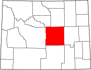 | |
| Towns | ||
| CDPs |
| |
| Unincorporated communities | ||
| ||
This article about a location in Wyoming is a stub. You can help Wikipedia by expanding it. |
Текст в блоке "Читать" взят с сайта "Википедия" и доступен по лицензии Creative Commons Attribution-ShareAlike; в отдельных случаях могут действовать дополнительные условия.
Другой контент может иметь иную лицензию. Перед использованием материалов сайта WikiSort.org внимательно изучите правила лицензирования конкретных элементов наполнения сайта.
Другой контент может иметь иную лицензию. Перед использованием материалов сайта WikiSort.org внимательно изучите правила лицензирования конкретных элементов наполнения сайта.
2019-2026
WikiSort.org - проект по пересортировке и дополнению контента Википедии
WikiSort.org - проект по пересортировке и дополнению контента Википедии