world.wikisort.org - USA
Mosby (also Half-Breed Crossing) is an unincorporated community in southwestern Garfield County, Montana, United States. It lies along Highway 200 southwest of the town of Jordan, the county seat of Garfield County. Its elevation is 2,513 feet (766 m) above sea level.[1] Mosby had a post office that opened on 1904-06-29 was moved on 1983-02-18, and closed on 2015-07-30 [2] but the community still has a separate ZIP code of 59058.[3] As of 2015, there is an RV park where the gas station was. There was a gas station and repair shop open from 1950 to 1983.
Mosby, Montana | |
|---|---|
Unincorporated community | |
 Mosby  Mosby | |
| Coordinates: 46°59′32″N 107°53′1″W | |
| Country | United States |
| State | Montana |
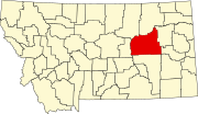
| County | Garfield |
| Elevation | 2,513 ft (766 m) |
| Time zone | UTC-7 (Mountain (MST)) |
| • Summer (DST) | UTC-6 (MDT) |
| ZIP codes | 59058 |
| GNIS feature ID | 774406 |
Originally known as Baldwin, this town takes its name from the area’s first settler, who arrived in 1891.[4]
The Mosby Dome Cat Creek Oil Field is in this area.
Climate
According to the Köppen Climate Classification system, Mosby has a semi-arid climate, abbreviated "BSk" on climate maps.[5]
References
- U.S. Geological Survey Geographic Names Information System: Mosby, Montana
- U.S. Geological Survey Geographic Names Information System: Mosby Post Office
- Zip Code Lookup
- "Mosby". Montana Place Names Companion. Montana Historical Society. Retrieved 7 April 2021.
- Climate Summary for Mosby, Montana
Municipalities and communities of Garfield County, Montana, United States | ||
|---|---|---|
County seat: Jordan | ||
| Town |
|  |
| Unincorporated communities |
| |
| ||
Authority control | |
|---|---|
| General | |
| National libraries | |
This Garfield County, Montana state location article is a stub. You can help Wikipedia by expanding it. |
Другой контент может иметь иную лицензию. Перед использованием материалов сайта WikiSort.org внимательно изучите правила лицензирования конкретных элементов наполнения сайта.
WikiSort.org - проект по пересортировке и дополнению контента Википедии