world.wikisort.org - USA
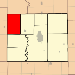
Morrow Township is one of ten townships in Adair County, Missouri, United States. As of the 2010 census, its population was 431.[3] It is named for John Morrow, one of Adair County's original judges.[4]
Morrow Township, Missouri | |
|---|---|
Township | |
 | |
| Coordinates: 40°17′02″N 092°47′32″W | |
| Country | United States |
| State | Missouri |
| County | Adair |
| Area | |
| • Total | 53.39 sq mi (138.27 km2) |
| • Land | 53.37 sq mi (138.22 km2) |
| • Water | 0.02 sq mi (0.05 km2) 0.04% |
| Elevation | 797 ft (243 m) |
| Population (2010) | |
| • Total | 431 |
| • Density | 8/sq mi (3.1/km2) |
| FIPS code | 29-50096[2] |
| GNIS feature ID | 0766213 |
Geography
Morrow Township covers an area of 53.39 square miles (138.27 km2) and contains no incorporated settlements. It contains eight cemeteries: Branstutter, Broyles, Campbell, Cox, Daniels, Megrew, Morelock and Shibleys Point.
The streams of Pleasant Creek, Plum Branch and Turkey Creek run through this township.
References
- "US Board on Geographic Names". United States Geological Survey. 2007-10-25. Retrieved 2008-01-31.
- "U.S. Census website". United States Census Bureau. Retrieved 2008-01-31.
- "Geographic Identifiers: 2010 Demographic Profile Data (G001): Morrow township, Adair County, Missouri". U.S. Census Bureau, American Factfinder. Archived from the original on February 12, 2020. Retrieved June 20, 2013.
- Violette, E. M. (1911). History of Adair County. The Denslow History Company. pp. 39.
External links
Municipalities and communities of Adair County, Missouri, United States | ||
|---|---|---|
County seat: Kirksville | ||
| Cities |
|  |
| Villages |
| |
| Townships | ||
| CDP |
| |
| Other communities |
| |
| Ghost towns |
| |
| Footnotes | ‡This populated place also has portions in an adjacent county or counties | |
| ||
Текст в блоке "Читать" взят с сайта "Википедия" и доступен по лицензии Creative Commons Attribution-ShareAlike; в отдельных случаях могут действовать дополнительные условия.
Другой контент может иметь иную лицензию. Перед использованием материалов сайта WikiSort.org внимательно изучите правила лицензирования конкретных элементов наполнения сайта.
Другой контент может иметь иную лицензию. Перед использованием материалов сайта WikiSort.org внимательно изучите правила лицензирования конкретных элементов наполнения сайта.
2019-2025
WikiSort.org - проект по пересортировке и дополнению контента Википедии
WikiSort.org - проект по пересортировке и дополнению контента Википедии