world.wikisort.org - USA
Mission Ridge is an unincorporated community in northern Stanley County, South Dakota, United States. It lies along Highway 1806 north of the city of Fort Pierre, the county seat of Stanley County.[2] Its elevation is 1,985 feet (605 m).[1] Mission Ridge has a post office with the ZIP code of 57557.[3]
Mission Ridge | |
|---|---|
Unincorporated community | |
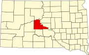
 Mission Ridge Location within the state of South Dakota  Mission Ridge Mission Ridge (the United States) | |
| Coordinates: 44°41′31″N 100°47′45″W | |
| Country | United States |
| State | South Dakota |
| County | Stanley |
| Elevation | 1,985 ft (605 m) |
| Time zone | UTC-6 (Central (CST)) |
| • Summer (DST) | UTC-5 (CDT) |
| ZIP codes | 57557 |
| GNIS feature ID | 1266866[1] |
The community was named for the elevated town site near Mission Creek.[4]
References
- "Mission Ridge, South Dakota". Geographic Names Information System. United States Geological Survey. Retrieved 2008-03-04.
- Rand McNally. The Road Atlas '05. Chicago: Rand McNally, 2005, p. 93.
- Zip Code Lookup
- Federal Writers' Project (1940). South Dakota place-names, v.1-3. University of South Dakota. p. 50.
Municipalities and communities of Stanley County, South Dakota, United States | ||
|---|---|---|
County seat: Fort Pierre | ||
| City |
|  |
| Unincorporated communities |
| |
| Indian reservations |
| |
| Ghost towns |
| |
| Footnotes | ‡This populated place also has portions in an adjacent county or counties | |
| ||
This South Dakota state location article is a stub. You can help Wikipedia by expanding it. |
Текст в блоке "Читать" взят с сайта "Википедия" и доступен по лицензии Creative Commons Attribution-ShareAlike; в отдельных случаях могут действовать дополнительные условия.
Другой контент может иметь иную лицензию. Перед использованием материалов сайта WikiSort.org внимательно изучите правила лицензирования конкретных элементов наполнения сайта.
Другой контент может иметь иную лицензию. Перед использованием материалов сайта WikiSort.org внимательно изучите правила лицензирования конкретных элементов наполнения сайта.
2019-2025
WikiSort.org - проект по пересортировке и дополнению контента Википедии
WikiSort.org - проект по пересортировке и дополнению контента Википедии