world.wikisort.org - USA
Millgrove Township is one of twelve townships in Steuben County, Indiana, United States. As of the 2010 census, its population was 1,577 and it contained 990 housing units.[2]
Millgrove Township | |
|---|---|
Township | |
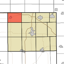 Location in Steuben County | |
| Coordinates: 41°44′05″N 85°08′12″W | |
| Country | United States |
| State | Indiana |
| County | Steuben |
| Government | |
| • Type | Indiana township |
| Area | |
| • Total | 23.74 sq mi (61.5 km2) |
| • Land | 22.03 sq mi (57.1 km2) |
| • Water | 1.71 sq mi (4.4 km2) 7.20% |
| Elevation | 955 ft (291 m) |
| Population (2010) | |
| • Total | 1,577 |
| • Density | 71.6/sq mi (27.6/km2) |
| Time zone | UTC-5 (Eastern (EST)) |
| • Summer (DST) | UTC-4 (EDT) |
| Area code(s) | 260 |
| GNIS feature ID | 453629 |

History
Fawn River State Fish Hatchery was listed on the National Register of Historic Places in 1997.[3]
Geography
According to the 2010 census, the township has a total area of 23.74 square miles (61.5 km2), of which 22.03 square miles (57.1 km2) (or 92.80%) is land and 1.71 square miles (4.4 km2) (or 7.20%) is water.[2] Lakes in this township include Bell Lake, Brown Lake, Chair Factory Lake, Lake Gage, Lake Syl-van, Lime Lake, Lime Lake, Perch Lake, Rhodes Lake, Sally Owen Lake, Tamarack Lake and Warner Lake. The stream of Crooked Creek runs through this township.
Cities and towns
- Orland
Unincorporated towns
- Panama at 41.7064392°N 85.1074684°W
(This list is based on USGS data and may include former settlements.)
Cemeteries
The township contains three cemeteries: Carlton, Greenlawn and Mill Grove.
Major highways
 Interstate 80
 Indiana State Road 120
 Indiana State Road 327
References
- "US Board on Geographic Names". United States Geological Survey. October 25, 2007. Retrieved 2017-05-08.
- "Population, Housing Units, Area, and Density: 2010 - County -- County Subdivision and Place -- 2010 Census Summary File 1". United States Census. Archived from the original on 2020-02-12. Retrieved 2013-05-10.
- "National Register Information System". National Register of Historic Places. National Park Service. July 9, 2010.
External links
Places adjacent to Millgrove Township, Steuben County, Indiana | ||||||||||||||||
|---|---|---|---|---|---|---|---|---|---|---|---|---|---|---|---|---|
| ||||||||||||||||
Municipalities and communities of Steuben County, Indiana, United States | ||
|---|---|---|
County seat: Angola | ||
| City |
|  |
| Towns |
| |
| Townships |
| |
| Unincorporated communities |
| |
| Footnotes | ‡This populated place also has portions in an adjacent county or counties | |
| ||
Другой контент может иметь иную лицензию. Перед использованием материалов сайта WikiSort.org внимательно изучите правила лицензирования конкретных элементов наполнения сайта.
WikiSort.org - проект по пересортировке и дополнению контента Википедии