world.wikisort.org - USA
Miller Township is one of fourteen townships in Dearborn County, Indiana. As of the 2010 census, its population was 9,810 and it contained 3,651 housing units.[3]
Miller Township | |
|---|---|
Township | |
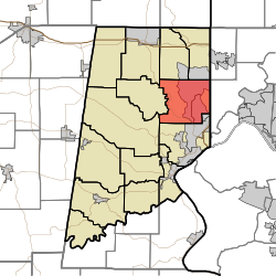 Location of Miller Township in Dearborn County | |
| Coordinates: 39°10′48″N 84°52′27″W | |
| Country | United States |
| State | Indiana |
| County | Dearborn |
| Government | |
| • Type | Indiana township |
| Area | |
| • Total | 26.37 sq mi (68.3 km2) |
| • Land | 26.14 sq mi (67.7 km2) |
| • Water | 0.23 sq mi (0.6 km2) |
| Elevation | 568 ft (173 m) |
| Population (2010) | |
| • Total | 9,810 |
| • Density | 375.3/sq mi (144.9/km2) |
| FIPS code | 18-49464[2] |
| GNIS feature ID | 453628 |
History
Miller Township was organized in 1834.[4][5]
Geography
According to the 2010 census, the township has a total area of 26.37 square miles (68.3 km2), of which 26.14 square miles (67.7 km2) (or 99.13%) is land and 0.23 square miles (0.60 km2) (or 0.87%) is water.[3]
Cities and towns
- Bright (south half)
- Hidden Valley (vast majority)
Major highways
 Indiana State Road 1
Cemeteries
The township contains three cemeteries: Georgetown, Pelley and Sugar Ridge.
References
- "US Board on Geographic Names". United States Geological Survey. 2007-10-25. Retrieved 2008-01-31.
- "U.S. Census website". United States Census Bureau. Retrieved 2008-01-31.
- "Population, Housing Units, Area, and Density: 2010 - County -- County Subdivision and Place -- 2010 Census Summary File 1". United States Census. Archived from the original on 2020-02-12. Retrieved 2013-05-10.
- Shaw, Archibald (1915). History of Dearborn County, Indiana: Her People, Industries and Institutions. Unigraphic. pp. 205.
- History of Dearborn and Ohio Counties, Indiana. F. E. Weakley. 1885. pp. 456.
External links
Wikimedia Commons has media related to Miller Township, Dearborn County, Indiana.
Places adjacent to Miller Township, Dearborn County, Indiana | |
|---|---|
Municipalities and communities of Dearborn County, Indiana, United States | ||
|---|---|---|
County seat: Lawrenceburg | ||
| Cities |
|  |
| Towns |
| |
| Townships |
| |
| CDPs | ||
| Other unincorporated communities |
| |
| ||
Текст в блоке "Читать" взят с сайта "Википедия" и доступен по лицензии Creative Commons Attribution-ShareAlike; в отдельных случаях могут действовать дополнительные условия.
Другой контент может иметь иную лицензию. Перед использованием материалов сайта WikiSort.org внимательно изучите правила лицензирования конкретных элементов наполнения сайта.
Другой контент может иметь иную лицензию. Перед использованием материалов сайта WikiSort.org внимательно изучите правила лицензирования конкретных элементов наполнения сайта.
2019-2026
WikiSort.org - проект по пересортировке и дополнению контента Википедии
WikiSort.org - проект по пересортировке и дополнению контента Википедии