world.wikisort.org - USA
Milburn is an unincorporated community in Carlisle County, Kentucky, United States. Its elevation is 482 feet (147 m), and it is located at 36°47′55″N 88°53′59″W (36.7986679, -88.8997817).[1] Located along Kentucky Route 80 at its junction with Kentucky Routes 1371 and 1377, Milburn lies amid rolling countryside at the headwaters of Guess Creek, a tributary of Bayou du Chien; the nearest point on the Mississippi River is approximately 12 miles (19 km) to the west. Nearby cities include Arlington, 6 miles (9.7 km) by air to the west, and Bardwell, 8 miles (13 km) by air to the northwest; Milburn is connected to them by Kentucky Route 80 and Kentucky Route 1377 respectively. A state hunting preserve, the Obion Creek Wildlife Management Area, lies 2 miles (3.2 km) to the south.[2] A fire station is located in Milburn,[3] and a Creole cottage in the community, the George W. Stone House, is listed on the National Register of Historic Places.[4]
Milburn, Kentucky | |
|---|---|
Unincorporated community | |
 Milburn Location within the state of Kentucky  Milburn Milburn (the United States) | |
| Coordinates: 36°47′55″N 88°53′59″W | |
| Country | United States |
| State | Kentucky |
| County | Carlisle |
| Elevation | 482 ft (147 m) |
| Time zone | UTC-6 (Central (CST)) |
| • Summer (DST) | UTC-5 (CST) |
| GNIS feature ID | 498175[1] |
References
- U.S. Geological Survey Geographic Names Information System: Milburn, Kentucky
- DeLorme. Kentucky Atlas & Gazetteer. 3rd ed. Yarmouth: DeLorme, 2005, 75. ISBN 0-89933-340-0.
- U.S. Geological Survey Geographic Names Information System: Milburn Fire Department
- "National Register Information System". National Register of Historic Places. National Park Service. July 9, 2010.
Municipalities and communities of Carlisle County, Kentucky, United States | ||
|---|---|---|
County seat: Bardwell | ||
| Cities | 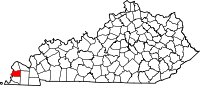 | |
| CDP | ||
| Other community | ||
| ||
Authority control | |
|---|---|
| General |
|
| National libraries | |
This Carlisle County, Kentucky state location article is a stub. You can help Wikipedia by expanding it. |
Другой контент может иметь иную лицензию. Перед использованием материалов сайта WikiSort.org внимательно изучите правила лицензирования конкретных элементов наполнения сайта.
WikiSort.org - проект по пересортировке и дополнению контента Википедии