world.wikisort.org - USA
Midlothian (/mɪdˈloʊθiən/ mid-LOH-thee-ən) is an unincorporated area in Chesterfield County, Virginia, U.S. Settled as a coal town, Midlothian village experienced suburbanization effects and is now part of the western suburbs of Richmond, Virginia south of the James River in the Greater Richmond Region.[4] Because of its unincorporated status, Midlothian has no formal government, and the name is used to represent the original small Village of Midlothian and a vast expanse of Chesterfield County in the northwest portion of Southside Richmond served by the Midlothian post office.
This article needs additional citations for verification. (June 2017) |
Midlothian, Virginia | |
|---|---|
Unincorporated area | |
 Ruins of the Grove Shaft air-pumping station, now part of the Mid-Lothian Mines Park. | |
 Midlothian, Virginia Location of Midlothian, Virginia  Midlothian, Virginia Midlothian, Virginia (Virginia)  Midlothian, Virginia Midlothian, Virginia (the United States) | |
| Coordinates: 37°31′17.4″N 77°39′53.2″W[1] | |
| Country | |
| State | |
| County | Chesterfield |
| Settled | c.1700 |
| Founded | c.1730 |
| Founded by | Wooldridge brothers |
| Named for | Mid-Lothian Mining and Manufacturing Company |
| Government | |
| • District supervisor | Leslie Haley |
| Elevation | 367 ft (112 m) |
| Population (2010)[3] | |
| • Total | 58,880 |
| Time zone | UTC-5:00 (EST) |
| • Summer (DST) | UTC-4:00 (EDT) |
| ZIP code | 23113 & 23114 |
| Area code | 804 |
| Website | www |
The Village of Midlothian was named for the early 18th-century coal mining enterprises of the Wooldridge family. Incorporated in 1836, their Mid-Lothian Mining and Manufacturing Company employed free and enslaved people to do the deadly work of digging underground.[5] Midlothian is the site of the first commercially-mined coal in the Colony of Virginia and North America.[6]
By the early 18th century, several mines were being developed in Chesterfield County by French Huguenots and others. The mine owners began to export the commodity from the region in the 1730s. Midlothian-area coal from Harry Heth's Black Heath mines heated the U.S. White House for President Thomas Jefferson.[7][8] The transportation needs of coal shipping stimulated construction of a paved toll road (Virginia's first), the Manchester Turnpike in 1807; and the Chesterfield Railroad, Virginia's first, in 1831; each traveled the 13 miles (21 km) from the mining community to the port of Manchester, just below the Fall Line of the James River. In 1850, the Richmond and Danville Railroad built Coalfield Station, a freight and later passenger depot, near the mines.
In the 1920s, the old turnpike was straightened and became part of the new east-west U.S. Route 60. A few decades later, residential neighborhoods were developed in Southside Richmond near Midlothian, including the large Salisbury community and the Brandermill planned development sited on Swift Creek Reservoir. In the 21st century, Midlothian extends many miles beyond the original village area.[citation needed] State Route 288 connects the community with Interstate 64 and the State Route 76 "Powhite Parkway" toll road, and Interstate 95 in the Richmond metropolitan area's southwestern quadrant.

Geography
Midlothian is located in the Piedmont geologic region of the state, and is made up of mainly a hilled, fertile land (it is somewhat of a plain.) It is located on the Richmond Basin, which is one of the Eastern North America Rift Basins. It contains some sedimentary rock and bituminous coal.
Watersheds
The Midlothian area serves as the headwaters to a number of creeks which ultimately contribute their waters to the flow of the James River. These include Swift Creek and Falling Creek. The Swift Creek Reservoir serves as the major source of fresh water for the county.
Demographics
As of 2020, the district of Midlothian had a total population of 72,711 consisting of 26,206 households.[9] The population was 69.6% White (50,584), 13.9% Black (10,095), 4.4% Asian (3,203), 0.3% Native American (206), 0.05% Pacific Islander (41), 4.7% of other races (3,412) and 7.1% of two or more races (5,170). People of Hispanic or Latino origin, of any race, made up 8.9% of the population (6,496).
In 2019, the median household income was $89,851.[9]
Economy
Midlothian was ranked #37 in CNNMoney's list of "The Best Places to Live" in 2005[10] and #99 in 2008.[11]
At the turn of the 21st century, a group of area business professionals formed an independent organization called the Western Chesterfield Business Alliance, which in 2013 was renamed the Midlothian Business Alliance.
Government
Midlothian is an unincorporated area of Chesterfield County. The area is represented by an elected district supervisor on the county's board of supervisors. The position has been held by Republican Leslie Haley since 2015.[12]
Infrastructure
In 2004, completion of State Route 288 connected Midlothian to the circumferential highway network of greater Richmond Region. Development was controversial, and some residents wanted to avoid the scale seen in Northern Virginia. After years of discussion, in March 2006 Chesterfield County approved intensive zoning for the Watkins Centre, promoted as a large, mixed-use office complex and retail "lifestyle center" at the intersection of Route 288 and U.S. 60, 2 miles (3.2 km) west of the Village of Midlothian.
With the addition of the multimillion-dollar Bon Secours Hospital, St. Francis, Midlothian has a major hospital within five minutes of Midlothian's highest concentration of residents.
James River High School, part of Chesterfield County Public Schools located in Midlothian, won the President's Blue Ribbon School of Excellence Award in 2000. In 2015, Cosby High School, also located in Midlothian, received this recognition.[13]
History
Etymology
The origins of the name of Midlothian are subject to debate. Many think that the name came from two brothers from East Lothian and West Lothian in Scotland who founded a village. For the name of the village they decided to name it after their respective homelands and a compromise was made, thus making the name of Midlothian.
However, this story is mostly a legend based in some truth. The two brothers who were said to have founded the village were likely Abraham Salle and Dr. Archibald Logwood Wooldridge (often called A. S. and A. L. Wooldridge). They, along with their two sisters, Jane Elam and Charlotte Wooldridge, incorporated a mining company called the Midlothian Coal Mining Company in 1835.[14] This company's lands consisted of most of the present-day land south of Midlothian Turnpike in the village of Midlothian and is thought to have given its name to the village. The name of the coal company came from the Midlothian tract of land that was one of the two tracts that made up the company's original land holdings of 404 1/2 acres.[15] The name of the tract came from a house that was located there and was owned by the Wooldridge family. The first Wooldridge in America, and the one who had assembled most of the Midlothian area lands, John Wooldridge came in the late 17th century from England. However, his ancestors in England had connections with the region of Midlothian in Scotland, and it is from here that the name is originally derived.
The village had not always been called Midlothian. In the late 1700s, the area was listed on maps simply as "Coal Mines" and later came to be known as Coalfield. The modern-day Coalfield Road is a remnant of this name. The station where the Richmond and Danville railroads cut through the village was called Coalfield Station. It was first built in 1850 later to be destroyed in 1864 during the Civil War. The second Coalfield Station was built two years later in 1866 to be finally demolished in 1957. The station stood at the intersection of Salisbury Drive and the railroad.[16] The US Post Office established at the station had the name of Midlothian. This reflected the importance of the Midlothian Coal Mining Company. By the late 1800s, the area had ceased to be called Coalfield and was referred to as Midlothian.
Early History
Before the arrival of Europeans in the 17th century, the area had been populated for thousands of years by various cultures of Native Americans. Among these in historic times were the Siouan-speaking Monacan tribe. They often came into conflict with the Algonquian-speaking members of the Powhatan Confederacy, who were generally located to the east in the Virginia Tidewater area.
In 1700 and after, French Huguenot settlers, who were Protestant, came to the area in the Virginia Colony to escape Catholic religious persecution in France. Most came from London, where they had resettled as refugees. Although the Crown had offered the French land in Lower Norfolk County, the governor of the colony and William Byrd offered them the village of Manakin Town, which had been abandoned by the Monacan. Byrd and the governor intended to use the French as a buffer settlement, and thought they would be easier to control apart from the English. The location was about 20 miles (32 km) above the head of navigation on the James River at what became Richmond. The French, many of whom were artisans and merchants, struggled to survive on the isolated frontier. The terrain was hilly and largely wooded, and shipping of farm products such as tobacco crops was not easy.
The greater natural resource in the Midlothian area was coal, and the area was ultimately developed with coal mining and railroads. About 10 miles (16 km) west of the fall line of the James River at present-day Richmond is a basin of coal, which was one of the earliest mined in the Virginia Colony. Scots settlers with mining skills began to mine this resource in the 18th century. Many coal-related enterprises in the Midlothian area of Chesterfield County began early in the 18th century.
In 1846, Chesterfield County's first Black church, First Baptist Church of Midlothian, was founded. It was rebuilt in 1877 after a fire, and the reconstruction included a small one-room building to be the first public school for Black children in the area.[17]
Coal mining
The Village area of today's Midlothian started as a settlement of coal miners in the 18th century which were among the oldest mining shafts in the United States.[18] In 1709, Midlothian produced the first commercially mined coal in the United States. Among other participants in the area's emerging coal business was Colonel Henry "Harry" Heth, a businessman who emigrated from England about 1759. He established offices at Norfolk and Manchester, where several generations of his family were also involved in the business. [citation needed]
During the American Revolution, coal produced in the Midlothian coal pits supplied the cannon factory on the James River at Westham, upstream from Richmond; it produced shot and shells for the Continental Army. By the end of the War, developers shipped Chesterfield coal to Philadelphia, New York, Boston and to every city in Virginia. Commenting on the area's coal in his Notes on the State of Virginia (1781–82), then-Governor Thomas Jefferson stated: "The country on James river, from 15 to 20 miles above Richmond, and for several miles northward and southward, is replete with mineral coal of a very excellent quality."[19] During his presidency, Jefferson ordered coal from the Black Heath Mine in Midlothian for use in the White House. [citation needed]
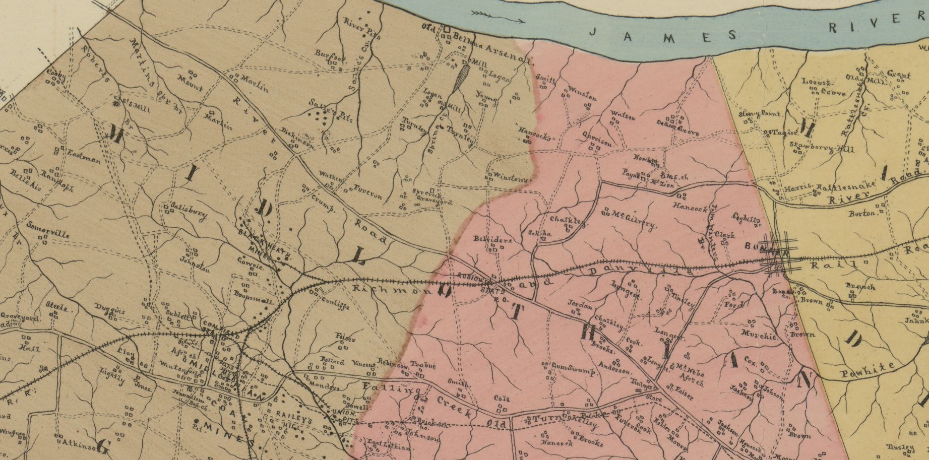
In 1989 the Chesterfield County Board of Supervisors approved a special area plan for Midlothian Mines Park, partly as a response to economic growth along Midlothian Turnpike resulting in population explosion.[20] The core of the new "Special Area Plan" was based on the boundary of the plan of 1989 and extended westward to Route 288 as a natural boundary, and a map of the Midlothian community special area plan boundary was provided by John G. Ownby for the Richmond Times-Dispatch.[21] Midlothian Mines Park, on the site of the first commercially-mined coal deposits in the Colony of Virginia, first opened for visitors in 2004.[22]
Early roads, first turnpike, and railroads
In 1802, a petition to form the Manchester Turnpike Company was created by mine owners and investors. They wanted the construction of a macadam toll road at least 30 feet wide from Manchester to Falling Creek bridge.[23] The toll road, Manchester and Falling Creek Turnpike, was built in 1804 to ease traffic on what is now Old Buckingham Road. Farm and passenger wagons were allowed to only pay the toll one-way, however coal wagons were to pay half toll on return due to the wear the heavy wagons would create on the road.[24] It was graveled in 1807, making it Virginia's first hard-surfaced road. The road's descendant is known today as Midlothian Turnpike.
By 1824, an estimated 70 to 100 wagons, each of which was loaded with four or five tons of coal, made a daily trip on the turnpike, transporting to the docks near Manchester the million or more bushels (30,000 metric tons) of coal that were produced in Chesterfield County each year. The heavily loaded coal wagons tended to cut deep ruts in the turnpike, raising clouds of dust in summer and churning the road into mud in the rainy season. As there were few options for shunpiking, citizens whose faster buggies dawdled along behind the lumbering wagons urged the state legislature to do something about it—a canal, a better road, but something.
The result was the Chesterfield Railroad, a 13 miles (21 km) mule- and gravity-powered line that connected the Midlothian coal mines with wharves located at Manchester, directly across from Richmond. Partially funded by the Virginia Board of Public Works, the railroad began operating in 1831, the first in the state. By 1852, the newer, steam-driven Richmond and Danville Railroad (R&D) began operation to Coalfield Station, later renamed Midlothian; it quickly supplanted the slower Chesterfield Railroad. In a financial reorganization in 1894, the R&D line through Midlothian became part of the Southern Railway system. It is now part of Norfolk Southern Railway. According to the 1895 Virginia atlas, the population of Midlothian was 375.[25]
20th century: village becomes surrounded by suburban development
In the 20th century, coal mining declined. The area became less populated, remaining largely wooded with farms scattered along mostly rural and dirt roads. Gradually, post-war construction of the highway network and the growth of metropolitan Richmond brought subdivision residential development. When the Swift Creek Reservoir was created in 1965, the availability of water and sewer service accelerated residential growth, with Brandermill built in 1975.
In 1988, an extension of the Powhite Parkway and widening of Midlothian Turnpike and Hull Street Road (U.S. Route 360) provided much-needed highway infrastructure. The area continued to attract new residents as farm and forest lands were redeveloped into residential subdivisions. The expansion of the area assigned to the Midlothian post office caused a much larger area to be assigned to have a "Midlothian" ZIP code on their address. As a result, many address locations within Chesterfield County that are far away from the original Midlothian village on U.S. Route 60 have "Midlothian" as their preferred place name. Chesterfield County's Midlothian Community Special Area Plan[26] defines the Midlothian community as roughly the area between the Village of Midlothian and Lucks Lane to the south.[27]
Historic landmarks
Chesterfield County Historic Landmarks near the Midlothian Village include:
- Bellona Arsenal
- Bethel Baptist Church
- Bellgrade Plantation, 11500 West Huguenot Road[28]
- Dinwiddie County Pullman Car
- Trabue's Tavern, 11940 Old Buckingham Road
- Hallsboro Store
- Hallsborough Tavern, 16300 Midlothian Turnpike
- Ivymont Manor, 14111 Midlothian Turnpike (built in 1850)[29]
- Southside Speedway, 12800 Genito Road
- Chesterfield Railroad, portion of roadbed (visible off Sturbridge Drive south of Midlothian Turnpike behind Pocono Green Shopping Center)
Chesterfield Museum
An exhibit on local mining history in the Chesterfield Museum includes a length of iron rail from the incline railway, the first in Virginia.
In popular culture
Midlothian is the inspiration for the fictional town of Middlesex, Virginia in the cult film Donnie Darko. "It’s meant to be a stylized, satirical, comic book, fantasyland version of what I remember Midlothian, Virginia to be, I guess," filmmaker Richard Kelly has explained.[30]
See also
- Aetna Hill (Midlothian, Virginia house)
References
- U.S. Geological Survey Geographic Names Information System: Midlothian
- "County of Chesterfield, VA | Midlothian District - Leslie Haley - Midlothian District". www.chesterfield.gov. Retrieved 5 October 2016.
- "2010 Census Interactive Population Search - VA - Midlothian district". Census 2010. US Census Bureau. Retrieved 7 October 2016.
- "Midlothian". Virginia is for Lovers. Virginia Tourism Corporation. Retrieved 7 October 2016.
- "Historic Overview Mid-Lothian Mines and Railroad Foundation - Midlothian, Virginia". Mid-Lothian Mines Park. Retrieved 6 October 2016.
- Nelson, Scott Reynolds (1999). Iron Confederacies: Southern Railways, Klan Violence, and Reconstruction. Chapel Hill: Univ. of North Carolina Press. ISBN 9780807848036.
- "Heath Gravity RR Marker is back". Salisbury Homeowners. The Salisbury Courier. 2013. p. 1. Retrieved 6 October 2016.
- Farina, Elizabeth (1 May 2009). "Celebrate Mid-Lothian Mines, the village's history on May 2". Richmond-Times Dispatch. Retrieved 6 October 2016.
- "Explore Census Data". data.census.gov. Retrieved 2021-10-31.
- "CNNMoney.com: Best places to live: Midlothian, VA snapshot". money.cnn.com. Retrieved 2021-10-31.
- "Best places to live 2008 - Top 100 City details: Midlothian, VA - from MONEY Magazine". money.cnn.com. Retrieved 2021-10-31.
- "Midlothian District | Chesterfield County, VA". www.chesterfield.gov. Retrieved 2021-10-31.
- Cosby High is named a National Blue Ribbon School mychesterfieldschools.com, 25 September 2015
- Acts of the General Assembly of Virginia, Passed at the Session of 1834-35, Commencing 1st December, 1834, and Ending 12th March, 1835, In the Fifty-Ninth Year of the Commonwealth. Richmond, Virginia: Samuel Shepard. 1835. p. 172. Retrieved 17 May 2019.
- Acts of the General Assembly of Virginia, Passed at the Session of 1834-35, Commencing 1st December, 1834, and Ending 12th March, 1835, In the Fifty-Ninth Year of the Commonwealth. Richmond, Virginia: Samuel Shepard. 1835. p. 172. Retrieved 17 May 2019.
- Burtchett, Barbara I. (May 1983). A history of the village of Midlothian, emphasizing the period 1835-1935. Richmond, Virginia: University of Richmond: UR Scholarship Repository: Masters' Theses. pp. 46, 58, 86. Retrieved 17 May 2019.
- "Beyond the mines: How a 175-year-old church in Midlothian became the heartbeat of a thriving Black community". Chesterfield Observer. 2021-02-17. Retrieved 2021-10-31.
- "Historic Overview Mid-Lothian Mines and Railroad Foundation - Midlothian, Virginia". Mid-Lothian Mines Park. Retrieved 21 April 2019.
- "Notes on the State of Virginia". avalon.law.yale.edu. Avalon Project. Retrieved 7 October 2016.
- Schmidt, Markus. "Chesterfield seeks input from residents to draft vision for Midlothian's future". No. May 21, 2016. Richmond Times-Dispatch.
...[T]he once-quiet village has seen its population explode 125 percent in the 6-square-mile plan area, from 7,500 people in 2000 to 16,700 in 2014.
- Times-Dispatch, MARKUS SCHMIDT Richmond. "Chesterfield seeks input from residents to draft vision for Midlothian's future". Richmond Times-Dispatch. Retrieved March 16, 2019.
- "Coal in Virginia". www.virginiaplaces.org. Retrieved 21 April 2019.
- KELLEHER, ED. "Midlothian Turnpike: a twisting history, with some twisting tales". Richmond Times-Dispatch. Retrieved 2021-10-31.
- Burtchett, Barbara Irene, "A history of the village of Midlothian, Virginia, emphasizing the period 1835-1935" (1983). Master's Theses. 479. Retrieved 2021-10-31.
- Elizabeth Dabney Coleman (1954). "Forerunner of Virginia's First Railway [The Chesterfield Tramway, 1830-1850]". Virginia Cavalcade. 4 (3): 4.
- "Midlothian Community Special Area Plan | Chesterfield County, VA". www.chesterfield.gov. Archived from the original on 2019-03-29.
- "Archived copy". Archived from the original on 2019-03-29. Retrieved 2019-03-29.
{{cite web}}: CS1 maint: archived copy as title (link) - "The Ghosts of Bellgrade". ruthschris.com. Ruth's Chris Steak House. Retrieved September 7, 2018.
- "Historic Midlothian Driving Tour" (PDF). experiencechesterfield.com. Experience Chesterfield. Retrieved September 7, 2018.
- Murray, Rebecca. "Inside "Donnie Darko" with Writer/Director Richard Kelly". About.com Entertainment. Retrieved 7 October 2016.
Further reading
- James, George Watson (1967), "Gravity plus mules equal "steam" ", Virginia Record, Richmond, VA. (Apr. 1967 issue v. 89, no.4, p. 8)
- Lutz, Frank E.. (1954) Chesterfield, An Old Virginia County, William Byrd Press, Inc., Richmond, Virginia.
- O’Dell, Jeffrey M. (1983) Chesterfield County: Early Architecture and Historic Sites, Chesterfield County Board of Supervisors, Chesterfield, Virginia.
- Scarburgh, George Parker, (1850), Opinion of Honorable George P. Scarburgh, of Accomac, Virginia, in the cases between the Chesterfield Railroad Company and the Richmond and Danville Railroad Company, Richmond, VA: H. K. Ellyson
- Weaver, Bettie W. (Bettie Weaver)(1961—1962) "The Mines of Midlothian", in Virginia Cavalcade Winter: pages 40–47.
- Chesterfield Railway Chronology
- Burke Davis (1985) The Southern Railway: Road Of The Innovators Chapel Hill, N.C.: University of North Carolina Press
- Confederate Railroads website
- Special Collections, Virginia Tech University Library
External links
- Midlothian Business Alliance
- Midlothian Mines and Rail Road Foundation
- Walton Park Community Association
- The Village of Midlothian Website
- Midlothian Rotary Club
- Kiwanis Club of Midlothian-Chesterfield
Municipalities and communities of Chesterfield County, Virginia, United States | ||
|---|---|---|
County seat: Chesterfield Court House | ||
| CDPs |
|  |
| Unincorporated communities |
| |
| ||
Authority control | |
|---|---|
| General | |
| National libraries | |
Другой контент может иметь иную лицензию. Перед использованием материалов сайта WikiSort.org внимательно изучите правила лицензирования конкретных элементов наполнения сайта.
WikiSort.org - проект по пересортировке и дополнению контента Википедии