world.wikisort.org - USA
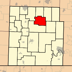
McDowell Township is one of twenty-five townships in Barry County, Missouri, United States. In the 1890s, the McDowell mines mined extracted lead and jack ore.[3][4] As of the 2000 census, its population was 275.
McDowell Township | |
|---|---|
Township | |
 | |
| Coordinates: 36°49′31″N 093°47′52″W | |
| Country | United States |
| State | Missouri |
| County | Barry |
| Area | |
| • Total | 23.85 sq mi (61.78 km2) |
| • Land | 23.85 sq mi (61.78 km2) |
| • Water | 0 sq mi (0 km2) 0% |
| Elevation | 1,296 ft (395 m) |
| Population (2000) | |
| • Total | 275 |
| • Density | 11.5/sq mi (4.5/km2) |
| FIPS code | 29-44966[2] |
| GNIS feature ID | 0766260 |
Geography
McDowell Township covers an area of 23.85 square miles (61.8 km2) and contains no incorporated settlements.
The streams of Calton Creek, Gunter Creek, Little Flat Creek, Stansberry Creek and Willow Branch run through this township.
References
- "US Board on Geographic Names". United States Geological Survey. 2007-10-25. Retrieved 2008-01-31.
- "U.S. Census website". United States Census Bureau. Retrieved 2008-01-31.
- McGuffin, J.B., ed. (August 15, 1893). "As Others See Us". The Granada Gazette.
A high grade of lead and jack ore is being mined at McDowell, Barry county, Mo., and it is believed that the county around there is likely to become a mining camp of no mean proportions.
- "McDowell". Barry County Museum. Cassville, MO. Retrieved 2022-07-12.
External links
Municipalities and communities of Barry County, Missouri, United States | ||
|---|---|---|
County seat: Cassville | ||
| Cities |  | |
| Villages | ||
| Townships |
| |
| CDPs |
| |
| Unincorporated communities |
| |
| Ghost towns |
| |
| Footnotes | ‡This populated place also has portions in an adjacent county or counties | |
| ||
This Barry County, Missouri state location article is a stub. You can help Wikipedia by expanding it. |
Текст в блоке "Читать" взят с сайта "Википедия" и доступен по лицензии Creative Commons Attribution-ShareAlike; в отдельных случаях могут действовать дополнительные условия.
Другой контент может иметь иную лицензию. Перед использованием материалов сайта WikiSort.org внимательно изучите правила лицензирования конкретных элементов наполнения сайта.
Другой контент может иметь иную лицензию. Перед использованием материалов сайта WikiSort.org внимательно изучите правила лицензирования конкретных элементов наполнения сайта.
2019-2025
WikiSort.org - проект по пересортировке и дополнению контента Википедии
WikiSort.org - проект по пересортировке и дополнению контента Википедии