world.wikisort.org - USA
Masonville is an unincorporated community and a U.S. Post Office in Larimer County, Colorado, United States. The Masonville Post Office has the ZIP Code 80541.[2]
Masonville, Colorado | |
|---|---|
Unincorporated community | |
 General store in Masonville | |
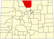
 Masonville Location in Colorado  Masonville Location in the United States | |
| Coordinates: 40°29′14″N 105°12′36″W | |
| Country | |
| State | |
| County | Larimer[1] |
| Elevation | 5,387 ft (1,642 m) |
| Time zone | UTC-7 (MST) |
| • Summer (DST) | UTC-6 (MDT) |
| ZIP code[2] | 80541 |
| Area code(s) | 970 |
| GNIS feature ID | 0204676 |
Geography
Masonville is located at 40°29′14″N 105°12′36″W (40.487171,-105.210056).
References
- "US Board on Geographic Names". United States Geological Survey. 2007-10-25. Retrieved 2008-01-31.
- "ZIP Code Lookup". United States Postal Service. January 2, 2007. Archived from the original (JavaScript/HTML) on November 22, 2010. Retrieved January 2, 2007.
Municipalities and communities of Larimer County, Colorado, United States | ||
|---|---|---|
County seat: Fort Collins | ||
| Cities |
|  |
| Towns |
| |
| CDPs |
| |
| Unincorporated communities | ||
| Ghost towns |
| |
| Footnotes | ‡This populated place also has portions in an adjacent county or counties | |
| ||
Текст в блоке "Читать" взят с сайта "Википедия" и доступен по лицензии Creative Commons Attribution-ShareAlike; в отдельных случаях могут действовать дополнительные условия.
Другой контент может иметь иную лицензию. Перед использованием материалов сайта WikiSort.org внимательно изучите правила лицензирования конкретных элементов наполнения сайта.
Другой контент может иметь иную лицензию. Перед использованием материалов сайта WikiSort.org внимательно изучите правила лицензирования конкретных элементов наполнения сайта.
2019-2026
WikiSort.org - проект по пересортировке и дополнению контента Википедии
WikiSort.org - проект по пересортировке и дополнению контента Википедии