world.wikisort.org - USA
Marvel is a census-designated place (CDP) and post office on the Southern Ute Indian Reservation in southwestern La Plata County, Colorado, United States. The CDP is a part of the Durango, CO Micropolitan Statistical Area. The Marvel post office has the ZIP Code 81329 (post office boxes).[3]
Marvel, Colorado | |
|---|---|
Census Designated Place | |
 Marvel post office, August 2019 | |
 Marvel Location of the Marvel CDP in the State of Colorado. | |
| Coordinates: 37°06′40″N 108°07′35″W[1] | |
| Country | |
| State | |
| County | La Plata County |
| Government | |
| • Type | unincorporated town |
| Area | |
| • Total | 0.133 sq mi (0.345 km2) |
| • Land | 0.133 sq mi (0.345 km2) |
| • Water | 0.000 sq mi (0.000 km2) |
| Elevation | 6,726 ft (2,050 m) |
| Time zone | UTC-7 (MST) |
| • Summer (DST) | UTC-6 (MDT) |
| ZIP Code[3] | 81329 |
| Area code | 970 |
| GNIS feature[2] | Marvel CDP |
History
The Marvel area was homesteaded in the late-1800s and early-1900s with ranching, farming, and oil extraction being the main economic drivers in the region.
Geography
The area around Marvel is very dry and the region becomes more and more arid as one travels towards the New Mexico border and further away from the La Plata mountains. While the town lies within the Reservation, the land within and around the town is owned by private landowners and the reservation proper only starts several miles to the South and East of Marvel.
The Marvel CDP has an area of 85 acres (0.345 km2), all land.[1]
Demographics
| Year | Pop. | ±% |
|---|---|---|
| 2020 | — | |
| Source: United States Census Bureau | ||
The United States Census Bureau defined the Marvel CDP for the United States Census 2020.
See also
- List of census-designated places in Colorado
References
- "State of Colorado Census Designated Places - BAS20 - Data as of January 1, 2020". United States Census Bureau. Retrieved December 22, 2020.
- "U.S. Board on Geographic Names: Domestic Names". United States Geological Survey. Retrieved December 22, 2020.
- "Look Up a ZIP Code". United States Postal Service. Retrieved December 22, 2020.
External links
Municipalities and communities of La Plata County, Colorado, United States | ||
|---|---|---|
County seat: Durango | ||
| City | 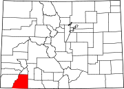 | |
| Towns | ||
| CDPs | ||
| Unincorporated communities | ||
| Ghost towns |
| |
| Indian reservations |
| |
| Footnotes | ‡This populated place also has portions in an adjacent county or counties | |
| ||
Другой контент может иметь иную лицензию. Перед использованием материалов сайта WikiSort.org внимательно изучите правила лицензирования конкретных элементов наполнения сайта.
WikiSort.org - проект по пересортировке и дополнению контента Википедии