world.wikisort.org - USA
Marrowbone is a census-designated place in Cumberland County, Kentucky, United States. As of the 2010 census it had a population of 217.[2] It has a post office, with the ZIP code of 42759.[3]
Marrowbone, Kentucky | |
|---|---|
Census-designated place | |
 Modern Woodmen lodge building on Kentucky Route 90 | |
 Marrowbone Location within the state of Kentucky  Marrowbone Marrowbone (the United States) | |
| Coordinates: 36°49′39″N 85°30′24″W | |
| Country | United States |
| State | Kentucky |
| County | Cumberland |
| Area | |
| • Total | 1.29 sq mi (3.34 km2) |
| • Land | 1.27 sq mi (3.30 km2) |
| • Water | 0.01 sq mi (0.04 km2) |
| Elevation | 643 ft (196 m) |
| Population (2020) | |
| • Total | 147 |
| • Density | 115.38/sq mi (44.54/km2) |
| Time zone | UTC-6 (Central (CST)) |
| • Summer (DST) | UTC-5 (CDT) |
| ZIP codes | 42759 |
| FIPS code | 21-50124 |
| GNIS feature ID | 497558 |
The Marrowbone Historic District, which includes three properties, is listed on the National Register of Historic Places.
Geography
It lies along Kentucky Route 90 west of the city of Burkesville, the county seat of Cumberland County.[4] Its elevation is 643 feet (196 m), and it is located at about (36.8288889, -85.5030556).[5]
Demographics
| Historical population | |||
|---|---|---|---|
| Census | Pop. | %± | |
| 2020 | 147 | — | |
| U.S. Decennial Census[6] | |||
References
- "2020 U.S. Gazetteer Files". United States Census Bureau. Retrieved March 18, 2022.
- "Geographic Identifiers: 2010 Demographic Profile Data (G001): Marrowbone CDP, Kentucky". U.S. Census Bureau, American Factfinder. Archived from the original on February 12, 2020. Retrieved August 13, 2014.
- Zip Code Lookup
- Rand McNally. The Road Atlas '06. Chicago: Rand McNally, 2006, p. 42.
- U.S. Geological Survey Geographic Names Information System: Marrowbone, Cumberland County, Kentucky, Geographic Names Information System, 1979-09-20. Accessed 2007-12-31.
- "Census of Population and Housing". Census.gov. Retrieved June 4, 2016.
Municipalities and communities of Cumberland County, Kentucky, United States | ||
|---|---|---|
County seat: Burkesville | ||
| City | 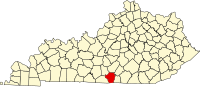 | |
| CDP | ||
| Other unincorporated communities |
| |
| ||
This Cumberland County, Kentucky state location article is a stub. You can help Wikipedia by expanding it. |
Текст в блоке "Читать" взят с сайта "Википедия" и доступен по лицензии Creative Commons Attribution-ShareAlike; в отдельных случаях могут действовать дополнительные условия.
Другой контент может иметь иную лицензию. Перед использованием материалов сайта WikiSort.org внимательно изучите правила лицензирования конкретных элементов наполнения сайта.
Другой контент может иметь иную лицензию. Перед использованием материалов сайта WikiSort.org внимательно изучите правила лицензирования конкретных элементов наполнения сайта.
2019-2025
WikiSort.org - проект по пересортировке и дополнению контента Википедии
WikiSort.org - проект по пересортировке и дополнению контента Википедии