world.wikisort.org - USA
Mallory Township is a township in Clayton County, Iowa, USA. At the 2010 census, its population was 395, down from 411 ten years earlier.
Mallory Township | |
|---|---|
Township | |
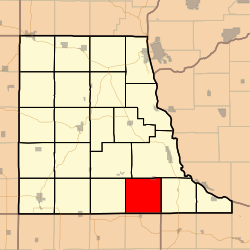 Location in Clayton County | |
| Coordinates: 42°41′31″N 091°11′26″W | |
| Country | |
| State | |
| County | Clayton |
| Area | |
| • Total | 35.98 sq mi (93.19 km2) |
| • Land | 35.98 sq mi (93.18 km2) |
| • Water | 0 sq mi (0.01 km2) 0.01% |
| Elevation | 1,181 ft (360 m) |
| Population (2010) | |
| • Total | 391 |
| • Density | 10.9/sq mi (4.2/km2) |
| GNIS feature ID | 0468336 |
Geography
Mallory Township covers an area of 35.98 square miles (93.2 km2) and contains one incorporated settlement, Osterdock. According to the USGS, it contains seven cemeteries: Bethel, Bolsinger, Brown, Hansel, King, Koenig and Noggle.
The streams of Joles Creek, Mill Creek and Peck Creek run through this township.
References
External links
Municipalities and communities of Clayton County, Iowa, United States | ||
|---|---|---|
County seat: Elkader | ||
| Cities |
|  |
| Townships | ||
| Unincorporated communities |
| |
| Footnotes | ‡This populated place also has portions in an adjacent county or counties | |
| ||
This article about the geography of Clayton County, Iowa is a stub. You can help Wikipedia by expanding it. |
Текст в блоке "Читать" взят с сайта "Википедия" и доступен по лицензии Creative Commons Attribution-ShareAlike; в отдельных случаях могут действовать дополнительные условия.
Другой контент может иметь иную лицензию. Перед использованием материалов сайта WikiSort.org внимательно изучите правила лицензирования конкретных элементов наполнения сайта.
Другой контент может иметь иную лицензию. Перед использованием материалов сайта WikiSort.org внимательно изучите правила лицензирования конкретных элементов наполнения сайта.
2019-2026
WikiSort.org - проект по пересортировке и дополнению контента Википедии
WikiSort.org - проект по пересортировке и дополнению контента Википедии