world.wikisort.org - USA
Luzerne is a borough located 5 miles (8 km) north of Wilkes Barre in Luzerne County, Pennsylvania, United States. The population was 2,703 at the 2020 census.[3]
Luzerne, Pennsylvania | |
|---|---|
Borough | |
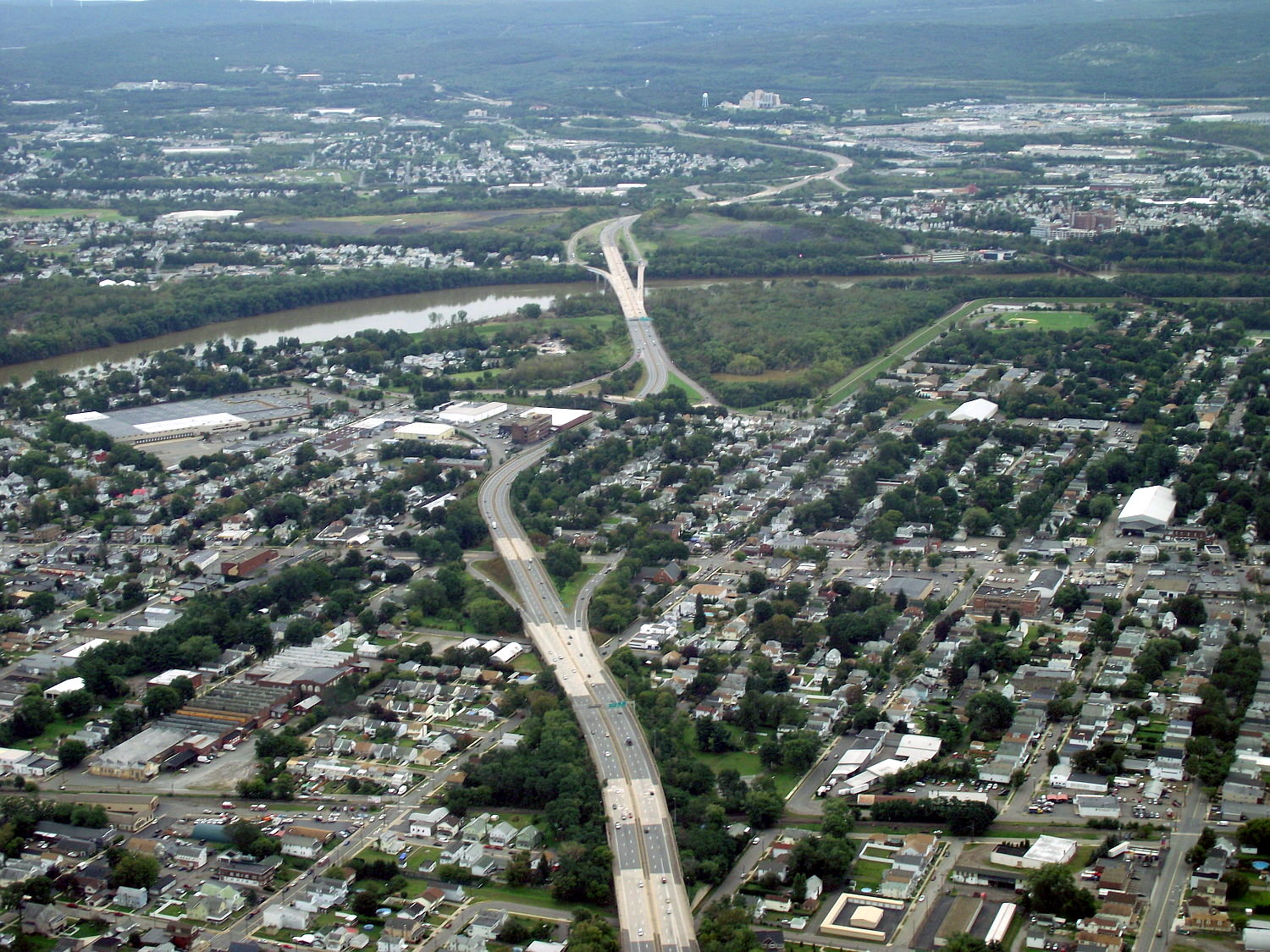 A picture of PA 309 as it travels through Luzerne and the surrounding communities. Luzerne is pictured in the foreground. | |
 Location of Luzerne in Luzerne County, Pennsylvania | |
 Luzerne  Luzerne | |
| Coordinates: 41°17′02″N 75°53′34″W | |
| Country | United States |
| State | Pennsylvania |
| County | Luzerne |
| Settled | 1807 |
| Incorporated | 1882 |
| Government | |
| • Type | Borough Council |
| Area | |
| • Total | 0.71 sq mi (1.83 km2) |
| • Land | 0.71 sq mi (1.83 km2) |
| • Water | 0.00 sq mi (0.00 km2) |
| Population (2020)[2] | |
| • Total | 2,711 |
| • Density | 3,834.51/sq mi (1,480.62/km2) |
| Time zone | UTC-5 (Eastern (EST)) |
| • Summer (DST) | UTC-4 (EDT) |
| Zip code | 18709 |
| Area code | 570 |
| FIPS code | 42-45568 |
| Website | luzerneborough |
History
The community was first settled in 1807. It was later incorporated as a borough in 1882. Like Luzerne County, the borough was named after Chevalier de la Luzerne, a French diplomat.[4] In the early twentieth century, coal mining and manufacturing were the main industries in the community. The borough had coal mines, a foundry, drill factories, flour and feed mills, a canning factory, and a silk mill.
Geography
Luzerne is located at 41°17′2″N 75°53′34″W (41.283780, -75.892890).[5]
According to the United States Census Bureau, the borough has a total area of 0.69 square miles (1.8 km2), all land.
Demographics
| Historical population | |||
|---|---|---|---|
| Census | Pop. | %± | |
| 1890 | 2,398 | — | |
| 1900 | 3,817 | 59.2% | |
| 1910 | 5,426 | 42.2% | |
| 1920 | 5,998 | 10.5% | |
| 1930 | 6,950 | 15.9% | |
| 1940 | 7,082 | 1.9% | |
| 1950 | 6,176 | −12.8% | |
| 1960 | 5,118 | −17.1% | |
| 1970 | 4,504 | −12.0% | |
| 1980 | 3,703 | −17.8% | |
| 1990 | 3,206 | −13.4% | |
| 2000 | 2,952 | −7.9% | |
| 2010 | 2,845 | −3.6% | |
| 2020 | 2,703 | −5.0% | |
| 2021 (est.) | 2,710 | [3] | 0.3% |
| Sources:[6][7][8][2] | |||
As of the census[7] of 2000, there were 2,952 people, 1,410 households, and 767 families living in the borough. The population density was 4,299.3 people per square mile (1,651.8/km2). There were 1,520 housing units at an average density of 2,213.7 per square mile (850.5/km2).
The racial makeup of the borough was 98.92% White, 0.34% African American, 0.07% Asian, 0.20% from other races, and 0.47% from two or more races. Hispanic or Latino of any race were 0.44% of the population.
There were 1,410 households, out of which 20.2% had children under the age of 18 living with them, 38.7% were married couples living together, 11.0% had a female householder with no husband present, and 45.6% were non-families. 40.9% of all households were made up of individuals, and 21.0% had someone living alone who was 65 years of age or older. The average household size was 2.09 and the average family size was 2.87.
In the borough the population was spread out, with 17.6% under the age of 18, 7.3% from 18 to 24, 28.7% from 25 to 44, 22.5% from 45 to 64, and 23.9% who were 65 years of age or older. The median age was 43 years. For every 100 females there were 88.7 males. For every 100 females age 18 and over, there were 86.6 males.
The median income for a household in the borough was $27,614, and the median income for a family was $37,730. Males had a median income of $27,054 versus $21,250 for females. The per capita income for the borough was $16,217. About 6.8% of families and 11.4% of the population were below the poverty line, including 14.5% of those under age 18 and 10.9% of those age 65 or over.
See also
- List of towns and boroughs in Pennsylvania
References
- "ArcGIS REST Services Directory". United States Census Bureau. Retrieved October 12, 2022.
- "Census Population API". United States Census Bureau. Retrieved Oct 12, 2022.
- Bureau, US Census. "City and Town Population Totals: 2020—2021". Census.gov. US Census Bureau. Retrieved August 4, 2022.
- Gannett, Henry (1905). The Origin of Certain Place Names in the United States. U.S. Government Printing Office. p. 192.
- "US Gazetteer files: 2010, 2000, and 1990". United States Census Bureau. 2011-02-12. Retrieved 2011-04-23.
- "Census of Population and Housing". U.S. Census Bureau. Retrieved 11 December 2013.
- "U.S. Census website". United States Census Bureau. Retrieved 2008-01-31.
- "Incorporated Places and Minor Civil Divisions Datasets: Subcounty Resident Population Estimates: April 1, 2010 to July 1, 2012". Population Estimates. U.S. Census Bureau. Archived from the original on 2 June 2013. Retrieved 11 December 2013.
External links
![]() Media related to Luzerne, Pennsylvania at Wikimedia Commons
Media related to Luzerne, Pennsylvania at Wikimedia Commons

Authority control | |
|---|---|
| General |
|
| National libraries | |
На других языках
[de] Luzerne (Pennsylvania)
Luzerne ist eine Ortschaft im Luzerne County des US-Bundesstaates Pennsylvania. Der als Borough statuierte Ort liegt acht Kilometer nördlich von Wilkes-Barre in der Nähe des Susquehanna River. Zu Beginn des 20. Jahrhunderts gab es im Ort vielfältige industrielle Aktivitäten wie beispielsweise Kohleminen, Getreidemühlen oder eine Gießerei. 1900 lebten 3817 Menschen in Luzerne, 1910 waren es 5425 und 1940 dann 7082. Im Jahr 2000 hatte der Ort 2952 Einwohner.- [en] Luzerne, Pennsylvania
Другой контент может иметь иную лицензию. Перед использованием материалов сайта WikiSort.org внимательно изучите правила лицензирования конкретных элементов наполнения сайта.
WikiSort.org - проект по пересортировке и дополнению контента Википедии