world.wikisort.org - USA
Los Angeles City Council District 7 is one of the 15 districts of the Los Angeles City Council. It covers much of the northeastern San Fernando Valley. On May 16, 2017, Monica Rodriguez was elected to fill the open seat following the resignation of Felipe Fuentes[1] and was sworn in as a council member on July 1, 2017.[2]
Los Angeles City Council District 7 | |
|---|---|
City district | |
 | |
| Country | United States |
| State | California |
| County | Los Angeles |
| City | Los Angeles |
| Government | |
| • Type | City district |
| • Body | Los Angeles City Council |
| • Councilmember | Monica Rodriguez (Democratic) |
| Website | monicarodriguez |
District geography
The Seventh District includes the following neighborhoods:
- Sylmar
- Mission HIlls
- Pacoima
- Sunland-Tujunga
- Lake View Terrace
- Shadow Hills
- La Tuna Canyon
- Northern portion of North Hills East
The certified Neighborhood Councils whose jurisdictions fall within the City Council District are: Sylmar, Mission Hills, Pacoima, North Hills East, Foothill Trails District, Sunland-Tujunga and very small portions of the Sun Valley Area.[3]
The Los Angeles Police Department Divisions within the district are the Mission and Foothill divisions. The whole district is covered by the Los Angeles Fire Department's 12th Battalion in their North Division and contains the following Fire Districts: 7 covering North Hills East, 24 covering Lake View Terrace and part of Tujunga, 74 covering Sunland-Tujunga, 75 covering Mission Hills, 77 covering Shadow Hills and La Tuna Canyon, 91 covering Sylmar, and 98 covering Pacoima. The council district is within the East Valley LADOT Engineering District.[3]
Boundary
The borders of the Council District as of the 2021 ordinance are formed by the following line: starting from the northwest point at the cross between the I-5 and the Los Angeles city limit, following that limit into the Sunland-Tujunga region, until the crossing of the Los Angeles and Glendale city boundaries near Mount Lukens. The border follows the city boundaries south then to the west until a point near La Tuna Peak in the Verdugo Mountains. Starting at this point, the district border separates from the city boundaries and starts to be bound briefly with the second district northwest through Verdugo Mountain Park until moving in a straight line west into Vinedale Street to its intersection with Glenoaks Boulevard. At this intersection the district begins to be bound with the sixth district. The border follows Glenoaks briefly north then Sunland Boulevard until turning northwest, separating a residential area in Shadow Hills to the northeast from the Vulcan landfill in the oppposite side until reaching Wentworth Street, following it northeast until it reaches the Hansen Dam Municipal Golf Course where it splits westward following the golf course's south boundary until splitting to the southwest at Branford Street. The border follows Branford southwest until reaching the I-5 which it then follows northward intil its interchange with the 118. From this interchange it moves southward following the Pacoima Wash and splitting southward through the Pacoima Spreading Grounds to the intersection with Natick Avenue and Woodman Avenue, following the latter briefly south until its intersection with Lassen Street. The border follows Lassen briefly westward until turning south once again into the Pacoima Wash. It follows the wash until Nordhoff Street, turning into it briefly west until turning south into Noble Avenue, then west again into Rayen Street until reaching the I-405. At this point the border bounds the district with the twelfth district. From Rayen and the 405, the border moves north following the 405 into the I-5 up until it returns to the city limit. The district does not include the City of San Fernando, which lies inside of the boundary.[3]
For all the neighborhoods and communities represented, see the official City of Los Angeles Map of District 7, showing its boundaries.
Historic locations
A new city charter effective in 1925 replaced the former plurality-at-large voting system for a nine-member city council within a district system, having a 15-member council. Each district was to be approximately equal in population, based upon the voting in the previous gubernatorial election, so redistricting was done every four years. In the present day, redistricting is done every ten years, based upon the preceding U.S. census results.[4] The numbering system established in 1925 for City Council districts began with No. 1 in the north of the city, in the San Fernando Valley, and ended with No. 15 in the south, in the Harbor area.
At the beginning, the Seventh District was situated south of Downtown Los Angeles. It was moved to the San Fernando Valley in 1956.[5]
1925: Bounded on the north by Jefferson Boulevard, on the south by Slauson Boulevard, on the west by Vermont Avenue and on the east by South Park Avenue.[6][7]
1926: 46th Street, Jefferson Boulevard, Vermont and Alameda avenues, with district headquarters at 529 West 41st Place.[8][9]
1928: Same as above, with the addition of the Exposition-Vermont-Vernon-Arlington area.[10]
1932–33: On the east by Alameda Avenue, on the west by Crenshaw Boulevard, on the north by Exposition Boulevard and on the south by Vernon Avenue.[11][12]
1937: On the west by Crenshaw Boulevard, on the north by Exposition Boulevard, on the east by the city boundary with Vernon and on the south by Vernon Avenue.[13]
1940: Same as above.[14]
1947. It was noted that the district's population was "nearly 50 per cent Negro."[15]
1956: Move to the San Fernando Valley, after Councilman Don A. Allen was elected to the State Assembly.[5] North: City boundary; south: Riverside Drive; east, Coldwater Canyon and Woodman Avenues; west, generally Balboa Boulevard.[5]
1961: Van Nuys, Sepulveda, Granada Hills and Sylmar.[16]
1986: Panorama City, part of Sun Valley and Sylmar.[17]
1993: A 70% Latino and 19% African-American council district that covered "much of the northeast Valley" encompassing "one of Los Angeles's poorest areas" and containing "the shuttered General Motors plant in Van Nuys as well as Blythe Street in Panorama City, one of the Valley's most drug-infested areas until a police crackdown."[18]
Registered voters were 39% Anglo, 30% Latino and 19% African-American.[19]
Officeholders
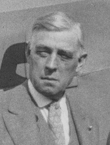
The 7th District has been represented by eleven men and one woman.
Downtown
| Officeholder | Term of office | |
|---|---|---|
 |
Ralph Luther Criswell | 1925–1927 |
 |
Howard W. Davis | 1927–1935 |
 |
Will H. Kindig | 1927–1935 |
|
Howard W. Davis | 1937–1939 |
 |
Carl C. Rasmussen | 1939–1947 |
 |
Don A. Allen | 1947–1957 |
San Fernando Valley
| Officeholder | Term of office | |
|---|---|---|
 |
James C. Corman | 1957–1961 |
 |
Ernani Bernardi | 1961–1993 |
 |
Richard Alarcon | 1993–1998 |
 |
Alex Padilla | 1999–2006 |
|
Richard Alarcon | 2007–2013 |
 |
Felipe Fuentes | 2013–2016 |
 |
Monica Rodriguez | 2017–present |
See also
- Los Angeles City Council districts
- List of Los Angeles municipal election returns
- San Fernando Valley-related list
References
- "L.A. Councilman Felipe Fuentes plans to step down early to become a lobbyist". Los Angeles Times. 15 August 2016.
- Smith, Dakota (2017-05-17). "City Council winners: Gil Cedillo, Monica Rodriguez, labor". Los Angeles Times. ISSN 0458-3035. Retrieved 2017-05-24.
- "NavigateLA" (PDF). navigatela.lacity.org. Retrieved 2022-10-14.
- Tina Daunt and Seema Mehta, "Council Districts Drawn to Benefit Valley, Latinos," Los Angeles Times, June 12, 2002
- "Council Votes Redistricting After Flare-up Over Changes," Los Angeles Times, October 24, 1956, page B-1
- "First Map Showing City Council's Districts," Los Angeles Times, January 16, 1925, page 1 The map shows all 15 council districts. The official boundaries of all 15 as limned by the city clerk are at "Councilmanic Districts Are Traced by Clerk Dominguez," Los Angeles Times, February 12, 1925, page A-2
- "Here Are the Hundred and Twelve Aspirants for the City's Fifteen Councilmanic Seats," Los Angeles Times, May 3, 1925, page 7
- "To the Citizens of Los Angeles," Los Angeles Times, February 14, 1926, page B-5
- Bing location for district office
- "Council Areas' Lines Changed," Los Angeles Times, December 29, 1928, page A-1
- "District Lines Get Approval," Los Angeles Times, December 24, 1932, page 2
- "City Reapportionment Measure Gets Approval," Los Angeles Times, January 19, 1933 With map of all districts.
- "New Council Zones Defined," Los Angeles Times, January 7, 1937, page A-18
- "Proposed New Alignment for City Voting Precincts" (with map), Los Angeles Times, November 30, 1940, page A-3
- "Voters to Decide Issues Tuesday," Los Angeles Times, May 25, 1947, page A-2
- Carlton Williams, "12 Vie for 7th District Council Post," Los Angeles Times, March 21, 1961
- "Los Angeles' Realigned Council Districts," Los Angeles Times, September 21, 1986, page B -3
- Jack Cheevers, "Elections: The Head of a Pacoima Youth Group Joins a Growing Field . . .," Los Angeles Times, January 27, 1993
- Scott Harris, "Last Press Release of the Anti-Politician," Los Angeles Times, July 4, 1993
- Note: Most of the Los Angeles Times links require the use of a library card.
External links
Members of the Los Angeles City Council | |||||||||||
|---|---|---|---|---|---|---|---|---|---|---|---|
| |||||||||||
 |
| ||||||||||
Los Angeles city areas within the San Fernando and Crescenta Valleys | ||
|---|---|---|
| Districts and neighborhoods |
|  |
| Points of interest |
| |
| Neighboring cities and communities | ||
| ||
Government of Los Angeles | |||||||
|---|---|---|---|---|---|---|---|
City Hall | |||||||
 | City Council |  | |||||
| Departments |
| ||||||
| Elections |
| ||||||
| Officials |
| ||||||
| School Districts |
| ||||||
| By topic |
|  |
|---|---|---|
| Government |
| |
| ||
Другой контент может иметь иную лицензию. Перед использованием материалов сайта WikiSort.org внимательно изучите правила лицензирования конкретных элементов наполнения сайта.
WikiSort.org - проект по пересортировке и дополнению контента Википедии