world.wikisort.org - USA
Long Reach is an unincorporated community in Tyler County, West Virginia, United States. Long Reach is located along the Ohio River and West Virginia Route 2, 2.8 miles (4.5 km) southwest of Friendly.[2]
Long Reach, West Virginia | |
|---|---|
Unincorporated community | |
 Long Reach, West Virginia  Long Reach, West Virginia | |
| Coordinates: 39°29′03″N 81°05′33″W | |
| Country | United States |
| State | West Virginia |
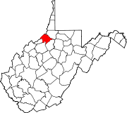
| County | Tyler |
| Elevation | 646 ft (197 m) |
| Time zone | UTC-5 (Eastern (EST)) |
| • Summer (DST) | UTC-4 (EDT) |
| Area code(s) | 304 & 681 |
| GNIS feature ID | 1549794[1] |
Long Reach is located along a 17-mile (27 km) relatively straight portion stretch of the Ohio River. This is the longest and straightest stretch of the entire river.[3]
References
- "Long Reach". Geographic Names Information System. United States Geological Survey.
- Tyler County, West Virginia General Highway Map (PDF) (Map). West Virginia Department of Transportation. 2011. p. 1. Archived from the original (PDF) on April 25, 2012. Retrieved February 22, 2012.
- Hay, Jerry M. (2008). Ohio River Guidebook. Inland Waterways Books. p. 28. ISBN 9781605852171. Retrieved 22 November 2013.
Municipalities and communities of Tyler County, West Virginia, United States | ||
|---|---|---|
County seat: Middlebourne | ||
| Cities |
|  |
| Towns |
| |
| Unincorporated communities |
| |
| Footnotes | ‡This populated place also has portions in an adjacent county or counties | |
| ||
This article about a location in Tyler County, West Virginia is a stub. You can help Wikipedia by expanding it. |
Текст в блоке "Читать" взят с сайта "Википедия" и доступен по лицензии Creative Commons Attribution-ShareAlike; в отдельных случаях могут действовать дополнительные условия.
Другой контент может иметь иную лицензию. Перед использованием материалов сайта WikiSort.org внимательно изучите правила лицензирования конкретных элементов наполнения сайта.
Другой контент может иметь иную лицензию. Перед использованием материалов сайта WikiSort.org внимательно изучите правила лицензирования конкретных элементов наполнения сайта.
2019-2026
WikiSort.org - проект по пересортировке и дополнению контента Википедии
WikiSort.org - проект по пересортировке и дополнению контента Википедии