world.wikisort.org - USA
Littlefield is an unincorporated community and census-designated place in Mohave County, Arizona, United States, that is located in the Arizona Strip region.[2] As of the 2020 census, its population was 256,[3] down from 308 in 2010.[4] It lies just south of Interstate 15, next to the Virgin River, approximately 10 miles (16 km) northeast of Mesquite, Nevada. Littlefield is located in the 86432 ZIP Code.
Littlefield, Arizona | |
|---|---|
Census-designated place | |
 Littlefield Latter-day Saints Church | |
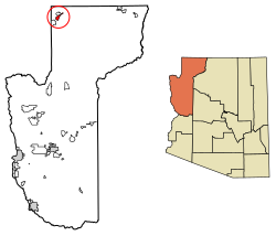 Location in Mohave County, Arizona | |
 Littlefield  Littlefield | |
| Coordinates: 36°53′14″N 113°55′47″W | |
| Country | United States |
| State | Arizona |
| County | Mohave |
| Founded | 1865 |
| Area | |
| • Total | 11.80 sq mi (30.55 km2) |
| • Land | 11.80 sq mi (30.55 km2) |
| • Water | 0.00 sq mi (0.00 km2) |
| Elevation | 1,850 ft (560 m) |
| Population (2020)[3] | |
| • Total | 256 |
| • Density | 21.70/sq mi (8.38/km2) |
| Time zone | UTC-7 (MST) |
| ZIP code | 86432 |
| FIPS code | 04-41470 |
| GNIS feature ID | 7237[2] |
History
Littlefield was first settled by Latter-day Saints, also known as Mormons, in 1865.[5]
Littlefield is the former home of the Littlefield Unified School District, the geographically largest school district in Arizona. The only remnant of the school district in Littlefield itself is the historic adobe Littlefield Schoolhouse, currently under renovation.
Geography
Littlefield is in the northwest corner of Mohave County (and the state of Arizona), along Interstate 15, with access from Exit 8. It is bordered to the north, across I-15, by the community of Beaver Dam. I-15 leads southwest 10 miles (16 km) to Mesquite, Nevada, and 90 miles (140 km) to Las Vegas, while to the northeast the highway enters the Virgin River Gorge and leads 29 miles (47 km) to St. George, Utah.
Littlefield, Beaver Dam, and Scenic have the distinction of being the only towns in Arizona along I-15. Owing to its location in the Arizona Strip, northwest of Grand Canyon National Park and west of the Virgin River, it is isolated by hundreds of miles from the rest of the state. Travel to other towns within Arizona requires crossing through either Nevada or Utah, or driving on unpaved roads to the rest of Arizona's road network.
Demographics
| Historical population | |||
|---|---|---|---|
| Census | Pop. | %± | |
| 2010 | 308 | — | |
| 2020 | 256 | −16.9% | |
| U.S. Decennial Census[6] | |||
The city is made up of 72.7 percent Hispanic, 27.3 percent White, 0 percent Black/Asian.[7]
See also
- List of census-designated places in Arizona
- Beaver Dam High School (Beaver Dam, Arizona)
- The Church of Jesus Christ of Latter-day Saints in Arizona
Notes
![]() Media related to Littlefield, Arizona at Wikimedia Commons
Media related to Littlefield, Arizona at Wikimedia Commons
- "2021 U.S. Gazetteer Files: Arizona". United States Census Bureau. Retrieved May 24, 2022.
- U.S. Geological Survey Geographic Names Information System: Littlefield
- "P1. Race – Littlefield CDP, Arizona: 2020 DEC Redistricting Data (PL 94-171)". U.S. Census Bureau. Retrieved May 24, 2022.
- "U.S. Census website". United States Census Bureau. Retrieved 2011-05-14.
- Andrew Jenson. Encyclopedic History of the Church. (Salt Lake City: Deseret News Press, 1941). p. 438
- "Census of Population and Housing". Census.gov. Retrieved June 4, 2016.
- "Littlefield, AZ | Data USA".

Authority control | |
|---|---|
| General |
|
| National libraries | |
На других языках
[de] Littlefield (Arizona)
Littlefield ist eine gemeindefreie Siedlung (Unincorporated Community) im Mohave County im Nordwesten des US-Bundesstaats Arizona. Im Jahr 2010 lebten dort 308 Menschen.[1] Die Siedlung liegt an der Interstate 15 und dem Virgin River im äußersten Nordwesten des kaum besiedelten und zerklüfteten sogenannten Arizona Strips. Das restliche Arizona ist über das Straßennetz nur über Nevada oder Utah zu erreichen.- [en] Littlefield, Arizona
Другой контент может иметь иную лицензию. Перед использованием материалов сайта WikiSort.org внимательно изучите правила лицензирования конкретных элементов наполнения сайта.
WikiSort.org - проект по пересортировке и дополнению контента Википедии