world.wikisort.org - USA
Limestone County is a county of the U.S. state of Alabama. As of the 2020 census, the county's population was 103,570.[3] Its county seat is Athens.[4] The county is named after Limestone Creek. Limestone County is included in the Huntsville, AL Metropolitan Statistical Area.
Limestone County | |
|---|---|
U.S. county | |
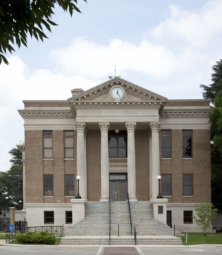 Limestone County Courthouse in Athens | |
 Location within the U.S. state of Alabama | |
 Alabama's location within the U.S. | |
| Coordinates: 34°48′40″N 86°59′03″W | |
| Country | |
| State | |
| Founded | February 6[1], 1818[1] |
| Named for | Limestone Creek |
| Seat | Athens |
| Largest city | Athens |
| Government | |
| • Chairman | Collin Daly[2] |
| Area | |
| • Total | 607 sq mi (1,570 km2) |
| • Land | 560 sq mi (1,500 km2) |
| • Water | 47 sq mi (120 km2) 7.8% |
| Population (2020) | |
| • Total | 103,570 |
| • Estimate (2021) | 107,517 |
| • Density | 170/sq mi (66/km2) |
| Time zone | UTC−6 (Central) |
| • Summer (DST) | UTC−5 (CDT) |
| Congressional district | 5th |
| Website | limestonecounty-al |
| |
History
Limestone County was established by the Alabama Territorial legislature on February 6, 1818.[1] On November 27, 1821, the Alabama State legislature passed an Act that altered the boundary of Limestone County to include the area east of the mouth of the Elk River with the Tennessee River. At the time, that area was a part of Lauderdale County.[5]

Geography
According to the United States Census Bureau, the county has a total area of 607 square miles (1,570 km2), of which 560 square miles (1,500 km2) is land and 47 square miles (120 km2) (7.8%) is water.[6] It is the third smallest county in Alabama by land area.
River
- Tennessee River
- Elk River
Adjacent counties
- Giles County, Tennessee - north
- Lincoln County, Tennessee - northeast
- Madison County, Alabama - east
- Morgan County, Alabama - southeast
- Lawrence County, Alabama - southwest
- Lauderdale County, Alabama - west
National protected area
- Wheeler National Wildlife Refuge (part)
Demographics
| Historical population | |||
|---|---|---|---|
| Census | Pop. | %± | |
| 1820 | 9,871 | — | |
| 1830 | 14,807 | 50.0% | |
| 1840 | 14,374 | −2.9% | |
| 1850 | 16,483 | 14.7% | |
| 1860 | 15,306 | −7.1% | |
| 1870 | 15,017 | −1.9% | |
| 1880 | 21,600 | 43.8% | |
| 1890 | 21,201 | −1.8% | |
| 1900 | 22,387 | 5.6% | |
| 1910 | 26,880 | 20.1% | |
| 1920 | 31,341 | 16.6% | |
| 1930 | 36,629 | 16.9% | |
| 1940 | 35,642 | −2.7% | |
| 1950 | 35,766 | 0.3% | |
| 1960 | 36,513 | 2.1% | |
| 1970 | 41,699 | 14.2% | |
| 1980 | 46,005 | 10.3% | |
| 1990 | 54,135 | 17.7% | |
| 2000 | 65,676 | 21.3% | |
| 2010 | 82,782 | 26.0% | |
| 2020 | 103,570 | 25.1% | |
| 2021 (est.) | 107,517 | [7] | 3.8% |
| U.S. Decennial Census[8] 1790–1960[9] 1900–1990[10] 1990–2000[11] 2010–2020[3] | |||
2000 census
As of the 2000 census,[12] there were 65,676 people, 24,688 households, and 18,219 families living in the county. The population density was 45/km2 (116/sq mi). There were 26,897 housing units at an average density of 18/km2 (47/sq ;mi). The racial makeup of the county was 78.79% White, 15.33% Black or African American, 0.46% Native American, 0.35% Asian, 0.02% Pacific Islander, 1.14% from other races, and 0.91% from two or more races. 2.65% of the population were Hispanic or Latino of any race.
According to the census of 2000, the largest ancestry groups in Limestone County were English 66.31%, Scots-Irish 15.12%, and African 13.33%
There were 24,688 households, 34.80% had children under the age of 18 living with them, 60.00% were married couples living together, 10.40% had a female householder with no husband present, and 26.20% were non-families. 23.40% of households were one person and 8.90% were one person aged 65 or older. The average household size was 2.55 and the average family size was 3.02.
The age distribution was 24.90% under the age of 18, 8.80% from 18 to 24, 32.10% from 25 to 44, 23.10% from 45 to 64, and 11.10% 65 or older. The median age was 36 years. For every 100 females, there were 103.10 males. For every 100 females age 18 and over, there were 101.80 males.
The median household income in the county was $37,405, and the median family income was $45,146. Males had a median income of $35,743 versus $23,389 for females. The per capita income for the county was $17,782. About 9.80% of families and 12.30% of the population were below the poverty line, including 16.20% of those under age 18 and 14.60% of those age 65 or over.
2010 census
As of the 2010 census,[13] there were 82,782 people, 31,446 households, and 22,876 families living in the county. The population density was 57.1/km2 (147.8/sq mi). There were 34,977 housing units at an average density of 24.1/km2 (62.5/sq mi). The racial makeup of the county was 80.3% White, 12.6% Black or African American, 0.7% Native American, 1.1% Asian, 0.1% Pacific Islander, 3.5% from other races, and 1.8% from two or more races. 5.5% of the population were Hispanic or Latino of any race.
There were 31,446 households, 31.4% had children under the age of 18 living with them, 57.0% were married couples living together, 11.4% had a female householder with no husband present, and 27.3% were non-families. 23.7% of households were one person and 8.5% were one person aged 65 or older. The average household size was 2.54 and the average family size was 3.00.
The age distribution was 24.0% under the age of 18, 8.0% from 18 to 24, 28.1% from 25 to 44, 27.6% from 45 to 64, and 12.3% 65 or older. The median age was 38.4 years. For every 100 females, there were 102.5 males. For every 100 females age 18 and over, there were 107.0 males.
The median household income in the county was $46,682, and the median family income was $55,518. Males had a median income of $46,071 versus $31,609 for females. The per capita income for the county was $24,007. About 10.3% of families and 13.5% of the population were below the poverty line, including 17.5% of those under age 18 and 11.0% of those age 65 or over.
2020 census
| Race | Num. | Perc. |
|---|---|---|
| White (non-Hispanic) | 75,692 | 73.08% |
| Black or African American (non-Hispanic) | 13,177 | 12.72% |
| Native American | 458 | 0.44% |
| Asian | 1,857 | 1.79% |
| Pacific Islander | 70 | 0.07% |
| Other/Mixed | 5,068 | 4.89% |
| Hispanic or Latino | 7,248 | 7.0% |
As of the 2020 United States census, there were 103,570 people, 32,020 households, and 23,919 families residing in the county.
Government and politics
Limestone County comprises the Thirty-Ninth Judicial Circuit of Alabama. The Thirty-Ninth Judicial Circuit was created in the early 1980s when Limestone County broke away from Morgan County to form its own circuit.
The Thirty-Ninth Judicial Circuit has two circuit judges and two district judges. The two circuit judges are Judge Robert M. Baker and Judge B. Chadwick Wise. The two district judges are Judge Matthew R. Huggins and Judge R. Gray West.
The current District Attorney is Brian C.T. Jones.
The current Sheriff of Limestone County is Joshua McLaughlin. The term for sheriffs is four years, and there is no term limit.[15][16]
Collin Daly (R) is the Chairman of the County Commission.[2]
Limestone County is reliably Republican at the presidential level. The last Democrat to win the county in a presidential election is Jimmy Carter, who won it by an absolute majority in 1980.
| Year | Republican | Democratic | Third party | |||
|---|---|---|---|---|---|---|
| No. | % | No. | % | No. | % | |
| 2020 | 34,640 | 70.36% | 13,672 | 27.77% | 923 | 1.87% |
| 2016 | 29,067 | 72.14% | 9,468 | 23.50% | 1,759 | 4.37% |
| 2012 | 25,295 | 71.17% | 9,829 | 27.66% | 416 | 1.17% |
| 2008 | 23,598 | 70.33% | 9,536 | 28.42% | 417 | 1.24% |
| 2004 | 19,702 | 67.77% | 9,126 | 31.39% | 245 | 0.84% |
| 2000 | 14,204 | 60.10% | 8,992 | 38.05% | 438 | 1.85% |
| 1996 | 10,862 | 52.52% | 8,045 | 38.90% | 1,775 | 8.58% |
| 1992 | 9,862 | 45.66% | 8,087 | 37.45% | 3,648 | 16.89% |
| 1988 | 9,086 | 61.56% | 5,455 | 36.96% | 219 | 1.48% |
| 1984 | 8,423 | 60.12% | 5,410 | 38.62% | 177 | 1.26% |
| 1980 | 4,574 | 34.18% | 8,180 | 61.12% | 630 | 4.71% |
| 1976 | 2,997 | 24.98% | 8,803 | 73.36% | 200 | 1.67% |
| 1972 | 6,188 | 73.21% | 2,079 | 24.60% | 185 | 2.19% |
| 1968 | 870 | 8.39% | 889 | 8.57% | 8,616 | 83.05% |
| 1964 | 2,377 | 43.99% | 0 | 0.00% | 3,027 | 56.01% |
| 1960 | 991 | 19.26% | 4,147 | 80.59% | 8 | 0.16% |
| 1956 | 589 | 12.40% | 4,145 | 87.26% | 16 | 0.34% |
| 1952 | 549 | 12.46% | 3,844 | 87.24% | 13 | 0.30% |
| 1948 | 112 | 5.65% | 0 | 0.00% | 1,870 | 94.35% |
| 1944 | 129 | 4.70% | 2,605 | 94.93% | 10 | 0.36% |
| 1940 | 95 | 3.12% | 2,941 | 96.58% | 9 | 0.30% |
| 1936 | 108 | 3.61% | 2,861 | 95.69% | 21 | 0.70% |
| 1932 | 107 | 3.85% | 2,667 | 95.94% | 6 | 0.22% |
| 1928 | 407 | 19.42% | 1,689 | 80.58% | 0 | 0.00% |
| 1924 | 136 | 8.40% | 1,415 | 87.35% | 69 | 4.26% |
| 1920 | 285 | 13.48% | 1,812 | 85.71% | 17 | 0.80% |
| 1916 | 92 | 5.84% | 1,450 | 92.12% | 32 | 2.03% |
| 1912 | 90 | 7.38% | 1,012 | 83.02% | 117 | 9.60% |
| 1908 | 238 | 16.38% | 1,188 | 81.76% | 27 | 1.86% |
| 1904 | 187 | 14.88% | 1,053 | 83.77% | 17 | 1.35% |
| 1900 | 1,157 | 50.68% | 1,063 | 46.56% | 63 | 2.76% |
| 1896 | 1,520 | 44.94% | 1,812 | 53.58% | 50 | 1.48% |
| 1892 | 18 | 0.54% | 1,447 | 43.40% | 1,869 | 56.06% |
| 1888 | 1,183 | 43.93% | 1,489 | 55.29% | 21 | 0.78% |
| 1884 | 1,450 | 49.56% | 1,430 | 48.87% | 46 | 1.57% |
| 1880 | 1,623 | 49.50% | 1,600 | 48.80% | 56 | 1.71% |
| 1876 | 1,343 | 44.37% | 1,684 | 55.63% | 0 | 0.00% |
| 1872 | 893 | 51.95% | 826 | 48.05% | 0 | 0.00% |
| 1868 | 355 | 23.17% | 1,177 | 76.83% | 0 | 0.00% |
| 1860 | 0 | 0.00% | 325 | 26.75% | 890 | 73.25% |
| 1856 | 0 | 0.00% | 790 | 73.76% | 281 | 26.24% |
| 1852 | 227 | 25.53% | 662 | 74.47% | 0 | 0.00% |
| 1848 | 374 | 30.99% | 833 | 69.01% | 0 | 0.00% |
| 1844 | 325 | 25.19% | 965 | 74.81% | 0 | 0.00% |
| 1840 | 356 | 28.41% | 897 | 71.59% | 0 | 0.00% |
| 1836 | 319 | 30.85% | 715 | 69.15% | 0 | 0.00% |
| 1832 | 0 | 0.00% | 912 | 100.00% | 0 | 0.00% |
Education
School districts include:[19]
- Limestone County School District operates public schools for students living in most areas of Limestone County not incorporated in the Cities of Athens, Decatur, Huntsville, and/or Madison.
- Athens City Schools - K-12 education for the city of Athens
- Decatur City School District
- Huntsville City School District
- Madison City School District
Tertiary education:
- Calhoun Community College - 2-year college located in the southern part of the county in Decatur
- Athens State University - 2-year upper level university located in Athens
Transportations
Major highways
 Interstate 65
 Interstate 565
 U.S. Highway 31
 U.S. Highway 72
 Alternate U.S. Highway 72/State Route 20
 State Route 53
 State Route 99
 State Route 127
 State Route 251
Railways
- CSX Transportation—freight line that runs North to South[20]
- Norfolk Southern Railway—freight line that runs east–west[20]
Airport
Huntsville International Airport (HSV) is the nearest major commercial airport, 23 miles east. Nashville Airport (BNA) is approximately 104 miles north.
Recreation
- Cowford Campground – riverside campground with 48 campsites with full hookups. Next to Cowford Landing.
- Cowford Landing – swimming, fishing, and boating. Next to Cowford Campground.
- Limestone County Canoe and Kayak Trail – a 21.9 miles (35.2 km) along the Elk River for canoeing with five access sites. Designated a National Recreation Trail in 2010.[21]
- Noah Bike and Vintage Car Trail – a road route for bicycles, motorcycles, and vintage cars in Northwest Limestone County that is 89 miles (143 km) long. The starts and ends at the Athens-Limestone Visitor's Center at 34.803°N 86.967°W.
- Richard Martin Trail – a 10.2 miles (16.4 km) rail trail in northern part of the county for bicycling, horseback riding, and walking.[22] Designated a National Recreation Trail in 2010.[21]
- Antebellum Trail – a trail rich in the Antebellum period architecture that highlights Athens, Belle Mina and Mooresville.
- Ardmore Walking Tracks – One .25 miles (0.40 km) walking track is located in Ardmore Town Park on Park Avenue. The other 0.5 miles (0.80 km) track is locating in Ardmore's John Barns Park on Ardmore Ridge Road
- Athens Greenway Walking Trail – This 3.3 miles (5.3 km) walking trail starts at the Athens SportsPlex goes by Athens High School and Athens Public Archery Range and continues to U.S. Highway 72 for an additional 1.2 miles (1.9 km)
- Athens Historic Volksmarch – An American Volksport Association (AVA) sanctioned 10K (6.2 miles) walk.
- Beaty Historic District Walking Tour "Step Back In Time" – walking tour of the Robert Beaty Historic District which was placed on the Registry of Historic Places in 1984.
- Civil War Trail – Driving/walking trail highlighting the history of the Civil War in the greater Limestone County community.
- The Glory Road – Driving tour of historic and community churches of Limestone County
GOLFING
- Canebrake Club – membership
- Chriswood Golf Course – community
- Southern Gayles Golf Club – community
FISHING
- Limestone County Alabama offers access to the prime fishing waters of the Elk River, Tennessee River and Wheeler Lake.
HUNTING
- Limestone Hunting Preserve & Sporting Clays offers deer, dove, quail, pheasant and chukar hunts and sporting clays.
- Piney Creek Kennels and Hunting Preserve offers 100+ acres of dove and quail hunting land.
- Swan Creek WMA – 8,870 acres of Alabama Department of Conservation managed area and includes a shooting range
- Tennessee Valley Federal Property – 11,300 acres of regulated hunting land
FESTIVALS
- February
- Hospice Chili Challenge – last weekend
- March
- Polk Sallet Follies – second week, Thursday-Saturday
- Home and Garden Show – second weekend
- April
- Athens Cruise In (April–September)
- Saturday Historic Walking Tours – Athens & Mooresville – each Saturday
- Cars and Bikes on the Square – last Saturday
- Singing on the Square (April–September) – third Fridays
- Earth Day Celebration – third Saturday
- May
- Athens-Limestone Relay for Life
- Limestone Sheriff's Rodeo
- Athens Bible School Homespun Arts and Crafts Show
- June
- Athens Lions Club Kiddie Carnival (last weekend in June to first weekend August)
- July
- Limestone County Week of Independence (last Saturday of June to first Saturday of July)
- Firework Show
- Ardmore Lions Club Tractor and Truck Pull – second weekend
- CASA Mud Volleyball Tournament – third Saturday
- Alabama Championship Tractor and Truck Pull – Tanner – last weekend
- August
- Ardmore Crape Myrtle Festival
- Ardmore Police Reserve Rodeo
- Piney Chapel American Farm Heritage Days
- September
- Athens Grease Festival
- October
- Tennessee Valley Old Time Fiddlers Convention – first full weekend
- Wacky Quacky Ducky Derby – first full weekend
- Athens Storytelling Festival – last weekend
- November
- Hilltop Arts Festival
- Athens Christmas Open House
- December
- Athens Christmas Parade
- Limestone County Tree Lighting (same night as Athens Parade)
- Ardmore Christmas Parade
- Elkmont Lions Club Christmas Parade
- Sippin' Cider
- Lincoln Bridgeforth Park Tree Lighting
Points of interest
MUSEUMS
- Alabama Veterans Museum and Archives - honoring veterans and their families with displays of memorabilia from the Revolutionary War to the present.
- College Inn/Newby Gulf Station Museum - This landmark was restored to look like a 1940s gas station. It has been featured in Southern Living photo spreads.
- Donnell House - This historic landmark is the former home of Reverend Donnell and a significant site for the "Sack of Athens"
- Houston Memorial Library and Museum - The cornerstone of the Houston Historic District, the building now houses a library and the county museum.
- Limestone County Archives - Contains community and genealogical records for Limestone County.
POINTS OF INTEREST
- Alabama Welcome Center - Just south of the Alabama/Tennessee border, this facility is home to a Saturn 1B rocket as well as war memorials for World War II, Korea and Vietnam.
- Athens State University - A significant site for the "Sack of Athens". Founders Hall is the original structure of the university and is graced with 4 large pillars. Founders Hall also houses the New Testament Chapel containing life-size carvings depicting Christ and other New Testament figures.
- Trinity School - Established by the American Missionary Association to educate the children of freed slaves.
- Limestone County Confederate Soldiers Memorial
Communities
Cities
- Athens (county seat)
- Decatur (mostly in Morgan County)
- Huntsville (mostly in Madison County)
- Madison (mostly in Madison County)
Towns

Unincorporated communities
See also
- National Register of Historic Places listings in Limestone County, Alabama
- Properties on the Alabama Register of Landmarks and Heritage in Limestone County, Alabama
References
- A digest of the laws of the State of Alabama: containing the statutes and resolutions in force at the end of the General Assembly in January, 1823. Published by Ginn & Curtis, J. & J. Harper, Printers, New-York, 1828. Title 10. Chapter XII. Page 85. An Act to establish the western and southern Boundaries of Madison County, and to establish the Counties of Limestone and Lauderdale--Passed February 6, 1818.
- "Commission". Limestone County, Alabama. Retrieved July 7, 2017.
- "State & County QuickFacts". United States Census Bureau. Retrieved April 7, 2022.
- "Find a County". National Association of Counties. Retrieved June 7, 2011.
- A digest of the laws of the State of Alabama: containing the statutes and resolutions in force at the end of the General Assembly in January, 1823. Published by Ginn & Curtis, J. & J. Harper, Printers, New-York, 1828. Title 10. Chapter XXXII. Page 99. An Act to alter and extend the Boundaries of Limestone County--Passed November 27, 1821.
- "2010 Census Gazetteer Files". United States Census Bureau. August 22, 2012. Retrieved August 22, 2015.
- "Annual Estimates of the Resident Population for Counties: April 1, 2020 to July 1, 2021". Retrieved April 7, 2022.
- "U.S. Decennial Census". United States Census Bureau. Retrieved August 22, 2015.
- "Historical Census Browser". University of Virginia Library. Retrieved August 22, 2015.
- Forstall, Richard L., ed. (March 24, 1995). "Population of Counties by Decennial Census: 1900 to 1990". United States Census Bureau. Retrieved August 22, 2015.
- "Census 2000 PHC-T-4. Ranking Tables for Counties: 1990 and 2000" (PDF). United States Census Bureau. April 2, 2001. Retrieved August 22, 2015.
- "U.S. Census website". United States Census Bureau. Retrieved May 14, 2011.
- "U.S. Census website". United States Census Bureau. Retrieved July 31, 2015.
- "Explore Census Data". data.census.gov. Retrieved December 16, 2021.
- "Mike Blakely, Alabama's longest serving sheriff, convicted at trial". August 2, 2021.
- "Limestone County Coroner Mike West assumes role as sheriff after Mike Blakely's conviction". August 3, 2021.
- "Dave Leip's Atlas of U.S. Presidential Elections". Retrieved November 21, 2016.
- "Our Campaigns - U.S. President". Retrieved January 22, 2021.
- "2020 CENSUS - SCHOOL DISTRICT REFERENCE MAP: Limestone County, AL" (PDF). U.S. Census Bureau. Retrieved August 1, 2022. - Text list
- Alabama Railway Map Archived March 12, 2012, at the Wayback Machine. 2008. Alabama Department of Transportation. Accessed December 10, 2010.
- 2010 NRT designations. National Recreation Trails. June 2, 2010. U.S. Department of Interior. Accessed March 15, 2012.
- Richard Martin Trail National Recreation Trails Database. American Trails. Last Updated 06/09/2011.
- "Athens-Limestone County Tourism". Visit Athens Alabama. Retrieved March 6, 2018.
External links
- Official website

- University of Alabama's Cartographic Research Laboratory Historic Aerial Photos Collection for Athens and Limestone County
- University of Alabama's Cartographic Research Laboratory Historic Map Collection for Athens and Limestone County
Places adjacent to Limestone County, Alabama | ||||||||||||||||
|---|---|---|---|---|---|---|---|---|---|---|---|---|---|---|---|---|
| ||||||||||||||||
Municipalities and communities of Limestone County, Alabama, United States | ||
|---|---|---|
County seat: Athens | ||
| Cities |  | |
| Towns | ||
| Unincorporated communities | ||
| Footnotes | ‡This populated place also has portions in an adjacent county or counties | |
| ||
State of Alabama | |
|---|---|
Montgomery (capital) | |
| Topics |
|
| Society |
|
| Regions |
|
| Flora and fauna |
|
| Largest cities | |
| Metros |
|
| Counties |
|
Authority control | |
|---|---|
| General | |
| National libraries | |
| Other |
|
На других языках
[de] Limestone County (Alabama)
Das Limestone County[1][2] ist ein County im Bundesstaat Alabama der Vereinigten Staaten. Der Verwaltungssitz (County Seat) ist Athens.- [en] Limestone County, Alabama
[ru] Лаймстон (округ, Алабама)
Ла́ймстон[4] (англ. Limestone County) — округ в штате Алабама, США. Официально образован 6 февраля 1818 года. По состоянию на 2010 год, численность населения составляла 82 782 человека. Административный центр округа — Атенс.Другой контент может иметь иную лицензию. Перед использованием материалов сайта WikiSort.org внимательно изучите правила лицензирования конкретных элементов наполнения сайта.
WikiSort.org - проект по пересортировке и дополнению контента Википедии