world.wikisort.org - USA
Lewis Chapel is an unincorporated community in Sequatchie County, Tennessee, United States.[1] It is located in the eastern part of the county atop the Cumberland Plateau. Tennessee State Route 111 connects the community to Dunlap in the Sequatchie Valley to the west and Soddy-Daisy and the outskirts of Chattanooga in the Tennessee Valley to the east.
Lewis Chapel, Tennessee | |
|---|---|
Unincorporated community | |
 Lewis Chapel Volunteer Fire Department (left) and Lewis Chapel Community Center | |
| Nickname: Lewis Chapel Mountain | |
 Lewis Chapel, Tennessee  Lewis Chapel, Tennessee | |
| Coordinates: 35°20′27″N 85°18′27″W | |
| Country | United States |
| State | Tennessee |
| County | Sequatchie |
| Elevation | 1,818 ft (554 m) |
| Time zone | UTC-6 (Central (CST)) |
| • Summer (DST) | UTC-5 (CDT) |
| ZIP codes | 37327, 37338 |
| Area code | 423 |
| GNIS feature ID | 1291078[1] |
Lewis Chapel was probably named for the Reverend Edgar R. Lewis, an early minister in the area.[2]
References
- U.S. Geological Survey Geographic Names Information System: Lewis Chapel, Tennessee
- Larry Miller, Tennessee Place Names (Indiana University Press, 2001), p. 122.
Municipalities and communities of Sequatchie County, Tennessee, United States | ||
|---|---|---|
County seat: Dunlap | ||
| City | 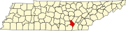 | |
| CDP | ||
| Other communities |
| |
| ||
This Sequatchie County, Tennessee geography–related article is a stub. You can help Wikipedia by expanding it. |
Текст в блоке "Читать" взят с сайта "Википедия" и доступен по лицензии Creative Commons Attribution-ShareAlike; в отдельных случаях могут действовать дополнительные условия.
Другой контент может иметь иную лицензию. Перед использованием материалов сайта WikiSort.org внимательно изучите правила лицензирования конкретных элементов наполнения сайта.
Другой контент может иметь иную лицензию. Перед использованием материалов сайта WikiSort.org внимательно изучите правила лицензирования конкретных элементов наполнения сайта.
2019-2026
WikiSort.org - проект по пересортировке и дополнению контента Википедии
WikiSort.org - проект по пересортировке и дополнению контента Википедии