world.wikisort.org - USA
Levant is an unincorporated community in Thomas County, Kansas, United States.[1] As of the 2020 census, the population of the community and nearby areas was 68.[2] It is located approximately 7.5 miles (12.1 km) west of Colby.
Levant, Kansas | |
|---|---|
Unincorporated community | |
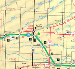 KDOT map of Thomas County (legend) | |
 Levant  Levant | |
| Coordinates: 39°23′08″N 101°11′42″W[1] | |
| Country | United States |
| State | Kansas |
| County | Thomas |
| Elevation | 3,311 ft (1,009 m) |
| Population (2020)[2] | |
| • Total | 68 |
| Time zone | UTC-6 (CST) |
| • Summer (DST) | UTC-5 (CDT) |
| ZIP code | 67743 |
| Area code | 785 |
| FIPS code | 20-39700 [1] |
| GNIS ID | 471192 [1] |
History
Levant has a post office with ZIP code 67743.[3] The post office in Levant was established in 1888.[4]
Climate
According to the Köppen Climate Classification system, Levant has a semi-arid climate, abbreviated "BSk" on climate maps.[5]
Demographics
| Historical population | |||
|---|---|---|---|
| Census | Pop. | %± | |
| 2020 | 68 | — | |
| U.S. Decennial Census | |||
For statistical purposes, the United States Census Bureau has defined Levant as a census-designated place (CDP).
Education
The community is served by Colby USD 315 public school district.[6]
Levant High School was closed through school unification. The Levant High School mascot was Tigers.[7]
References
- "Levant, Kansas", Geographic Names Information System, United States Geological Survey
- "Profile of Levant, Kansas (CDP) in 2020". United States Census Bureau. Archived from the original on December 7, 2021. Retrieved December 7, 2021.
- ZIP Code Lookup
- "Kansas Post Offices, 1828-1961". Kansas Historical Society. Archived from the original on 9 October 2013. Retrieved 27 June 2014.
- Climate Summary for Levant, Kansas
- "Colby Public Schools". USD 315. Retrieved 8 January 2017.
- "Levant High School - Tigers Yearbook". E-YEARBOOK.COM. Retrieved 8 January 2017.
Further reading
External links
Municipalities and communities of Thomas County, Kansas, United States | ||
|---|---|---|
County seat: Colby | ||
| Cities | 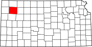 | |
| Unincorporated communities |
| |
| Ghost towns |
| |
| Footnotes | †This community is designated a Census-Designated Place (CDP) by the United States Census Bureau. ‡This community also has portions in an adjacent county or counties. | |
| ||
Текст в блоке "Читать" взят с сайта "Википедия" и доступен по лицензии Creative Commons Attribution-ShareAlike; в отдельных случаях могут действовать дополнительные условия.
Другой контент может иметь иную лицензию. Перед использованием материалов сайта WikiSort.org внимательно изучите правила лицензирования конкретных элементов наполнения сайта.
Другой контент может иметь иную лицензию. Перед использованием материалов сайта WikiSort.org внимательно изучите правила лицензирования конкретных элементов наполнения сайта.
2019-2026
WikiSort.org - проект по пересортировке и дополнению контента Википедии
WikiSort.org - проект по пересортировке и дополнению контента Википедии